Mornington Peninsula
The Mornington Peninsula is a peninsula located south-east of Melbourne, Australia. It is surrounded by Port Phillip to the west, Western Port to the east and Bass Strait to the south, and is connected to the mainland in the north. Geographically, the peninsula begins its protrusion from the mainland in the area between Pearcedale and Frankston. The area was originally home to the Mayone-bulluk and Boonwurrung-Balluk clans and formed part of the Boonwurrung nation's territory prior to European settlement.
Much of the peninsula has been cleared for agriculture and settlements. However, small areas of the native ecology remain in the peninsula's south and west, some of which is protected by the Mornington Peninsula National Park. In 2002, around 180,000 people lived on the peninsula and in nearby areas, most in the small towns on its western shorelines which are sometimes regarded as outlying suburbs of greater Melbourne; there is a seasonal population of around 270,000.[1]
The peninsula is primarily a local tourist region, with popular natural attractions such as the variety of beaches both sheltered and open-sea and many scenic sights and views. Other popular attractions include the various wineries, mazes and the diverse array of water sports made available by the diversity of beaches and calm waters of Port Phillip and Western Port. Most visitors to the peninsula are residents of Melbourne who camp, rent villas and share houses or stay in private beach houses. It is known simply as "The Peninsula" to locals and Melburnians alike, giving rise to the expression "going down the peninsula".
Geography

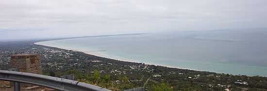
The peninsula extends from the mainland between Pearcedale and Frankston in a south-westerly direction for about 40 km (25 mi) at a width of about 15–20 kilometres (9.3–12.4 mi). It then begins to extend roughly 15 km (9.3 mi) in an west/north-westerly direction and tapers down to a width of about 2–3 km (1.2–1.9 mi) before terminating at Point Nepean. Much of the topography is flat in the north where it connects to the mainland, however moving south-west, it soon becomes hilly, culminating in the central hilly landscapes of Boneo, Main Ridge, Red Hill Tuerong and Moorooduc. The highest point, Arthurs Seat, located unusually close to the shoreline, stands at 305 metres (1,001 ft) above sea level. The peninsula hosts around 190 km (120 mi) of coastline.
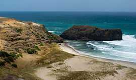
Its eastern shorelines meet many mangroves and mudflats in the waters of Western Port before it tapers down to form Crib Point, Stony Point and Sandy Point at the peninsula's most south-easterly point. In the south-east between Sandy Point and West Head, the mudflats give way to sandy beaches which in turn become more and more rocky further south. In the south the peninsula meets Bass Strait and the coastline becomes very rocky between West Head and Cape Schanck. The coast between Cape Schanck and Point Nepean consists of a long slow curvature of open-sea surf beaches, many too dangerous to swim in. Its western shorelines form various headlands and bays in the sheltered waters of Port Phillip, hosting many shallow safe beaches.
The western coastline facing Port Phillip starts at the narrow bay entrance, The Heads or The Rip, and proceeds as a series of gently curved bays defined by small rocky outcrops.
From an oceanic perspective, the Mornington Peninsula, together with the Bellarine Peninsula, separate the waters of Port Phillip from Bass Strait, except for a small gap known as The Rip, which also separates both peninsulas. The peninsula also separates the waters of Port Phillip and Western Port.
The Mornington Peninsula is crossed by many seismically active fault lines, monoclines, synclines and anticlines; the largest of which is the 100km long Selwyn Fault which is capable of producing earthquakes of around 7.5 magnitude. The Peninsula experiences many minor earthquakes every year, but most are too small to be felt. The last strong earthquake to rock the Peninsula had a magnitude of 5.0 and occurred on 7 July 1971 at 7:55am AEST with its epicentre off Flinders, along the southern end of the Tyabb Fault.
Political geography
The Mornington Peninsula is located over 40 km south-east of Melbourne. As of 2006 it has a population of 136,482 which can swell up to 250,000 during the summer months. The governing body, the Shire of Mornington Peninsula occupies the entire peninsula and is generally considered to be a good approximation of where the peninsula joins the mainland.
Mountains and hills

- Arthurs Seat 305 m (1,001 ft)
- Chapmans Point 274 m (899 ft)
- Franklin Point 195 m (640 ft)
- Bowens Point 145 m (476 ft)
- Anthony's Nose 40 m (130 ft) – tapers into Port Phillip
- McLears Hill – northeast end
- Mount Martha 160 m (520 ft)
- Jacksons Hill
- Mount Eliza
- Red Hill
- Olivers Hill
- Cheviot Hill – near Cheviot Beach
- Mt. St. Pauls – near Sorrento Ocean Beach
History
The peninsula was formed by the flooding of Port Phillip Bay after the end of the Ice Age about 10000 BC.[2] It may have extended into Port Phillip at various times, most recently between 800 BC and 1000 AD when Port Phillip Bay may have dried out.[3]

Indigenous Australians of the Mayone-bulluk and Boonwurrung-Balluk clans lived on the peninsula as part of the Boonwurrung People's territory prior to European settlement.[4] The territory hosted six clans who lived along the Victorian coast from the Werribee River across to Western Port Bay and Wilsons Promontory. The peninsula may have been home to between 100 – 500 people prior to European settlement.
At the time of European settlement, much of the Mornington Peninsula was covered with she-oak forests. These were quickly cleared to provide firewood for the growing city of Melbourne, and much of the peninsula was then covered with fruit orchards. Nevertheless much natural vegetation still exists, especially in an area of bushland in the south known as Greens Bush, and the coastal fringe bordering Bass Strait and Western Port Bay. Most large areas of bushland are now included within the Mornington Peninsula National Park.
As serious farming has declined, hobby farmers with an interest in the aesthetic and the natural environment have taken over much of the peninsula. This has led to an expansion of natural bushland on private property, and many native species, such as koalas, are becoming increasingly common. The local council also has a slight lean towards sustainable practices.
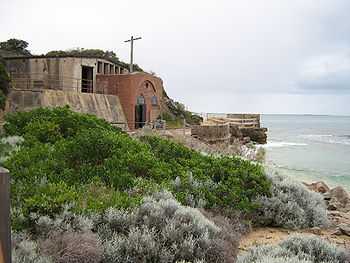
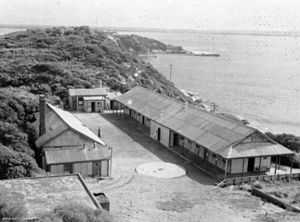
Point Nepean military installations
- See also, Fort Nepean
Harold Holt disappearance
On 17 December 1967, Prime Minister Harold Holt went swimming at Cheviot Beach on what is now Point Nepean National Park. At the time this was still a restricted area. Mr. Holt, who was 59 and had had a recent shoulder injury, plunged into the surf. He disappeared from view and was never seen again. Despite an extensive search his body was never found. He was officially presumed dead on 19 December 1967.
Parklands

The peninsula is one of four biosphere reserves in Victoria, the other three being national parks, and the only one with a resident population that reaches some 250,000 people during the peak tourist season. Some of the major parklands on the peninsula include:
- Land:
- Mornington Peninsula National Park
- Point Nepean National Park
- Arthurs Seat State Park
- Moonlit Sanctuary Wildlife Conservation Park
- Quail Island Nature Conservation Reserve
- Mount Martha Park
- Main Ridge Flora Reserve
- Coolart Wetlands and Homestead Reserve
- Baxter Park
- Marine:
- Port Phillip Heads Marine National Park
- Yaringa Marine National Park
Golf courses

- Portsea Golf Club (18)
- Sorrento Golf Club (18)
- The Dunes Golf Links (9&18)
- Moonah Links Golf Course (2x18)
- Eagle Ridge Golf Course (18)
- The Golf Club St. Andrews Beach (18)
- National Golf Club (3x18)
- Cape Schanck Resort & Golf Club (18)
- Flinders Golf Course (18)
- Rosebud Country Club (36)
- Rosebud Park Public Golf Course (18)
- Mount Martha Public Golf Course (18)
- Mornington Golf Club (18)
- Devilbend Golf Club (18)
Other features
Shipwrecks
- SS Cheviot – wrecked in the rocks of Cheviot Beach (1887)
- Wauchope – sunk off the coast of Sorrento (1918)
Transport
The peninsula is serviced predominantly by a network of roads. Public transport is limited to a bus service which services urban areas on the western shorelines and a train service for the eastern areas of the peninsula. The following methods of transport are available to access various regions of the peninsula:
- Road: – The Peninsula is easily reached via the Peninsula Link that joins EastLink at Carrum Downs, as well as from Melbourne by car via the Nepean Highway. Another route is via the Frankston Freeway to Frankston, and then via the Moorooduc Highway. Another option is via the Monash Freeway (M1) and the Western Port Highway to the eastern side of the Peninsula. An alternative route from the Monash Freeway is via Eastlink to the Frankston Freeway.
- Bus: – A bus service runs along the entire length of the peninsula to Portsea, departing from Frankston railway station in metropolitan Melbourne. A number of bus services run partway down the peninsula from Frankston Railway Station along the Nepean Highway. These run to various destinations such as Mount Martha and Mornington, via Mount Eliza.
- Train: – Metro Trains Melbourne run a diesel rail service from Frankston to Hastings and Stony Point, from where a ferry can be taken to French and Phillip Islands. A bus service also runs to Flinders on the south coast. Rail lines at one time also extended to Mornington and to Red Hill but these have now been closed.
- Ferry: – The Searoad Ferry Service operates two vehicle and passenger ferries on an hourly service between the Mornington and Bellarine Peninsulas, departing from Queenscliff on the Bellarine and arriving at Sorrento on the Mornington.
Tourism

The Mornington Peninsula has a long history of being a favourite holiday destination for residents of Melbourne. Popular tourism times are; long weekends such as Cup Weekend and Queens Birthday, the week involving Christmas, Boxing Day and New Years, with the months of December and January being the peak tourist period. Most visitors to the peninsula are local to central Victoria.
Accommodation
Wealthier visitors to the peninsula usually own beach houses on large properties or with extensive views or beach access and as a result, there are very few established commercial hotels. There are however, many smaller motels priced to suit families and middle income earners. Large shared beach houses are also popular, although perhaps the most popular form of accommodation lie in the many caravan parks and camping grounds where many visitors own or rent on-site caravans and annexes or camp in tents. Camping is particularly popular on foreshore reserves where camping is permitted. Some visitors continuously book particular sites and many camping grounds have been camped on by the same family for 2 or 3 generations. For the unestablished tourist, these camping grounds must be booked anywhere from 1 to 5 years in advance for foreshore sites, while further inland sites are more easily available with at most a 3 to 6 month wait. It is estimated that around 30–40% of the houses on the peninsula are not owned by permanent residents reflecting the popularity of owned beach houses. Most of these 'beach houses' are owned by residents of Melbourne.
Other notable attractions
In addition to the national parks and golf courses, other notable tourist attractions include:
- HMAS Cerberus – military base, historical buildings, museum and decommissioned Oberon class submarine.
- Moonlit Sanctuary Wildlife Conservation Park – native nocturnal animal walks held nightly.
- Red Hill Market
- McCrae Homestead, National Trust of Australia
- Mornington Peninsula Regional Gallery

Recreation

Some popular activities on the peninsula include:
- Hang gliding – On the steep cliffs of the south-west coastlines. Particularly near Portsea, Rye and Sorento. Hang gliding is restricted around Point Nepean.
- Skiffleboarding – Particularly on the flat beaches near Rosebud, Rye, Somers and Balnarring Beach.
- Surfing – On the south-west coastline on Bass Strait. Particularly at Gunnamatta, Sorrento, Portsea and First Reef at Point Leo Surf Beaches.
- Fishing – Mostly hobby fishing off piers and in beaches on Port Phillip.
- Sailing – Various locations on the shores of Port Phillip and Western Port including Somers, Balnarring Beach, Safety Beach and many others.
- Scuba diving – Particularly at Mornington Pier, Rye Pier, Blairgowrie Pier, Portsea Pier & Portsea Hole and Flinders Pier. Diving tours for Port Phillip and Bass Strait depart from Portsea. A remarkable variety of diving environments including wrecks, reefs, drift dives, scallop dives, seal dives and wall dives.
- Running & Cycling – Popular along the Nepean Highway as it follows the coastline on Port Phillip.
Environmental issues
A sewerage outlet near Boag Rock, a couple of kilometres up the coast from Gunnamatta Surf Beach, pumps treated sewerage into the ocean which finds its way to swimmers and surfers at Gunnamatta during particular tidal conditions.
Agriculture


The Mornington Peninsula is a notable wine region, producing small quantities of high quality wine from around 60 wineries. While most varieties are grown, the cool, maritime climate of the Peninsula is particularly noted for pinot noir.[5] Many wineries are open for public tastings and several have quality restaurants.
Apples were the staple product of the Peninsula for several generations, with whole trainloads being dispatched to the city and ports. The number of orchards has been dramatically reduced, however there are many other producers on the Peninsula, specialising in berries, cherries, and other fruits, as well as market gardens. There is increased interest in organic production, and there are even organic beef producers.
The Peninsula not only produces fresh products, with small-scale manufacturers of niche products as diverse as cheese, chocolate, chutney, jam, and olive oil. Local produce is also to be found at markets held around the Peninsula, such as the monthly market at Red Hill. A local organisation, Mornington Peninsula Gourmet, has been set up to support the many small producers on the Peninsula.
See also
References
- ↑ "Mornington Peninsula and Western Port Biosphere Reserve Stage 1 Nomination". UNESCO. 2002. p. 8. Retrieved 15 November 2013.
- ↑ Bowler, J.M. "Port Phillip Survey 1957–1963: The Geology & Geomorphology". MEMOIRS of the NATIONAL MUSEUM OF VICTORIA MELBOURNE, No. 27 Issued, 1966. NATIONAL MUSEUM OF VICTORIA. Retrieved 13 September 2013.
- ↑ Gary, Stuart. "Port Phillip Bay once high and dry". news in Science. Australian Broadcating Commission. Retrieved 13 September 2013.
- ↑ "Boonwurrung Information". Buluk Arts. Retrieved 17 March 2014.
- ↑ Mornington Peninsula Wine Region, retrieved 21 July 2011
External links
- Statistical Info on the Mornington Peninsula's Population
- Mornington Peninsula Shire web site
- Discover Mornington Peninsula
- Mornington Peninsula – Tourism Victoria – Government tourism site
- McCrae Homestead and Burrell Galleries, National Trust of Australia
Coordinates: 38°21′04″S 145°03′50″E / 38.351°S 145.064°E
| Wikimedia Commons has media related to Mornington Peninsula. |