Montpelier, Ohio
| Montpelier, Ohio | |
|---|---|
| Village | |
|
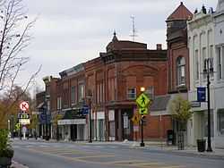
Downtown Montpelier | |
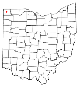 Location of Montpelier, Ohio | |
| Coordinates: 41°34′59″N 84°36′15″W / 41.58306°N 84.60417°WCoordinates: 41°34′59″N 84°36′15″W / 41.58306°N 84.60417°W | |
| Country | United States |
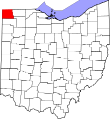
| State | Ohio |
| County | Williams |
| Village of Montpelier | 1845 |
| Government[1] | |
| • Mayor | Steve Yagelski |
| • Manager | Pam Lucas |
| Area[2] | |
| • Total | 2.93 sq mi (7.59 km2) |
| • Land | 2.91 sq mi (7.54 km2) |
| • Water | 0.02 sq mi (0.05 km2) |
| Elevation[3] | 856 ft (261 m) |
| Population (2010)[4] | |
| • Total | 4,072 |
| • Estimate (2012[5]) | 4,052 |
| • Density | 1,399.3/sq mi (540.3/km2) |
| Time zone | Eastern (EST) (UTC-5) |
| • Summer (DST) | EDT (UTC-4) |
| ZIP code | 43543 |
| Area code(s) | 419 |
| FIPS code | 39-51772[6] |
| GNIS feature ID | 1065475[3] |
| Website | http://www.montpelieroh.net/ |
Montpelier is a village in Williams County, Ohio, United States. The population was 4,072 at the 2010 census.
History
In the early 1840s, John Bryner and Jesse Tucker built a water-powered mill in Section 2 of Superior Township at a bend in the St. Joseph River. The Village of Montpelier, located just south of there, was first surveyed in May, 1845.
The Detroit, Butler & St. Louis Railroad (later known as the Wabash and today as the Norfolk Southern) laid track through Montpelier in 1880. The railroad’s arrival spurred phenomenal growth, and in 10 years, Montpelier’s population tripled to 1,203, making it Williams County’s second largest community. Montpelier experienced another banner year in 1892, when the Wabash Railroad purchased more than 20 acres to construct a locomotive roundhouse and rail yard in Montpelier. These improvements coincided with the opening of the railroad’s new Chicago to Detroit extension.
In 1901, the Wabash rail extension from Montpelier to Toledo was completed; in 1907, the railroad moved its shops from Ashley, Indiana to Montpelier. In 1917, the railroad’s division offices were relocated to Montpelier.
During the Twentieth Century, road and air transportation replaced railroads for most long-distance passenger travel in the United States, which caused a decline in the railroad’s use and importance. In 1971, the Wabash discontinued passenger service through Montpelier and division offices were moved to Fort Wayne, Indiana.
Geography
Montpelier is located at 41°34′59″N 84°36′15″W / 41.58306°N 84.60417°W (41.582981, -84.604204).[7]
According to the United States Census Bureau, the village has a total area of 2.93 square miles (7.59 km2), of which 2.91 square miles (7.54 km2) is land and 0.02 square miles (0.05 km2) is water.[2]
Demographics
2010 census
As of the census[4] of 2010, there were 4,072 people, 1,649 households, and 1,055 families residing in the village. The population density was 1,399.3 inhabitants per square mile (540.3/km2). There were 1,843 housing units at an average density of 633.3 per square mile (244.5/km2). The racial makeup of the village was 96.2% White, 0.1% African American, 0.5% Native American, 1.4% Asian, 0.4% from other races, and 1.3% from two or more races. Hispanic or Latino of any race were 3.4% of the population.
There were 1,649 households of which 33.4% had children under the age of 18 living with them, 42.4% were married couples living together, 15.0% had a female householder with no husband present, 6.5% had a male householder with no wife present, and 36.0% were non-families. 30.7% of all households were made up of individuals and 12.4% had someone living alone who was 65 years of age or older. The average household size was 2.43 and the average family size was 3.00.
The median age in the village was 36.1 years. 26.9% of residents were under the age of 18; 8% were between the ages of 18 and 24; 26.2% were from 25 to 44; 24.5% were from 45 to 64; and 14.5% were 65 years of age or older. The gender makeup of the village was 47.5% male and 52.5% female.
2000 census
As of the census[6] of 2000, there were 4,320 people, 1,751 households, and 1,131 families residing in the village. The population density was 1,601.0 people per square mile (617.8/km²). There were 1,866 housing units at an average density of 691.5 per square mile (266.8/km²). The racial makeup of the village was 96.62% White, 0.30% African American, 0.16% Native American, 1.48% Asian, 0.02% Pacific Islander, 0.65% from other races, and 0.76% from two or more races. Hispanic or Latino of any race were 1.53% of the population.
There were 1,751 households out of which 33.6% had children under the age of 18 living with them, 48.0% were married couples living together, 11.8% had a female householder with no husband present, and 35.4% were non-families. 30.2% of all households were made up of individuals and 15.1% had someone living alone who was 65 years of age or older. The average household size was 2.43 and the average family size was 2.99.
In the village the population was spread out with 27.4% under the age of 18, 9.8% from 18 to 24, 27.6% from 25 to 44, 19.0% from 45 to 64, and 16.2% who were 65 years of age or older. The median age was 34 years. For every 100 females there were 90.2 males. For every 100 females age 18 and over, there were 86.2 males.
The median income for a household in the village was $31,678, and the median income for a family was $41,250. Males had a median income of $31,389 versus $21,508 for females. The per capita income for the village was $14,791. About 4.3% of families and 6.2% of the population were below the poverty line, including 5.2% of those under age 18 and 7.3% of those age 65 or over.
State highways
Village government
Montpelier is a Charter Village with a strong Manager/Village Council form of government. The Village Manager is Pam Lucas and the Village Mayor is Steve Yagelski. The members of the Village Council: Ric Echler (President), Chris Walker (Law Director), Jason Rockey, Nathan Thompson, Delmar Karnes, Dan Clum, and Jim Rockey.
Education
Montpelier is served by the Montpelier Exempted Village School District. Montpelier Junior/Senior High School and Montpelier Elementary School share the same campus, which is located on the village's south side. Their nickname is the Locomotives. They are a member of the Northwest Ohio Athletic League.
Water quality awards
In 2003, 2006, and 2007 Montpelier won the Berkeley Springs International Water Tasting competition for its municipal water supply. Montpelier triumphed over cities as diverse as Sparwood, British Columbia and Rice Lake, Wisconsin.[8]
County fairgrounds
The Williams County Fairgrounds is located on Montpelier's east side. The Williams County Historical Museum is located on the fairgrounds.
Notable person
- Paul Allman Siple, Antarctic explorer, who, with Charles F. Passel, developed the first formula and table for measuring wind chill, a term which Siple coined.
References
- ↑ http://www.montpelieroh.net/
- ↑ 2.0 2.1 "US Gazetteer files 2010". United States Census Bureau. Retrieved 2013-01-06.
- ↑ 3.0 3.1 "US Board on Geographic Names". United States Geological Survey. 2007-10-25. Retrieved 2008-01-31.
- ↑ 4.0 4.1 "American FactFinder". United States Census Bureau. Retrieved 2013-01-06.
- ↑ "Population Estimates". United States Census Bureau. Retrieved 2013-06-17.
- ↑ 6.0 6.1 "American FactFinder". United States Census Bureau. Retrieved 2008-01-31.
- ↑ "US Gazetteer files: 2010, 2000, and 1990". United States Census Bureau. 2011-02-12. Retrieved 2011-04-23.
- ↑ "Tidbits: Did You Know". American Profile. 2007-07-15.
External links
| |||||||||||||||||||||||||||||