Montmarault
| Montmarault | ||
|---|---|---|
|
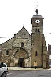
The church in Montmarault | ||
| ||
 Montmarault | ||
|
Location within Auvergne region  Montmarault | ||
| Coordinates: 46°19′06″N 2°57′20″E / 46.3183°N 2.9556°ECoordinates: 46°19′06″N 2°57′20″E / 46.3183°N 2.9556°E | ||
| Country | France | |
| Region | Auvergne | |
| Department | Allier | |
| Arrondissement | Montluçon | |
| Canton | Montmarault | |
| Intercommunality | Région de Montmarault | |
| Government | ||
| • Mayor (2008–2014) | René Mathonière | |
| Area1 | 9 km2 (3 sq mi) | |
| Population (2008)2 | 1,571 | |
| • Density | 170/km2 (450/sq mi) | |
| INSEE/Postal code | 03186 / 03390 | |
| Elevation |
394–498 m (1,293–1,634 ft) (avg. 487 m or 1,598 ft) | |
|
1 French Land Register data, which excludes lakes, ponds, glaciers > 1 km² (0.386 sq mi or 247 acres) and river estuaries. 2 Population without double counting: residents of multiple communes (e.g., students and military personnel) only counted once. | ||

Montmarault is a commune in the Allier department in central France.
Population
| Historical population | ||
|---|---|---|
| Year | Pop. | ±% |
| 1962 | 1,409 | — |
| 1968 | 1,446 | +2.6% |
| 1975 | 1,366 | −5.5% |
| 1982 | 1,443 | +5.6% |
| 1990 | 1,597 | +10.7% |
| 1999 | 1,663 | +4.1% |
| 2008 | 1,571 | −5.5% |
Tourism
The Petite Valette campground has been named the best camping of the Auvergne by the German ADAC.
See also
References
| Wikimedia Commons has media related to Montmarault. |