Montjean-sur-Loire
| Montjean-sur-Loire | |
|---|---|
|
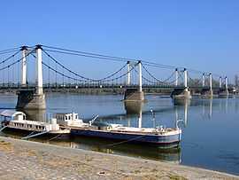
Loire bridge | |
 Montjean-sur-Loire | |
|
Location within Pays de la Loire region  Montjean-sur-Loire | |
| Coordinates: 47°23′21″N 0°51′35″W / 47.3892°N 0.8597°WCoordinates: 47°23′21″N 0°51′35″W / 47.3892°N 0.8597°W | |
| Country | France |
| Region | Pays de la Loire |
| Department | Maine-et-Loire |
| Arrondissement | Cholet |
| Canton | Saint-Florent-le-Vieil |
| Intercommunality | C.C du Canton of St-Florent-le-Vieil |
| Government | |
| • Mayor (2008–2014) | Christian Maillet |
| Area1 | 19.33 km2 (7.46 sq mi) |
| Population (2006)2 | 2,687 |
| • Density | 140/km2 (360/sq mi) |
| INSEE/Postal code | 49212 / 49570 |
| Elevation |
8–78 m (26–256 ft) (avg. 19 m or 62 ft) |
| Website | Site officiel de Montjean sur Loire |
|
1 French Land Register data, which excludes lakes, ponds, glaciers > 1 km² (0.386 sq mi or 247 acres) and river estuaries. 2 Population without double counting: residents of multiple communes (e.g., students and military personnel) only counted once. | |
Montjean-sur-Loire is a commune in the Maine-et-Loire department in western France.
See also
References
| Wikimedia Commons has media related to Montjean-sur-Loire. |