Montgesty
| Montgesty | |
|---|---|
|
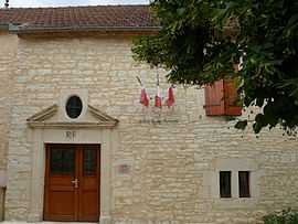
The town hall in Montgesty | |
 Montgesty | |
|
Location within Midi-Pyrénées region  Montgesty | |
| Coordinates: 44°34′48″N 1°17′52″E / 44.58°N 1.2978°ECoordinates: 44°34′48″N 1°17′52″E / 44.58°N 1.2978°E | |
| Country | France |
| Region | Midi-Pyrénées |
| Department | Lot |
| Arrondissement | Arrondissement of Cahors |
| Canton | Canton of Catus |
| Intercommunality | Communauté de communes de Catus |
| Government | |
| • Mayor (2008–2014) | Jean Noël Galthié |
| Area1 | 11.88 km2 (4.59 sq mi) |
| Population (1999)2 | 266 |
| • Density | 22/km2 (58/sq mi) |
| INSEE/Postal code | 46205 / 46150 |
| Elevation |
170–313 m (558–1,027 ft) (avg. 308 m or 1,010 ft) |
|
1 French Land Register data, which excludes lakes, ponds, glaciers > 1 km² (0.386 sq mi or 247 acres) and river estuaries. 2 Population without double counting: residents of multiple communes (e.g., students and military personnel) only counted once. | |
Montgesty is a commune in the Lot department in south-western France.
See also
- Jean-Gabriel Perboyre
- Communes of the Lot department
| Wikimedia Commons has media related to Montgesty. |