Monte Barone
| Monte Barone | |
|---|---|
 View from Valsesia (foreground: Denti di Gavala) | |
| Elevation | 2,044 m (6,706 ft)[1] |
| Prominence | 622 m (2,041 ft)[1][2] |
| Location | |
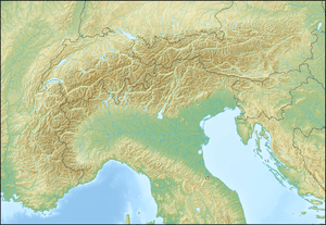 Monte Barone Location in the Alps | |
| Location | Province of Biella, Italy |
| Range | Alpi Biellesi |
| Coordinates | 45°44′15″N 08°09′12″E / 45.73750°N 8.15333°ECoordinates: 45°44′15″N 08°09′12″E / 45.73750°N 8.15333°E |
| Climbing | |
| Easiest route | from Piane di Coggiola |
Monte Barone is a mountain of the Alpi Biellesi, a sub-range of Pennine Alps. Due to its isolation offers a noteworthy point of view towars Po plain and can be seen from quite a long distance (i.e. from Turin).
Etymology
The name comes from Piedmontese language baron, which means heap or pile. The same etymology occurs for several other mountains like Colma di Mombarone or Monte Baron (Graian Alps).
Geography
The mountain is located in the drainage basin of Sesia between Strona di Postua's and Sessera's valleys, close to the border between Province of Vercelli and province of Biella. Administratively it is divided between the comunes of Coggiola and Caprile, both belonging to the province of Biella.
SOIUSA classification
According to the SOIUSA (International Standardized Mountain Subdivision of the Alps) the mountain can be classified in the following way:[3]
- main part = Western Alps
- major sector = North Western Alps
- section = Pennine Alps
- subsection = Southern Valsesia Alps
- supergroup = Alpi Biellesi
- group = Catena Monte Bo-Barone
- subgroup = Costiera Talamone-Barone
- code = I/B-9.IV-A.2.a
Access to the summit

The easiest route for the summit is a long footpath starting from Piane di Coggiola (950 m, BI) and reaching the mountain by its southern slopes.[4] A mountain hut with 22 bulk-beds located at 1,610 m, Rifugio Monte Barone, can be useful for hikers and climbers.[5]
Maps
- Italian official cartography (Istituto Geografico Militare - IGM); on-line version: www.pcn.minambiente.it
- Provincia di Biella cartography: Carta dei sentieri della Provincia di Biella, 1:25.00 scale, 2004; on line version: webgis.provincia.biella.it
References
- ↑ 1.0 1.1 Geoportale IGM on www.pcn.minambiente.it
- ↑ key col: Bocchetta della Boscarola (1,422 m)
- ↑ Marazzi, Sergio (2005). Atlante Orografico delle Alpi. SOIUSA (in Italian). Priuli & Verlucca. p. 134. ISBN 978-88-8068-273-8.
- ↑ Monte Barone di Coggiola, route description in italian on www.biellaclub.it (accessed on march the 3rd 2012)
- ↑ Rifugio Monte Barone - 1610m (Alpe Ponasca, Alta Valsessera), page on www.alpibiellesi.it (accessed on march the 3rd 2012)