Montbeugny
| Montbeugny | |
|---|---|
|
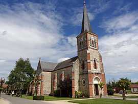
The church in Montbeugny | |
 Montbeugny | |
|
Location within Auvergne region  Montbeugny | |
| Coordinates: 46°31′47″N 3°29′23″E / 46.5297°N 3.4897°ECoordinates: 46°31′47″N 3°29′23″E / 46.5297°N 3.4897°E | |
| Country | France |
| Region | Auvergne |
| Department | Allier |
| Arrondissement | Moulins |
| Canton | Neuilly-le-Réal |
| Intercommunality | Moulins |
| Government | |
| • Mayor (2008–2014) | Guy Charmetant |
| Area1 | 32.65 km2 (12.61 sq mi) |
| Population (2008)2 | 639 |
| • Density | 20/km2 (51/sq mi) |
| INSEE/Postal code | 03180 / 03340 |
| Elevation |
238–287 m (781–942 ft) (avg. 274 m or 899 ft) |
|
1 French Land Register data, which excludes lakes, ponds, glaciers > 1 km² (0.386 sq mi or 247 acres) and river estuaries. 2 Population without double counting: residents of multiple communes (e.g., students and military personnel) only counted once. | |
Montbeugny is a commune in the Allier department in central France.
Population
| Historical population | ||
|---|---|---|
| Year | Pop. | ±% |
| 1962 | 504 | — |
| 1968 | 505 | +0.2% |
| 1975 | 457 | −9.5% |
| 1982 | 421 | −7.9% |
| 1990 | 557 | +32.3% |
| 1999 | 552 | −0.9% |
| 2008 | 639 | +15.8% |
See also
References
| Wikimedia Commons has media related to Montbeugny. |
I