Montaud, Hérault
| Montaud | ||
|---|---|---|
| ||
 Montaud | ||
|
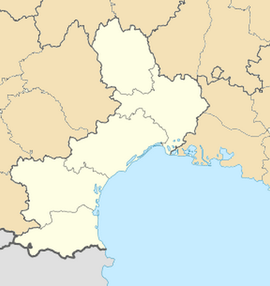
Location within Languedoc-Roussillon region  Montaud | ||
| Coordinates: 43°45′07″N 3°57′23″E / 43.7519°N 3.9564°ECoordinates: 43°45′07″N 3°57′23″E / 43.7519°N 3.9564°E | ||
| Country | France | |
| Region | Languedoc-Roussillon | |
| Department | Hérault | |
| Arrondissement | Montpellier | |
| Canton | Castries | |
| Intercommunality | Montpellier | |
| Government | ||
| • Mayor (2008–2014) | Pierre Combettes | |
| Area1 | 12.92 km2 (4.99 sq mi) | |
| Population (2008)2 | 857 | |
| • Density | 66/km2 (170/sq mi) | |
| INSEE/Postal code | 34164 / 34160 | |
| Elevation |
51–210 m (167–689 ft) (avg. 110 m or 360 ft) | |
|
1 French Land Register data, which excludes lakes, ponds, glaciers > 1 km² (0.386 sq mi or 247 acres) and river estuaries. 2 Population without double counting: residents of multiple communes (e.g., students and military personnel) only counted once. | ||
Montaud is a commune in the Hérault department in the Languedoc-Roussillon region in southern France.
Montaud is a mountain village with a dozen hamlets. It contains a school, a city hall, a church, and a few farms. Most inhabitants of Montaud work in nearby Montpellier, many as researchers, teachers, engineers and technicians.

History
French Cardinal, Bertrand Pierre (Cardinal de Colombier), who was used by the popes at Avignon for agent in wartime missions during the Hundred Years War and in the election of Charles of Bohemia to the imperial throne, died in Montaud in 1361.[1]
Montaud is located in the north of the Vercors, an important site of the French Resistance during World War II.
Children from the primary school of Montaud participated in a "spacetalk" via ARISS radio contact with astronaut Mike Finckle, aboard the International Space Station in 2004.[2]
Population
| Historical population | ||
|---|---|---|
| Year | Pop. | ±% |
| 1793 | 201 | — |
| 1821 | 284 | +41.3% |
| 1841 | 280 | −1.4% |
| 1856 | 279 | −0.4% |
| 1872 | 283 | +1.4% |
| 1886 | 202 | −28.6% |
| 1901 | 249 | +23.3% |
| 1921 | 263 | +5.6% |
| 1936 | 284 | +8.0% |
| 1962 | 288 | +1.4% |
| 1975 | 298 | +3.5% |
| 1982 | 413 | +38.6% |
| 1990 | 545 | +32.0% |
| 1999 | 617 | +13.2% |
| 2008 | 857 | +38.9% |
See also
References
| Wikimedia Commons has media related to Montaud (Hérault). |
