Montaiguët-en-Forez
| Montaiguët-en-Forez | ||
|---|---|---|
|
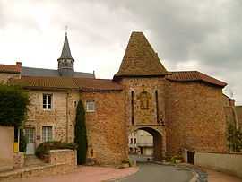
Town gate | ||
| ||
 Montaiguët-en-Forez | ||
|
Location within Auvergne region  Montaiguët-en-Forez | ||
| Coordinates: 46°16′18″N 3°48′09″E / 46.2717°N 3.8025°ECoordinates: 46°16′18″N 3°48′09″E / 46.2717°N 3.8025°E | ||
| Country | France | |
| Region | Auvergne | |
| Department | Allier | |
| Arrondissement | Vichy | |
| Canton | Le Donjon | |
| Intercommunality | Le Donjon–Val Libre | |
| Government | ||
| • Mayor (2008–2014) | Henri Beacud | |
| Area1 | 22.49 km2 (8.68 sq mi) | |
| Population (2008)2 | 312 | |
| • Density | 14/km2 (36/sq mi) | |
| INSEE/Postal code | 03178 / 03130 | |
| Elevation |
276–465 m (906–1,526 ft) (avg. 410 m or 1,350 ft) | |
|
1 French Land Register data, which excludes lakes, ponds, glaciers > 1 km² (0.386 sq mi or 247 acres) and river estuaries. 2 Population without double counting: residents of multiple communes (e.g., students and military personnel) only counted once. | ||

Montaiguët-en-Forez is a commune in the Allier department in central France.
Population
| Historical population | ||
|---|---|---|
| Year | Pop. | ±% |
| 1962 | 536 | — |
| 1968 | 564 | +5.2% |
| 1975 | 473 | −16.1% |
| 1982 | 404 | −14.6% |
| 1990 | 357 | −11.6% |
| 1999 | 320 | −10.4% |
| 2008 | 312 | −2.5% |
See also
References
| Wikimedia Commons has media related to Montaiguët-en-Forez. |