Monomoy National Wildlife Refuge
| Monomoy Island National Wildlife Refuge | |
|---|---|
|
IUCN category IV (habitat/species management area) | |
|
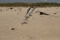
Tern at Monomoy | |
 Map of the United States | |
| Location | Barnstable County, Massachusetts, United States |
| Nearest city | Chatham, Massachusetts |
| Coordinates | 41°33′0″N 70°0′0″W / 41.55000°N 70.00000°WCoordinates: 41°33′0″N 70°0′0″W / 41.55000°N 70.00000°W |
| Area | 7,604 acres (30.77 km2) |
| Established | 1944 |
| Governing body | U.S. Fish and Wildlife Service |
| http://www.fws.gov/northeast/monomoy/ | |

Monomoy Island National Wildlife Refuge is federal wildlife refuge located on Monomoy Island in Massachusetts.
It was taken over by the US government just before World War II. The island was home to the Monomoy Island Gunnery Range until 1951[1] when the Monomoy National Wildlife Refuge was established. Its goal was to provide habitat for migratory birds. The size of the refuge is 7,604 acres (31 km²) with varied habitats of oceans, salt and freshwater marshes, dunes, freshwater ponds, and some historic manmade structures, such as the Monomoy Point Light and keeper's quarters (decommissioned but open to the public).
External links
References
- ↑ "Archives Search Report". US Corps of Engineers. Retrieved January 1, 2014.
![]() This article incorporates public domain material from websites or documents of the United States Fish and Wildlife Service.
This article incorporates public domain material from websites or documents of the United States Fish and Wildlife Service.
| ||||||||||||||||||||||||||||||||||||||||||||||||||||||||||