Monmouth Executive Airport
| Monmouth Executive Airport | |||||||||||||||
|---|---|---|---|---|---|---|---|---|---|---|---|---|---|---|---|
| IATA: BLM – ICAO: KBLM – FAA LID: BLM | |||||||||||||||
| Summary | |||||||||||||||
| Airport type | Public use | ||||||||||||||
| Owner | Wall Herald Corp. | ||||||||||||||
| Serves | Belmar / Farmingdale, New Jersey | ||||||||||||||
| Location | Wall Township, Monmouth County | ||||||||||||||
| Elevation AMSL | 153 ft / 47 m | ||||||||||||||
| Coordinates | 40°11′12″N 074°07′28″W / 40.18667°N 74.12444°WCoordinates: 40°11′12″N 074°07′28″W / 40.18667°N 74.12444°W | ||||||||||||||
| Map | |||||||||||||||
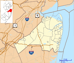 BLM Location in Monmouth County | |||||||||||||||
| Runways | |||||||||||||||
| |||||||||||||||
| Statistics (2010) | |||||||||||||||
| |||||||||||||||
Monmouth Executive Airport (IATA: BLM[2], ICAO: KBLM, FAA LID: BLM) is a privately owned, public use airport in Monmouth County, New Jersey.[1] It is in Wall Township six miles west of Belmar, east of Farmingdale.[1] The National Plan of Integrated Airport Systems for 2011–2015 categorized it as a general aviation reliever airport. Prior to 2003, it was known as Allaire Airport.[3] The airport was sold on December 3, 2013 to a consortium known as Wall Aviation.[4] The new owners intend to evict current renters and upgrade the facility to serve corporate clients.[5]
In an analysis by the Regional Plan Association in 2011, Monmouth Executive scored highly as a potential airport for airline flights to expand capacity and relieve aviation congestion in the New York area.[6]
Facilities
Monmouth Executive Airport covers 850 acres (344 ha) at an elevation of 153 feet (47 m). It has two asphalt runways: 14/32 is 7,371 by 85 feet (2,247 x 26 m) and 3/21 is 3,512 by 50 feet (1,070 x 15 m).[1]
In the year ending January 1, 2010 the airport had 57,229 aircraft operations, average 156 per day: 83% general aviation and 17% air taxi.[1]
Incidents and accidents
On February 15, 2010 a small aircraft, identified as a Cessna 337, crashed on approach to the airport, killing all five people on board. Witnesses said the plane broke apart after aborting a landing.
See also
References
- ↑ 1.0 1.1 1.2 1.3 1.4 FAA Airport Master Record for BLM (Form 5010 PDF). Federal Aviation Administration. Effective November 15, 2012.
- ↑ "IATA Airport Code Search (BLM: Belmar / Monmouth County)". International Air Transport Association. Retrieved October 25, 2013.
- ↑ "KBLM – Allaire Airport". FAA data republished by AirNav. Effective October 3, 2002. Archived from the original on November 7, 2002. Check date values in:
|date=(help) - ↑ Strunsky, Steve (December 8, 2013). "After 75 years in the family, Monmouth Executive Airport is under new management". The Star-Ledger. Retrieved 2013-12-08.
- ↑ Serrano, Ken (Nov 22, 2013). "Monmouth airport's new owners hope to lure more corporate jets". Asbury Park Press. Retrieved 2013-12-08.
- ↑ Zupan, Jeffrey M.; Brone, Richard E.; Lee, Matthew H. (January 2011), Upgrading to World Class The Future of the New York Region's Airports (PDF), Regional Plan Association
External links
- Monmouth Executive Airport (BLM) from New Jersey DOT Airport Directory
- Aviation photos of Monmouth Executive Airport at jetphotos.net
- Aerial image as of March 1995 from USGS The National Map
- FAA Terminal Procedures for BLM, effective April 2, 2015
- Resources for this airport:
- FAA airport information for BLM
- AirNav airport information for KBLM
- ASN accident history for BLM
- FlightAware airport information and live flight tracker
- NOAA/NWS latest weather observations
- SkyVector aeronautical chart, Terminal Procedures