Monistrol-d'Allier
| Monistrol-d'Allier | |
|---|---|
|
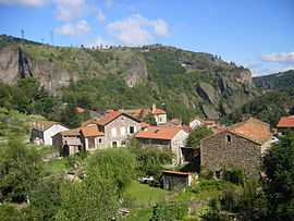
A general view of Monistrol-d'Allier | |
 Monistrol-d'Allier | |
|
Location within Auvergne region  Monistrol-d'Allier | |
| Coordinates: 44°58′09″N 3°38′39″E / 44.9692°N 3.6442°ECoordinates: 44°58′09″N 3°38′39″E / 44.9692°N 3.6442°E | |
| Country | France |
| Region | Auvergne |
| Department | Haute-Loire |
| Arrondissement | Le Puy-en-Velay |
| Canton | Saugues |
| Government | |
| • Mayor (2001–2008) | Raymond Ravat |
| Area1 | 27.32 km2 (10.55 sq mi) |
| Population (1999)2 | 219 |
| • Density | 8.0/km2 (21/sq mi) |
| INSEE/Postal code | 43136 / 43580 |
| Elevation | 551–1,074 m (1,808–3,524 ft) |
|
1 French Land Register data, which excludes lakes, ponds, glaciers > 1 km² (0.386 sq mi or 247 acres) and river estuaries. 2 Population without double counting: residents of multiple communes (e.g., students and military personnel) only counted once. | |
Monistrol-d'Allier is a commune in the Haute-Loire department in south-central France.
See also
| Wikimedia Commons has media related to Monistrol-d'Allier. |