Mongpawn
- Not to be confused with Mongpawng State
| Mongpawn | |||||
| State of the Shan States | |||||
| |||||
 | |||||
| History | |||||
| - | Foundation of the kingdom of Rajjavadi | 1816 | |||
| - | Abdication of the last Saopha | 1959 | |||
| Area | |||||
| - | 1901 | 960 km2 (371 sq mi) | |||
| Population | |||||
| - | 1901 | 13,143 | |||
| Density | 13.7 /km2 (35.5 /sq mi) | ||||

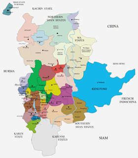
Mongpawn or Möngpawn (Burmese: Maingpun) was a Shan state in what is today Burma. The state is located in the valley of the Nam Pawn river.
History
According to tradition a predecessor state in the area was named Rajjavadi. Möngpawn state was founded in 1816 under the overlordship of Mongnai State. Historically Mongpawn played an important part before the British annexation of Upper Burma, at the time of the Burmese resistance movement 1885–95. The ruler of Mongpawn was an active supporter of the Limbin prince, Prince Kanaung Mintha, also known as Prince Limbin, was a son of King Tharrawaddy Min.
Traditionally about two thirds of the population in the state belonged to the Shan and about one third to the Pa'O people groups, the former living in the valley and the latter on the hilly areas.[1]
Rulers
The rulers of Mongpawn bore the title of Myoza and from 1887, Saopha.[2] They were entitled to a 9-gun salute by the British authorities.[3]
Myozas
- 1816 - 1860 Hkun Lek (d. 1860)
- 1860 - 1882 Hkun Ti (b. 1847 - d. 1928)
Saophas
- 1882 - 1928 Hkun Ti (s.a.)
- 1928 - 19 Jul 1947 Sao Sam Htun (b. 1907 - d. 1947)
- 20 Jul 1947 - 1962 Sao Hso Hom (b. 1936)
References
- ↑ Imperial Gazetteer of India, v. 17, p. 408.
- ↑ Ben Cahoon (2000). "World Statesmen.org: Shan and Karenni States of Burma". Retrieved 7 July 2014.
- ↑ Yawnghwe (Shan State) (9 Gun Salute)
External links
- "WHKMLA : History of the Shan States". 18 May 2010. Retrieved 21 December 2010.
- "The Imperial Gazetteer of India". Digital South Asia Library, University of Chicago. Retrieved 21 December 2010.
| ||||||||||||||||||||||||||||||
Coordinates: 20°42′N 97°26′E / 20.700°N 97.433°E