Mongpan State
| Mongpan | |||||
| State of the Shan States | |||||
| |||||
 | |||||
| Capital | Mong Pan | ||||
| History | |||||
| - | State founded | 1637 | |||
| - | Abdication of the last Saopha | 1959 | |||
| Area | |||||
| - | 1901 | 3,703 km2 (1,430 sq mi) | |||
| Population | |||||
| - | 1901 | 16,629 | |||
| Density | 4.5 /km2 (11.6 /sq mi) | ||||
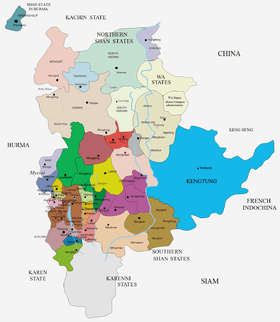
Mongpan or Möngpan was a Shan state in what is today Burma. It belonged to the Eastern Division of the Southern Shan States.
The town of Mong Pan was formerly the residence of the Sawbwa of Mongpan State. The capital is in the middle of a fertile plain. Most of the other areas of the state are mountainous, rich in teak forests. Loi Hkilek, a 2,133 high mountain is located in Mongkyawt District.[1]
History
According to legend there had been a predecessor state named . Mongpan state was founded in 1637, but little is known of the history of the state before the times of British Burma.[1] The four districts of Mongtang, Monghang, Mongkyawt and Monghta, located to the east beyond the east bank of the Salween belonged to the Cis-Salween Sawbwa of Mongpan.
In 1888 there was trouble owing to the action of Siam, who attempted to take possession of the trans-Salween districts. Siamese troops were posted in the four districts and Siam also claimed a further district, Monghsat, but posted no troops there.[2] Between December 1943 and 1945 all districts of Mongpan State east of the Salween were annexed by Thailand as part of the Saharat Thai Doem territory.
Rulers
The rulers of Mongpan bore the title of Saopha after 1867; their ritual style was Kambawsa Mahawuntha Thirdamaraza.[3]
Myozas
- 1637 - .... Tawk La
- .... - .... Twak Hkam
- .... - .... Twak Twe
- .... - .... Op La
- .... - .... Hkun Som
- .... - .... Shwe Tong
- .... - .... Sai U
- .... - .... Sai Nyo
- .... - 1809 Naw Hkam (d. 1809)
- 1809 - 1823 Mana Ne Myo (d. 1823)
- 1823 - 1858 Maung Shwe Hkam (d. 1858)
- 1858 - 1867 Hkun Tun U (d. 1886)
Saophas
- 1867 - 1886 Hkun Tun U (s.a.)
- 1886 - 1918 Hkun Num Leng (b. 1869 - d. 1918)
- 1918 - 1952 Hkun On
References
- ↑ 1.0 1.1 Imperial Gazetteer of India, v. 17, p. 407
- ↑ The Pacification of Burma, by Sir Charles Haukes Todd Crosthwaite
- ↑ Ben Cahoon (2000). "World Statesmen.org: Shan and Karenni States of Burma". Retrieved 7 July 2014.
External links
- "Gazetteer of Upper Burma and the Shan states"
- The Imperial Gazetteer of India
- "WHKMLA : History of the Shan States". 18 May 2010. Retrieved 21 December 2010.
| ||||||||||||||||||||||||||||||
Coordinates: 20°06′N 98°37′E / 20.100°N 98.617°E