Mongala District
Coordinates: 02°09′N 021°31′E / 2.150°N 21.517°E
| Mongala District | |
|---|---|
| District | |
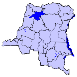 Location of Mongala District in the Democratic Republic of the Congo. | |
| Country |
|
| Province | Équateur |
Mongala District is a district located in the Équateur province, in the Democratic Republic of the Congo.
Mongala was to become one of 25 proposed provinces specified in the country's Constitution of 18 February 2006, to take effect no later than February 2009.[1] As of October 2010, this had not taken place.[2]
Location
Mongala is located at the northwest of the country on the Congo River, and borders the districts of Tshopo, Bas-Uele, Nord-Ubangi, Sud-Ubangi, Équateur and Tshuapa. It is divided into three territories:
- Bongandanga
- Bumba, major town and site of a former secessionist state (1963) in the province.
- Lisala
The capital of Mongala District is the town of Lisala.[3] The district includes the village of Yambuku.
Former province
From 1963–1966, Mongala was a province known as Moyen-Congo, but it was reintegrated into Équateur province under Mobutu. Presidents (later governors) of the Moyen-Congo province were:
- 6 April 1963 – June 1964 Laurent Eketebi (s.a.)
- (de facto from 15 September 1962)
- April 1963 – 30 July 1963 Denis Akundji
- (president of secessionist province of Bumba)
- 23 June 1964 – 10 August 1965 Augustin Engwanda
- 10 August 1965 – 25 April 1966 Denis Sakombi (born 1929, died 1985)
References
| ||||||||||||||||||||||||||||||||||||||||||||||