Mong Kung Township
| Mong Kung | |
|---|---|
| Township | |
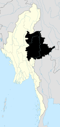
 Mong Kung Location in Burma | |
| Coordinates: 21°36′30″N 97°31′50″E / 21.60833°N 97.53056°ECoordinates: 21°36′30″N 97°31′50″E / 21.60833°N 97.53056°E | |
| Country |
|
| State | Shan State |
| District | Loilem District |
| Elevation | 1,095 m (3,593 ft) |
| Time zone | MST (UTC+6.30) |
Mong Kung Township or Mongkaung Township[1]) is a township of Loilen District in the Shan State of Burma. The principal town is Mong Kung.
Sometime prior to 2002, the southern portion of Mong Kung Township was transferred to Hopong Township in Taunggyi District.[2]
Notes
- ↑ "Myanmar States/Divisions & Townships Overview Map" Myanmar Information Management Unit (MIMU)
- ↑ Maplandia, as of 28 October 2010, showed the former boundaries, "Mong Kung Google Satellite Map" Maplandia
External links
- "Mongkaung Township - Shan State" Map, 14 June 2010, Myanmar Information Management Unit (MIMU)
| ||||||||||