Monett, Missouri
| Monett, Missouri | |
|---|---|
| City | |
| Motto: Pride & Progress | |
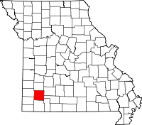
 Location of Monett, Missouri | |
| Coordinates: 36°55′25″N 93°55′20″W / 36.92361°N 93.92222°WCoordinates: 36°55′25″N 93°55′20″W / 36.92361°N 93.92222°W | |
| Country | United States |
| State | Missouri |
| Counties | Barry, Lawrence |
| Township | Monett, Pierce |
| Government | |
| • Mayor | James Orr[1] |
| Area[2] | |
| • Total | 8.45 sq mi (21.89 km2) |
| • Land | 8.43 sq mi (21.83 km2) |
| • Water | 0.02 sq mi (0.05 km2) |
| Elevation | 1,355 ft (413 m) |
| Population (2010)[3] | |
| • Total | 8,873 |
| • Estimate (2012[4]) | 8,922 |
| • Density | 1,052.6/sq mi (406.4/km2) |
| Time zone | Central (CST) (UTC-6) |
| • Summer (DST) | CDT (UTC-5) |
| ZIP code | 65708 |
| Area code(s) | 417 |
| FIPS code | 29-49196[5] |
| GNIS feature ID | 0729929[6] |
Monett is a city in Monett Township in Barry County and Pierce Township in Lawrence County, Missouri, United States. The population was 8,873 at the 2010 census.
History
Monett was founded in 1887. It was named for an agent of the New York Central Railroad.[7]
The St. Louis–San Francisco Railway (the "Frisco"), then known as the South Pacific Railroad, passed through the present location of Monett in 1870. When it began building a branch to Texas in 1880, the new branch left the main line at this location and a small community called Plymouth or Plymouth Junction grew up around the railroad junction and flag station. The postal name of the town during this period was Gonten, named after the postmaster. In 1887, the Frisco moved its local division point from Pierce City to Plymouth, which was considerably enlarged by the railroad and renamed Monett.
Until 1934, the portion of present-day Monett in Lawrence County was a separate town called Forest Park. The historical population totals in the table for 1930 and earlier census years do not include the population of Forest Park, which had a population of 478 in 1910, 432 in 1920 and 598 in 1930.
Geography
Monett is located at 36°55′25″N 93°55′20″W / 36.92361°N 93.92222°W (36.923725, -93.922332).[8]
According to the United States Census Bureau, the city has a total area of 8.45 square miles (21.89 km2), of which 8.43 square miles (21.83 km2) is land and 0.02 square miles (0.05 km2) is water.[2]
Demographics
| Historical population | |||
|---|---|---|---|
| Census | Pop. | %± | |
| 1890 | 1,699 | — | |
| 1900 | 3,115 | 83.3% | |
| 1910 | 4,177 | 34.1% | |
| 1920 | 4,206 | 0.7% | |
| 1930 | 4,099 | −2.5% | |
| 1940 | 4,395 | 7.2% | |
| 1950 | 4,771 | 8.6% | |
| 1960 | 5,359 | 12.3% | |
| 1970 | 5,937 | 10.8% | |
| 1980 | 6,148 | 3.6% | |
| 1990 | 6,529 | 6.2% | |
| 2000 | 7,396 | 13.3% | |
| 2010 | 8,873 | 20.0% | |
| Est. 2013 | 8,940 | 0.8% | |
| U.S. Decennial Census | |||
The town has seen quite a rapid growth over the last few years. In March 2006, a Lowe's opened up in addition to several new shopping centers. This community is driven primarily by its industrial sector. Several key businesses in town include Jack Henry & Associates, Tyson Foods, Hydro Aluminum, International Dehydrated Foods, Miracle, Architectural Systems Inc., EFCO, and WinTech.
2010 census
As of the census[3] of 2010, there were 8,873 people, 3,405 households, and 2,282 families residing in the city. The population density was 1,052.6 inhabitants per square mile (406.4/km2). There were 3,828 housing units at an average density of 454.1 per square mile (175.3/km2). The racial makeup of the city was 86.8% White, 0.8% African American, 0.9% Native American, 1.0% Asian, 0.1% Pacific Islander, 8.5% from other races, and 1.9% from two or more races. Hispanic or Latino of any race were 19.0% of the population.
There were 3,405 households of which 36.8% had children under the age of 18 living with them, 48.8% were married couples living together, 12.7% had a female householder with no husband present, 5.6% had a male householder with no wife present, and 33.0% were non-families. 27.9% of all households were made up of individuals and 11.2% had someone living alone who was 65 years of age or older. The average household size was 2.57 and the average family size was 3.12.
The median age in the city was 34 years. 27.8% of residents were under the age of 18; 9% were between the ages of 18 and 24; 26.6% were from 25 to 44; 22.1% were from 45 to 64; and 14.5% were 65 years of age or older. The gender makeup of the city was 48.1% male and 51.9% female.
2000 census
As of the census[5] of 2000, there were 7,396 people, 2,904 households, and 1,916 families residing in the city. The population density was 1,136.2 people per square mile (438.6/km²). There were 3,130 housing units at an average density of 480.8/sq mi (185.6/km²). The racial makeup of the city was 89.45% White, 2.00% African American, 0.82% Native American, 0.62% Asian, 0.11% Pacific Islander, 7.82% from other races, and 0.96% from two or more races.
There were 2,904 households out of which 32.0% had children under the age of 18 living with them, 51.2% were married couples living together, 10.7% had a female householder with no husband present, and 34.0% were non-families. 29.4% of all households were made up of individuals and 15.1% had someone living alone who was 65 years of age or older. The average household size was 2.49 and the average family size was 3.08.
In the city the population was spread out with 26.5% under the age of 18, 9.7% from 18 to 24, 27.3% from 25 to 44, 18.9% from 45 to 64, and 17.6% who were 65 years of age or older. The median age was 35 years. For every 100 females there were 91.1 males. For every 100 females age 18 and over, there were 86.8 males.
The median income for a household in the city was $30,764, and the median income for a family was $36,858. Males had a median income of $26,150 versus $18,211 for females. The per capita income for the city was $17,048. About 9.2% of families and 15.0% of the population were below the poverty line, including 25.4% of those under age 18 and 7.8% of those age 65 or over.
Climate
Climate is characterized by relatively high temperatures and evenly distributed precipitation throughout the year. The Köppen Climate Classification subtype for this climate is "Cfa" (Humid Subtropical Climate).[9]
| Climate data for Monett, Missouri | |||||||||||||
|---|---|---|---|---|---|---|---|---|---|---|---|---|---|
| Month | Jan | Feb | Mar | Apr | May | Jun | Jul | Aug | Sep | Oct | Nov | Dec | Year |
| Average high °C (°F) | 8 (46) |
10 (50) |
14 (57) |
22 (71) |
26 (78) |
30 (86) |
32 (90) |
32 (90) |
28 (83) |
23 (73) |
15 (59) |
9 (49) |
20.8 (69.3) |
| Average low °C (°F) | −5 (23) |
−3 (26) |
0 (32) |
7 (45) |
13 (55) |
17 (63) |
20 (68) |
18 (65) |
14 (58) |
8 (47) |
2 (35) |
−3 (27) |
7.3 (45.3) |
| Average precipitation mm (inches) | 38 (1.5) |
56 (2.2) |
81 (3.2) |
107 (4.2) |
124 (4.9) |
119 (4.7) |
91 (3.6) |
71 (2.8) |
107 (4.2) |
80 (3) |
66 (2.6) |
66 (2.6) |
1,006 (39.5) |
| Avg. precipitation days | 5 | 6 | 8 | 9 | 9 | 8 | 7 | 7 | 6 | 6 | 7 | 6 | 84 |
| Source: Weatherbase [10] | |||||||||||||
References
- ↑ "Mayor & Council". Welcome to the City of Monett. Retrieved 28 April 2015.
- ↑ 2.0 2.1 "US Gazetteer files 2010". United States Census Bureau. Retrieved 2012-07-08.
- ↑ 3.0 3.1 "American FactFinder". United States Census Bureau. Retrieved 2012-07-08.
- ↑ "Population Estimates". United States Census Bureau. Retrieved 2013-05-30.
- ↑ 5.0 5.1 "American FactFinder". United States Census Bureau. Retrieved 2008-01-31.
- ↑ "US Board on Geographic Names". United States Geological Survey. 2007-10-25. Retrieved 2008-01-31.
- ↑ Eaton, David Wolfe (1916). How Missouri Counties, Towns and Streams Were Named. The State Historical Society of Missouri. p. 206.
- ↑ "US Gazetteer files: 2010, 2000, and 1990". United States Census Bureau. 2011-02-12. Retrieved 2011-04-23.
- ↑ Climate Summary for Monett, Missouri
- ↑ "Weatherbase.com". Weatherbase. 2013. Retrieved on August 16, 2013.
External links
- Official City Website
- Online Edition of City Paper
- Monett Chamber of Commerce
- Monett School District
- Local Business Directory
- Historic maps of Monett in the Sanborn Maps of Missouri Collection at the University of Missouri
| |||||||||||||||||||||||||||||||||

| |||||||||||||||||||||||||||||||||