Monestier, Allier
| Monestier | |
|---|---|
|
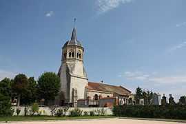
The church in Monestier | |
 Monestier | |
|
Location within Auvergne region  Monestier | |
| Coordinates: 46°15′22″N 3°06′51″E / 46.2561°N 3.1142°ECoordinates: 46°15′22″N 3°06′51″E / 46.2561°N 3.1142°E | |
| Country | France |
| Region | Auvergne |
| Department | Allier |
| Arrondissement | Moulins |
| Canton | Chantelle |
| Intercommunality | Sioule, Colettes et Bouble |
| Government | |
| • Mayor (2008–2014) | Alain Guillaumin |
| Area1 | 29.68 km2 (11.46 sq mi) |
| Population (2008)2 | 268 |
| • Density | 9.0/km2 (23/sq mi) |
| INSEE/Postal code | 03175 / 03140 |
| Elevation |
290–413 m (951–1,355 ft) (avg. 323 m or 1,060 ft) |
|
1 French Land Register data, which excludes lakes, ponds, glaciers > 1 km² (0.386 sq mi or 247 acres) and river estuaries. 2 Population without double counting: residents of multiple communes (e.g., students and military personnel) only counted once. | |
Monestier is a commune in the Allier department in central France.
Geography
The river Bouble forms most of the commune's southwestern border, then flows east through its southern part.
Population
| Historical population | ||
|---|---|---|
| Year | Pop. | ±% |
| 1962 | 436 | — |
| 1968 | 437 | +0.2% |
| 1975 | 359 | −17.8% |
| 1982 | 274 | −23.7% |
| 1990 | 282 | +2.9% |
| 1999 | 266 | −5.7% |
| 2008 | 268 | +0.8% |
See also
References
| Wikimedia Commons has media related to Monestier (Allier). |