Moelfre, Anglesey


Moelfre is a village and community on the north east coast of Isle of Anglesey in Wales, and on the Anglesey Coastal Path. It has a population of 1,064.[1] The meaning of the Welsh language word Moelfre translated in English is 'bald or barren hill', which describes the land behind the village, as seen from the sea. It is the same name as that of the Malvern Hills in Worcestershire and Herefordshire.[2] The village today has 502 households and 5% unemployment. The Royal Mail postcode begins LL72.
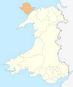
Location
The village of Moelfre is 5 minutes from the A5025. The nearest mainline railway stations are in Bangor and Llanfairpwllgwyngyll. These can be reached in under half an hour on the bus services which run through the village.
History
It was the site of the wreck in 1859 of the hybrid ship The Royal Charter near the end of its voyage from Australia to Liverpool.[3] There were no street lights in the village until well after the Second World War. Moelfre RNLI Lifeboat Station has a famous history, including the Hindlea rescue in 1959, when all the crew were rescued.
Economy and Culture
This area is popular as it is right by the large sandy beach Traeth Lligwy and the ancient stone homestead of Din Lligwy. Nearby Ynys Moelfre is a haven for birds, and seals and porpoises may also be seen. In the village there is a bakery, restaurants and a fish and chip shop as well as The RNLI Lifeboat Station and Seawatch Centre which are open to the public.
Actress Jennifer Ellison was rescued by the RNLI in August 2013.[4] off Moelfre.
References
- ↑ Office for National Statistics : Neighbourhood Statistics : Census 2001 : Isle of Anglesey
- ↑ Smart, Mike (2009). Malvern Hills. Frances Lincoln ltd. p. 15. ISBN 0711229155.
- ↑ Holden, Chris and Lesley (2009). Life and Death on the Royal Charter. Calgo Publications. ISBN 978-0-9545066-2-9.
- ↑ "Jennifer Ellison rescue". dailypost.co.uk. Retrieved March 24, 2015.
External links
| ||||||||||||||||||||||||||||
| ||||||