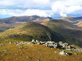
Moel yr Ogof
| Moel yr Ogof | |
|---|---|
 Moel yr Ogof from Moel Hebog with Moel Lefn behind. | |
| Elevation | 655 m (2,149 ft) |
| Prominence | 118 m (387 ft) |
| Parent peak | Moel Hebog |
| Listing | Hewitt, Nuttall, HuMP |
| Translation | hill of the cave (Welsh) |
| Location | |
| Location | Snowdonia, Gwynedd, Wales |
| Range | Moel Hebog |
| OS grid | SH565469 |
| Coordinates | 53°00′31″N 4°09′12″W / 53.0086°N 4.1534°WCoordinates: 53°00′31″N 4°09′12″W / 53.0086°N 4.1534°W |
| Topo map | OS Landranger 115 |
Moel yr Ogof is a summit in Snowdonia. It is a subsidiary summit of Moel Hebog and a sister peak to the lower Moel Lefn.
There is an Asbestos trial mine located on the summit. A small seam of white asbestos was discovered however insufficient amounts to commercially mine.
Owain Glyndŵr's cave can be found on the cliff at the western flank of the mountain. The Beddgelert Forest lies directly to the north east, while Cwm Pennant lies to the west. Good views of the Nantlle ridge to the north are observed.[1]
References
- ↑ Nuttall, John & Anne (1999). The Mountains of England & Wales - Volume 1: Wales (2nd edition ed.). Milnthorpe, Cumbria: Cicerone. ISBN 1-85284-304-7.
External links
.jpg)
Moel yr Ogof from Moel Hebog