Mischief Reef
| Disputed island Other names: Meiji Reef Panganiban reef Đá Vành Khăn | |
|---|---|
| Geography | |
 | |
| Location | South China Sea |
| Coordinates | 9°55′N 115°32′E / 9.917°N 115.533°ECoordinates: 9°55′N 115°32′E / 9.917°N 115.533°E |
| Archipelago | Spratly Islands |
| Administered by | |
| People's Republic of China | |
| Claimed by | |
| People's Republic of China | |
| Philippines | |
| Republic of China (Taiwan) | |
| Vietnam | |
| Part of a series on the |
| Spratly Islands |
|---|
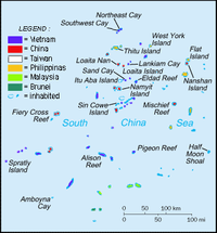
 Spratly Islands military occupations map |
| Related articles |
| Confrontations |
|
Southwest Cay incident (1975) |
| Military occupations |
|
|
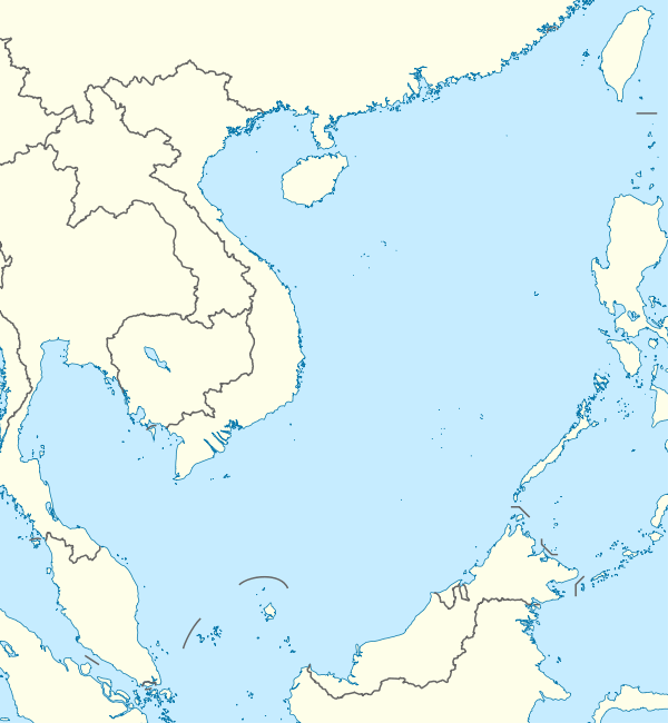
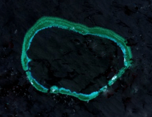
Mischief Reef (Chinese: 美济礁; pinyin: Meiji Jiao; literally: "Meiji Reef"; Tagalog: Panganiban reef[1]; Vietnamese: Đá Vành Khăn) is a large reef in the Spratly Islands in the South China Sea, located 250 kilometers west of the coast of Palawan.[2]
Mischief reef is occupied and controlled by the People's Republic of China, and claimed by the Republic of China (Taiwan), Philippines and Vietnam.
The area surrounding it is said[3] to be rich in yet unexplored oil and gas fields, and hence, it remains controversial.[4]
History and topography
One source says that Mischief reef was discovered by Henry Spratly in 1791 and was named after the German sailor Heribert Mischief, one of his crew.[5] It has rocks above water at low tide and a lagoon.[6]
Location and Description
Mischief reef is located at 9° 55' N, 115° 32' E.[7] It lies 50 nautical miles east of Union banks.[8]
Territorial disputes

In 1994 and 1995,[9] the PRC built initial structures on stilts while the Philippine Navy was not patrolling the area due to the monsoon season. Since the reef is 210 km (130 mi) from Palawan, the Philippine government immediately protested this action. However, the Chinese government rejected the protest and said that the structures were shelter for fishermen. In 1999, another wave of protests from Manila occurred when China added more structures to Mischief Reef which resembled military installations more closely than shelters for fishermen.[10]
The Philippines alleged China's actions in South China Sea were part of a "creeping invasion." For instance, China was also reported to have planted buoys in Sabina Shoal, which is 110 km (68 mi) away from Palawan. Philippines claimed that China had a well-rehearsed routine when laying claim to a new reef: first put down buoys, then build concrete markers. Temporary wooden or bamboo shelters followed, and if China was still not challenged, the permanent military forts went up. The Philippines tries to destroy the buoys or markers before China has time to build larger structures.[10]
The Philippines' decision not to destroy the Chinese structures on Mischief Reef prevented an escalation of the dispute. The Philippines claims that China has always been prepared for armed conflict when opposed, as is evident in China's defense of reefs from Vietnam in the 1988 Johnson South Reef Skirmish which resulted in more than 70 Vietnamese deaths.[10] The Philippines decided not to attack since it could have led the two countries into a war, the consequences of which could have escalated into a wider conflict.
On 11 July 2012, a Chinese Type 053 frigate Dongguan ran aground on the reef, sparking embarrassment for the Chinese government and causing an awkward diplomatic situation. The ship was later towed back to base. [11]
There are more than 100 Chinese troops on the reef.[12] Land reclamation started in 2015 inside the rims; similar activity occurs at Fiery Cross Reef.[13][14][15]
References
- ↑ "The battle for Mischief Reef". Warfighter strategic studies. Retrieved 27 November 2013.
- ↑ "Map of Mischief reef". Wikimapia. Retrieved 17 March 2014.
- ↑ Raman, B (1999). Chinese Territorial Assertions: The Case of the Mischief Reef. Chennai, India: Institute For Topical Studies.
- ↑ Meyer, Lt Col. Stanley E (1996). Incident at Mischief reef : Implications for The Philippines, China and The United States. Pennsylvania, USA: US Army war college, Carlisle barracks.
- ↑ "Spratly Islands Conflicting Claims". GlobalSecurity.org. Retrieved 24 August 2013.
- ↑ Cire Sarr (19 August 2001). "Digital Gazetteer of Spratly Islands". www.southchinasea.org. Retrieved 7 October 2014.
- ↑ Hancox, David; Prescott, Victor (1995). A Geographical Description of the Spratly Islands and an Account of Hydrographic Surveys amongst Those Islands. Maritime Briefings 1. University of Durham, International Boundaries Research Unit. p. 28. ISBN 978-1897643181.
- ↑ Campbell, Eric (20 May 2014). "Reef madness". Foreign Correspondent. ABC News. Retrieved 22 May 2014.
- ↑ Ian Storey, Herbert Yee (2004). The China threat : Perceptions and myths. Routledge. ISBN 0415347106.
- ↑ 10.0 10.1 10.2 McCarthy, Terry (8 March 1999). "Reef Wars". Time Asia (Puerto Princessa, Palawan) 153 (9). Retrieved 22 March 2008.
- ↑ http://www.theguardian.com/world/2012/jul/13/chinese-frigate-runs-aground-sea
- ↑ DJ Sta. Ana (13 June 2014). "China reclaiming land in 5 reefs?". www.abs-cbnnews.com. Retrieved 11 September 2014.
- ↑ Lee, Victor Robert. "China’s New Military Installations in the Disputed Spratly Islands: Satellite Image Update". Retrieved 17 March 2015.
- ↑ DAVID E. SANGER and RICK GLADSTONE. "Piling Sand in a Disputed Sea, China Literally Gains Ground" The New York Times, 8 April 2015.
- ↑ US admiral speech
Further reading
- Meyer, Stanley E. (1996). "Incident at Mischief Reef: Implications for the Philippines, China, and the United States". U.S. Army War College.
| ||||||||||||||||||