Mirzaganj Upazila
| Mirzaganj মির্জাগঞ্জ | |
|---|---|
| Upazila | |
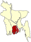
 Mirzaganj Location in Bangladesh | |
| Coordinates: 22°21.8′N 90°14.5′E / 22.3633°N 90.2417°ECoordinates: 22°21.8′N 90°14.5′E / 22.3633°N 90.2417°E | |
| Country |
|
| Division | Barisal Division |
| District | Patuakhali District |
| Area | |
| • Total | 175.45 km2 (67.74 sq mi) |
| Population (1991) | |
| • Total | 110,763 |
| • Density | 631/km2 (1,630/sq mi) |
| Time zone | BST (UTC+6) |
| Website | Official Map of the Mirzaganj Upazila |
Mirzaganj (Bengali: মির্জাগঞ্জ ) is an Upazila of Patuakhali District in the Division of Barisal, Bangladesh.[1]
Geography
Mirzaganj is located at 22°21′45″N 90°14′30″E / 22.3625°N 90.2417°E . It has 21,345 households and a total area of 175.45 km².
Demographics
According to the 1991 Bangladesh census, Mirzaganj had a population of 110,763. Males constituted 50.06% of the population, and females 49.94%. The population aged 18 or over was 56,446.
Administration
Mirzaganj thana was established in 1812 and was turned into an upazila in 1983. Mirzaganj has 6 Unions/Wards, 68 Mauzas/Mahallas, and 72 villages.
Education
Average literacy rate is 42.1%; male 48.6%, female 35.6%.
Educational institutions
- College: 5
- High school: 32
- Primary school: 70 (government), 62 (non-government)
- Satellite school: 4
- Old institutions:
- Subidkhali R I Pilot High School (1934)
- Subidkhali Government Model Primary School (1940)
- Kathaltali Government Primary School (1924)
- Basonda Government Primary School (1934)
Economy
Main crops
Paddy, sweet potato, lentil, chilli, sesame, linseed, ground nut etc.
Extinct and nearly extinct crops
Tobacco, jute and sugarcane.
Main fruits
Mango, jackfruit, banana, futi, watermelon.
Main exports
Banana, lentil, chilli.
Historical events
At the initial stage of the War of Liberation in 1971 a large number of youths were given military training in the training centre at village Deuli of this upazila. In an encounter between the Pakistani army and the local freedom fighters on the outskirts of Mirzaganj, 32 freedom fighters lost their lives causing heavy casualties to the enemy.
References
- ↑ Md. Mizanur Rahman (2012). "Mirzaganj Upazila". In Sirajul Islam and Ahmed A. Jamal. Banglapedia: National Encyclopedia of Bangladesh (Second ed.). Asiatic Society of Bangladesh.
| |||||||||||||||||||||||||||||||||
