Minuwangoda Divisional Secretariat
| Minuwangoda මිනුවන්ගොඩ மினுவந்கொட | |
|---|---|
| Minuwangoda Divisional Secretariat | |
 Minuwangoda Location in Sri Lanka | |
| Coordinates: 7°10′24″N 79°57′43″E / 7.17333°N 79.96194°ECoordinates: 7°10′24″N 79°57′43″E / 7.17333°N 79.96194°E | |
| Country |
|
| Province | Western Province |
| District | Gampaha District |
| Elevation | 48.67 ft (14.83 m) |
| Population (Sinhalese 170175, Others 7145)By 2015 | |
| • Total | 177,320 |
| • Density | 1,345.00/sq mi (519.31/km2) |
| Time zone | SLST (UTC+5.30) |
| Postal code | 11550 |
| Area code(s) | 011 |
| Website |
www |
Minuwangoda Divisional Secretariat is a Divisional Secretariat of Gampaha District, of Western Province, Sri Lanka.
Grama Niladhari Divisions Of Minuwangoda.[1]
- 98 - Mabodale / East
- 98/1 - Mabodale / North
- 98/2 - Mabodale / South
- 98/3 - Mabodale / West
- 98/4 - Withanamulla / Ihala
- 98/5 - Withanamulla / pahala
- 99 - Naiwala / North
- 99/1 - Naiwala / West
- 99/2 - Naiwala / East
- 99/3 - Nalapaha
- 99/4 - Yatagama
- 101 - Wadumulla
- 102 - Essalla
- 102/1 - Metikotumulla
- 103 - Watinapaha North
- 103/1 - Watinapaha/South
- 103/2 - Wankepumulla
- 103/3 - Kamaragoda
- 105 - Horampella/South
- 105/1 - Horampella/North
- 105/2 - Mahagama
- 105/3 - Arangawa
- 105/4 - Galkanda
- 105/5 - Bodhipihituwala
- 105/6 - Kudagoda
- 106 - Dewalapola
- 107 - Ganihimulla
- 107/1 - Peralanda
- 108 - Pethiyagoda North
- 108/1 - Pethiyagoda South
- 109 - Gallegedara
- 110 - Doranagoda/North
- 110/1 - Doranagoda/East
- 110/2 - Doranagoda/West
- 110/3 - Doranagoda/South
- 111 - Korase
- 111/1 - Korase/Central
- 111/2 - Korase /East
- 112 - Medemulla South
- 112/1 - Nilpanagoda
- 112/2 - Nilpanagoda/East
- 112/3 - Medemulla/North
- 112/4 - Nilpanagoda/west
- 113 - Wegowwa/South
- 113/1 - Wegowwa East
- 114 - Kalawana
- 115 - Helakandana
- 116 - Mathammana
- 117 - Welhena
- 117/1 - Weliya
- 117/2 - Ellangala
- 118 - Paththaduwana
- 118/1 - Paththaduwana West
- 118/2 - Paththaduwana
- 119 - Kotugoda
- 119/1 - Kotugoda no2
- 119/2 - Yagodamulla
- 119/3 - Yagodamulla North
- 119/4 - Yagodamulla South
- 119/5 - Opatha
- 119/6 - Samurdhigama
- 120 - Polwatta East
- 120/1 - Polwatta West
- 121 - Galloluwa
- 121/1 - Galloluwa East
- 122 - Unnaruwa
- 122/1 - Kalahugoda
- 123 - Yatiyana
- 123/1 - Peellawatta
- 123/2 - Kopiwatta
- 123/3 - Yatiyana East
- 123/4 - Yatiyana Central
- 124 - Boragodawatta North
- 124/1 - Boragodawatta South
- 125 - Minuwangoda Central
- 125/1 - Minuwangoda West
- 125/2 - Minuwangoda North
- 125/3 - Minuwangoda East
- 126 - Wattegedara
- 126/1 - Pansilgoda
- 126/2 - Burullapitiya
- 126/3 - Ambagahawatta
- 127 - Balabowa
- 128 - Wigoda
- 129 - Marapola
- 130 - Weediyawatta East
- 130/1 - Weediyawatta West
- 131 - Pahala Udugampola North
- 131/1 - Pahala Udugampola East
- 131/2 - Pahala Udugampola South
- 131/3 - Pahala Udugampola West
- 131/4 - Ihala Udugampola
- 131/5 - Goigama
- 132 - Dombawala
- 133 - Wathumulla
- 133/1 - Pedipola
- 134 - Asgiriya
- 134/1 - Asgiriya North
- 134/2 - Asgiriya South
- 134/3 - Asgiriya West
- 135 - Asgiriwalpola North
- 135/1 - Asgiriwalpola South
- 135/2 - Asgiriwalpola West
- 136 - Thammita
- 136/1 - Thammita West
- 137 - Madelgamuwa East
- 137/1 - Madelgamuwa West
- 137/2 - Batapotha
- 138 - Siyambalapitiya
- 138/1 - Maduruwita
- 139 - Nedagamuwa South
- 139/1 - Nedagamuwa North
- 139/2 - Nedagamuwa West
- 140 - Kehelbaddara East
- 140/1 - Kehelbaddara West
- 140/2 - Uggalboda
- 140/3 - Uggalboda West
- 141 - Hendimahara
Census.[2]
Census Of Population By Ethnicity.
| Ethnicity | Value |
|---|---|
| Sinhalese | 170175 |
| Sri Lankan Tamil | 826 |
| Indian Tamil | 2094 |
| Sri Lankan Moor | 3700 |
| Burgher | 240 |
| Malay | 207 |
| Sri Lankan Chetty | 11 |
| Other | 67 |
| Total | 177320 |
As a percentage.
Sinhalese (95.20%)
Sri Lankan Tamil (00.40%)
Indian Tamil (01.09%)
Sri Lankan Moor (02.10%)
Burgher (00.10%)
Malay (00.10%)
Sri Lankan Chetty (00.01%)
Other (1%)
Census Of Population By Religion.
| Religion | Value |
|---|---|
| Buddhist | 157807 |
| Hindu | 608 |
| Roman Catholic | 10844 |
| Christian | 1911 |
| Islamic | 6090 |
| Other | 60 |
| Total | 177320 |
As a percentage.
Buddhist (89.00%)
Hindu (0.34%)
Roman Catholic (6.10%)
Christian (1.10%)
Islamic (3.43%)
Other (0.03%)
Census Of Population By Gender.
| Gender | Value |
|---|---|
| Male | 92064 |
| Female | 85256 |
| Total | 177320 |
As a percentage.
Male (51.92%)
Female (48.08%)
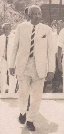
People From Minuwangoda
- Arjuna Ranatunga
- D. S. Senanayake
.jpg)
- Dudley Shelton Senanayake
- Edward Gunasekara
- Fredrick Richard Senanayake
- Mahagama Sekara
- Prasanna Ranatunga
- Reggie Ranatunga
- R.G. Senanayake
- R.L.H.L.Rajapakse
- Rukman Senanayake
- Ruwan Ranatunga
- Sanjeeva Ranatunga
- Tissa Ravinda Perera
Weather Statistics.
![]() Sri Lanka
Sri Lanka
| Climate data for Minuwangoda/Colombo, Sri Lanka | |||||||||||||
|---|---|---|---|---|---|---|---|---|---|---|---|---|---|
| Month | Jan | Feb | Mar | Apr | May | Jun | Jul | Aug | Sep | Oct | Nov | Dec | Year |
| Record high °C (°F) | 35.2 (95.4) |
35.6 (96.1) |
36.0 (96.8) |
35.2 (95.4) |
32.8 (91) |
33.5 (92.3) |
32.2 (90) |
32.2 (90) |
32.2 (90) |
33.6 (92.5) |
34.0 (93.2) |
34.2 (93.6) |
36.0 (96.8) |
| Average high °C (°F) | 30.9 (87.6) |
31.2 (88.2) |
31.7 (89.1) |
31.8 (89.2) |
31.1 (88) |
30.4 (86.7) |
30.0 (86) |
30.0 (86) |
30.2 (86.4) |
30.0 (86) |
30.1 (86.2) |
30.3 (86.5) |
30.64 (87.16) |
| Daily mean °C (°F) | 26.6 (79.9) |
26.9 (80.4) |
27.7 (81.9) |
28.2 (82.8) |
28.3 (82.9) |
27.9 (82.2) |
27.6 (81.7) |
27.6 (81.7) |
27.5 (81.5) |
27.0 (80.6) |
26.7 (80.1) |
26.6 (79.9) |
27.38 (81.3) |
| Average low °C (°F) | 22.3 (72.1) |
22.6 (72.7) |
23.7 (74.7) |
24.6 (76.3) |
25.5 (77.9) |
25.5 (77.9) |
25.2 (77.4) |
25.1 (77.2) |
24.8 (76.6) |
24.0 (75.2) |
23.2 (73.8) |
22.8 (73) |
24.11 (75.4) |
| Record low °C (°F) | 16.4 (61.5) |
18.9 (66) |
17.7 (63.9) |
21.2 (70.2) |
20.7 (69.3) |
21.4 (70.5) |
21.4 (70.5) |
21.6 (70.9) |
21.2 (70.2) |
21.0 (69.8) |
18.6 (65.5) |
18.1 (64.6) |
16.4 (61.5) |
| Average precipitation mm (inches) | 58.2 (2.291) |
72.7 (2.862) |
128.0 (5.039) |
245.6 (9.669) |
392.4 (15.449) |
184.9 (7.28) |
121.9 (4.799) |
119.5 (4.705) |
245.4 (9.661) |
365.4 (14.386) |
414.4 (16.315) |
175.3 (6.902) |
2,523.7 (99.358) |
| Avg. precipitation days | 5 | 5 | 9 | 14 | 16 | 16 | 12 | 11 | 15 | 17 | 15 | 10 | 145 |
| Average relative humidity (%) | 69 | 69 | 71 | 75 | 78 | 79 | 78 | 77 | 78 | 78 | 76 | 73 | 75 |
| Mean monthly sunshine hours | 248.0 | 248.6 | 275.9 | 234.0 | 201.5 | 195.0 | 201.5 | 201.5 | 189.0 | 201.5 | 210.0 | 217.0 | 2,623.5 |
| Source #1: World Meteorological Organization,[3] Hong Kong Observatory[4] | |||||||||||||
| Source #2: NOAA[5] | |||||||||||||
References
- ↑ "Grama Niladhari Divisions".
- ↑ "Statistical Information".
- ↑ "World Weather Information Service - Colombo". World Meteorological Organization. Retrieved November 6, 2012.
- ↑ "Climatological Information for Colombo, Sri Lanka". Hong Kong Observatory. Retrieved November 6, 2012.
- ↑ "COLOMBO Climate Normals 1961-1990". National Oceanic and Atmospheric Administration. Retrieved November 6, 2012.
| ||||||||||