Minuteman Bikeway
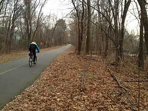
The Minuteman Bikeway is a 10-mile (16-kilometre)[1] paved multi-use rail trail located in the Greater Boston area of Massachusetts.
Route
Legend
| |||||||||||||||||||||||||||||||||||||||||||||||||||||||||||||||||||||||||||||||||||||||||||||||||||||||||||||||||||||||||||||||||||||||||||||||||||||||||||||||||||||||||||||||||||||||||||||||||||||||||||||||||||||||||||||||||||||||||||||||||||||||||||||
The Minuteman Bikeway runs from Bedford to the Alewife station at the northern end of the Red Line in Cambridge. It passes through the towns of Lexington and Arlington on the way. Also along the route are several notable regional sites, including Alewife Brook Reservation, Spy Pond and "Arlington’s Great Meadows" (actually located in Lexington).
At its Cambridge terminus, the bikeway connects with four other bike paths:
- the Fitchburg Cutoff Path
- the Cambridge Linear Park which, in turn, leads to the Somerville Community Path.
- the Alewife Brook Greenway, a connection to the Mystic River bike path, following Alewife Brook.[2] The Alewife Brook extension received $4M from the American Recovery and Reinvestment Act of 2009 as the "Minuteman Bikepath Connector" project.[3]
- a sidewalk path to Fresh Pond Reservation.
Plans are underway to extend the Somerville Community Path to downtown Boston, which would create a much larger continuous bikeway accessible from the Minuteman.
At the Bedford end, the Minuteman Bikeway connects with the Narrow Gauge Rail Trail and the Reformatory Branch Rail Trail.[4]
History
The path comprising the current Minuteman Bikeway has a long history. The trail closely approximates the route that Paul Revere took on his famous ride in 1775, which heralded the beginning of the American Revolution.
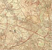
Along the way to becoming a railroad, the path's right-of-way was laid out east of Lexington in 1846 by the Lexington and West Cambridge Railroad and west of Lexington in 1873 by the Middlesex Central Railroad.
Railbanking of the line was first proposed in 1974, three years before passenger rail service was discontinued, and a full seven years before rail service was discontinued altogether (in 1981). In 1991, the final plan for the conversion was approved, and construction started on the original section of the bikeway. The path was dedicated in 1992 and completed the following year.[5]
In 1998 the bikeway was extended from East Arlington to Alewife station (in Cambridge). In 2002 it was entirely repaved and in 2004 the Bedford Depot Park Enhancement Project was completed at its western terminus.[5]
The property is currently owned by the Massachusetts Bay Transportation Authority and leased to the municipalities through which it passes on an interim basis. The MBTA at one point planned to use this right-of-way to extend the Red Line to Arlington Center and Arlington Heights.[6]
Beginning in Spring 2015, the crossing of the path through Arlington Center is expected to be rebuilt to be less discontinuous.[7][8]
Uses
Area residents use the bikeway for a host of activities, including bicycling, walking, jogging, and inline skating. The main use of the path, however, is for casual biking.[5] In the winter there is often enough snow on the bikeway for cross-country skiing. However, the Bikeway is now plowed from Alewife Station to Bedford.[9] No motorized vehicles are allowed except for powered wheelchairs and emergency vehicles.
Future possibilities
New connections under contemplation include one from Lexington to the Battle Road Trail and one to the Charles River bike path via Fresh Pond Reservation and the abandoned Watertown Branch Railroad. A portion of the latter path, at the Watertown end, has been completed.
In April 2014, state officials announced that the Somerville Community Path will be extended alongside the Green Line Extension, creating a continuous 4.5 mile route from the Minuteman Bikeway to Boston’s Charles River Bike Path.[10]
See also
Gallery of views along the bikeway
-
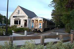
Bedford Depot Park, with old B&M RDC
-
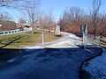
In Bedford, near Wiggins Avenue
-
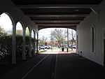
Lexington Depot
-

Spy Pond, Arlington
-

Snow on the path, Arlington
-
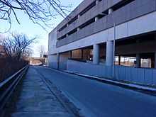
In Cambridge, near Alewife Station and junction with Fitchburg Cutoff Path
-
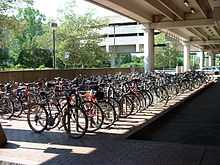
Bike parking at Alewife MBTA Station
-
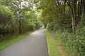
Connector to Cambridge Linear Park
References
- ↑ Some sources list it erroneously as 11 miles. The confusion arises because the mile marker at the beginning of the trail is 1 instead of 0. Wikipedia editors have measured the distance as shown on maps and in Google Earth, and it appears to be 10 miles to within a few hundredths of a mile. For further verification, see: Project for Public Spaces or About the Lexington Branch
- ↑ "Alewife Brook Greenway Corridor Improvement Project". Town of Arlington, MA. July 11, 2012. Retrieved 2013-08-15.
- ↑ "Patrick-Murray Administration Obligates 100% of ARRA Highway Funding One Month Ahead of Schedule". 2010-02-10. Retrieved 2010-03-02.
- ↑ Rail-Trails at Bedford Depot Park
- ↑ 5.0 5.1 5.2 Viser, Matt (2007), "Rage on the bikeway", The Boston Globe, Volume 272, Number 1, 2007-07-01, p.A1.
- ↑ http://boston.curbed.com/archives/2014/02/the-red-line-stops-in-arlington-and-lexington.php
- ↑ Project Update: September 25, 2014
- ↑ Map of Preferred Alternative - Arlington Center Safe Travel Project, March 21, 2013
- ↑ Gilsdorf, Ethan (June 29, 2008). "Popular bike trail gets even better". boston.com. Retrieved 2009-06-11.
- ↑ Conway, Abby Elizabeth (30 April 2014). "Somerville Bike Path To Extend To Boston". WBUR. Retrieved 3 May 2014.
External links
| Wikimedia Commons has media related to Minuteman Bikeway. |
- Minuteman Bikeway - official website
- Friends of the Community Paths
- Depot Park at the Bedford terminus
- Rails-to-Trails Conservancy
- High-speed video of entire trail south to north
- Virtual cycling video of entire trail round trip.
- 1870s railroad maps of what is now the Minuteman Bikeway
- Clear the Trail advocacy organization
- Friends of Lexington Bikeways website
- Map with popups of old maps from the 1870s showing each section of the bikeway
- On a Google map
- Friends of Arlington's Great Meadows