Millersburg, Minnesota
| Millersburg, Minnesota | |
|---|---|
| Unincorporated community | |
 Millersburg, Minnesota Location of the community of Millersburg | |
| Coordinates: 44°25′40″N 93°19′55″W / 44.42778°N 93.33194°WCoordinates: 44°25′40″N 93°19′55″W / 44.42778°N 93.33194°W | |
| Country | United States |
| State | Minnesota |
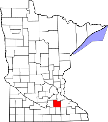
| County | Rice County |
| Township | Forest Township |
| Elevation | 1,076 ft (328 m) |
| Time zone | Central (CST) (UTC-6) |
| • Summer (DST) | CDT (UTC-5) |
| ZIP code | 55046 |
| Area code(s) | 507 |
| GNIS feature ID | 654828[1] |
Millersburg is an unincorporated community in Forest Township, Rice County, Minnesota, United States.
The community is located along Rice County Road 1 (Millersburg Boulevard) near its junction with Chester Avenue.
Nearby places include Lonsdale, Faribault, Northfield, and Dundas.
ZIP codes 55046 (Lonsdale), 55021 (Faribault), 55057 (Northfield), and 55019 (Dundas) all meet near Millersburg.
References
| |||||||||||||||||||||||||