Millard, Missouri
| Millard, Missouri | |
|---|---|
| Village | |
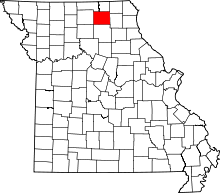
 Location within Adair County (left) and Missouri (right) | |
| Coordinates: 40°6′29″N 92°32′46″W / 40.10806°N 92.54611°WCoordinates: 40°6′29″N 92°32′46″W / 40.10806°N 92.54611°W | |
| Country | United States |
| State | Missouri |
| County | Adair |
| Township | Pettis |
| Area[1] | |
| • Total | 0.12 sq mi (0.31 km2) |
| • Land | 0.12 sq mi (0.31 km2) |
| • Water | 0 sq mi (0 km2) |
| Elevation | 961 ft (293 m) |
| Population (2010)[2] | |
| • Total | 89 |
| • Estimate (2012[3]) | 89 |
| • Density | 741.7/sq mi (286.4/km2) |
| Time zone | Central (CST) (UTC-6) |
| • Summer (DST) | CDT (UTC-5) |
| ZIP code | 63501 |
| Area code(s) | 660 |
| FIPS code | 29-48134[4] |
| GNIS feature ID | 0722364[5] |
Millard is a village in Pettis Township, Adair County, Missouri, United States. The population was 89 at the 2010 census.
History
Millard, like so many small American towns, owes its birth to the railroads. Mr. James Nicolas secured a land grant for the area surrounding present-day Millard from the State of Missouri in 1866. Nicolas then promptly sold the western half of the grant to the North Missouri Railroad Company. At the time the railroad was busy with the planning and construction of a line north from Macon with the destination being Kirksville. With the coming of the rail lines in 1868 a few families began to settle nearby, eventually reaching an estimated eighty families by the time a town plat was made in 1872. The name Belle Prairie was first assigned but soon changed to Millard, to honor the son of early pioneers Samuel and Maggie Miller. The railroads found Millard a convenient location to refuel, so a large coal storage bin and loading chute were established trackside. A small stockyard was also constructed, allowing farmers a place to keep their livestock before shipping them to markets in larger cities. In its turn-of-the-20th-century heyday Millard boasted as many as 19 businesses, however that number has been greatly reduced today. Two transportation advantages play to Millards favor: Kirksville Regional Airport is located directly across US Highway 63 from Millard, offering commuter air service to larger cities. In recent years US Highway 63 has been expanded to four lanes between Kirksville and Macon, Missouri with Millard being selected by MoDOT as the southern terminus of the Kirksville bypass.

Geography
Millard is located at 40°6′29″N 92°32′46″W / 40.10806°N 92.54611°W (40.108187, -92.546023).[6]
According to the United States Census Bureau, the village has a total area of 0.12 square miles (0.31 km2), all of it land.[1]
Demographics
Millard is part of the Kirksville Micropolitan Statistical Area.
2010 census
As of the census[2] of 2010, there were 89 people, 40 households, and 27 families residing in the village. The population density was 741.7 inhabitants per square mile (286.4/km2). There were 45 housing units at an average density of 375.0 per square mile (144.8/km2). The racial makeup of the village was 96.6% White, 1.1% from other races, and 2.2% from two or more races. Hispanic or Latino of any race were 1.1% of the population.
There were 40 households of which 22.5% had children under the age of 18 living with them, 57.5% were married couples living together, 7.5% had a female householder with no husband present, 2.5% had a male householder with no wife present, and 32.5% were non-families. 30.0% of all households were made up of individuals and 12.5% had someone living alone who was 65 years of age or older. The average household size was 2.23 and the average family size was 2.70.
The median age in the village was 51.5 years. 23.6% of residents were under the age of 18; 1.2% were between the ages of 18 and 24; 19.1% were from 25 to 44; 40.4% were from 45 to 64; and 15.7% were 65 years of age or older. The gender makeup of the village was 49.4% male and 50.6% female.
2000 census
As of the census[4] of 2000, there were 75 people, 34 households, and 24 families residing in the village. The population density was 606.5 people per square mile (241.3/km²). There were 39 housing units at an average density of 315.4/sq mi (125.5/km²). The racial makeup of the village was 100.00% White.
There were 34 households out of which 20.6% had children under the age of 18 living with them, 58.8% were married couples living together, 2.9% had a female householder with no husband present, and 29.4% were non-families. 23.5% of all households were made up of individuals and 8.8% had someone living alone who was 65 years of age or older. The average household size was 2.21 and the average family size was 2.58.
In the village the population was spread out with 17.3% under the age of 18, 4.0% from 18 to 24, 30.7% from 25 to 44, 32.0% from 45 to 64, and 16.0% who were 65 years of age or older. The median age was 44 years. For every 100 females there were 108.3 males. For every 100 females age 18 and over, there were 100.0 males.
The median income for a household in the village was $25,833, and the median income for a family was $35,625. Males had a median income of $19,375 versus $21,563 for females. The per capita income for the village was $16,458. There were 10.0% of families and 18.3% of the population living below the poverty line, including no under eighteens and 36.4% of those over 64.
References
- ↑ 1.0 1.1 "US Gazetteer files 2010". United States Census Bureau. Retrieved 2012-07-08.
- ↑ 2.0 2.1 "American FactFinder". United States Census Bureau. Retrieved 2012-07-08.
- ↑ "Population Estimates". United States Census Bureau. Retrieved 2013-05-30.
- ↑ 4.0 4.1 "American FactFinder". United States Census Bureau. Retrieved 2008-01-31.
- ↑ "US Board on Geographic Names". United States Geological Survey. 2007-10-25. Retrieved 2008-01-31.
- ↑ "US Gazetteer files: 2010, 2000, and 1990". United States Census Bureau. 2011-02-12. Retrieved 2011-04-23.
Further reading
- In The Days Of High-Heel Boots & Tobacco Spit by Nial Belzer. Published in The Chariton Collector, Spring, 1985.
- A Book Of Adair County History. Published by the Adair County Bicentennial Committee, 1976.
| |||||||||||||||||||||||||||||