Mill Woods Town Centre, Edmonton
| Mill Woods Town Centre | |
|---|---|
| Neighbourhood | |
 Mill Woods Town Centre Location of Mill Woods Town Centre in Edmonton | |
| Coordinates: 53°27′18″N 113°25′48″W / 53.455°N 113.430°W | |
| Country |
|
| Province |
|
| City | Edmonton |
| Quadrant[1] | NW |
| Ward[1] | 11 |
| Sector[2] | Southeast |
| Area[3][4] Community |
Mill Woods Mill Woods Town Centre |
| Government[5] | |
| • Administrative body | Edmonton City Council |
| • Councillor | Mike Nickel |
| Area[6] | |
| • Total | 0.52 km2 (0.20 sq mi) |
| Elevation | 691 m (2,267 ft) |
| Population (2012)[7] | |
| • Total | 1,247 |
| • Density | 2,398.1/km2 (6,211/sq mi) |
| • Change (2009–12) |
|
| • Dwellings | 689 |
Mill Woods Town Centre is best known for its shopping mall and is the commercial centre of the Mill Woods area of Edmonton, Alberta, Canada. What is less well known is that the mall is part of a larger neighbourhood with the same name. The larger neighbourhood is home to a sizable residential population of 1074 according to the 2005 municipal census.[8]
Mill Woods Town Centre is bounded on the north by 28 Avenue, on the south by 23 Avenue, on the west by 66 Street, and on the east by 50 Street. Hewes Way, a major thoroughfare, cuts the neighbourhood roughly in half.
Demographics
In the City of Edmonton's 2012 municipal census, Mill Woods Town Centre had a population of 1,247 living in 689 dwellings,[7] a 7.9% change from its 2009 population of 1,156.[9] With a land area of 0.52 km2 (0.20 sq mi),[6] it had a population density of 2,398.1 people/km2 in 2012.[6][7]
Residential development

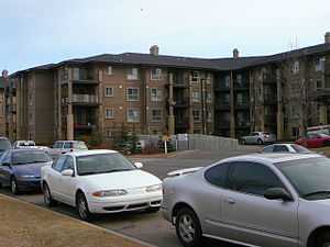
The neighbourhood's residential population lives in a mixture of rented apartments (44%) and apartment style condominiums (56%).[10] According to the 2001 federal census, all residential construction in the neighbourhood was built during the 1990s.[11]
The average household size is 1.7 persons. While there are a handful of three person households (4.3% of all households), households in the neighbourhood is pretty much equally split between one person households (47.8%) and two person households (47.8%).[12]
Surrounding neighbourhoods
 |
Kameyosek | Tawa | Weinlos |  |
| Mill Woods Park | |
Weinlos | ||
| ||||
| | ||||
| Ekota | Meyokumin | Pollard Meadows |
References
- ↑ 1.0 1.1 "City of Edmonton Wards & Standard Neighbourhoods" (PDF). City of Edmonton. Retrieved February 13, 2013.
- ↑ "Edmonton Developing and Planned Neighbourhoods, 2011" (PDF). City of Edmonton. Retrieved February 13, 2013.
- ↑ "The Way We Grow: Municipal Development Plan Bylaw 15100" (PDF). City of Edmonton. 2010-05-26. Retrieved February 13, 2013.
- ↑ "City of Edmonton Plans in Effect" (PDF). City of Edmonton. November 2011. Retrieved February 13, 2013.
- ↑ "City Councillors". City of Edmonton. Retrieved February 16, 2014.
- ↑ 6.0 6.1 6.2 "Neighbourhoods (data plus kml file)". City of Edmonton. Retrieved February 13, 2013.
- ↑ 7.0 7.1 7.2 "Municipal Census Results – Edmonton 2012 Census". City of Edmonton. Retrieved February 22, 2013.
- ↑ http://censusdocs.edmonton.ca/C05013/MUNICIPAL%202005/Neighbourhood/190MILL%20WOODS%20TOWN%20CENT.pdf
- ↑ "2009 Municipal Census Results". City of Edmonton. Retrieved February 22, 2013.
- ↑ http://censusdocs.edmonton.ca/C05002/MUNICIPAL%202005/Neighbourhood/190MILL%20WOODS%20TOWN%20CENT.pdf
- ↑ http://censusdocs.edmonton.ca/DD23/FEDERAL%202001/Neighbourhood/190MILL%20WOODS%20TOWN%20CENT.pdf
- ↑ http://censusdocs.edmonton.ca/DD20/FEDERAL%202001/Neighbourhood/190MILL%20WOODS%20TOWN%20CENT.pdf