Miklušovce
| Miklušovce | |
| Village | |
 | |
| Country | Slovakia |
|---|---|
| Region | Prešov |
| District | Prešov |
| Elevation | 481 m (1,578 ft) |
| Coordinates | 48°55′N 21°05′E / 48.917°N 21.083°ECoordinates: 48°55′N 21°05′E / 48.917°N 21.083°E |
| Area | 7.22 km2 (2.79 sq mi) |
| Population | 340 (2004-12-31) |
| Density | 47 / km2 (122 / sq mi) |
| First mentioned | 1330 |
| Postal code | 082 44 |
| Area code | +421-51 |
| Car plate | PO |
  Location of Miklušovce in Slovakia
| |
  Location of Miklušovce in the Prešov Region
| |
| Wikimedia Commons: Miklušovce | |
| Statistics: MOŠ/MIS | |
| Website: www.miklusovce.ocu.sk | |
Miklušovce (Hungarian: Miklósvágása) is a village and municipality in Prešov District in the Prešov Region of eastern Slovakia.
History
In historical records the village was first mentioned in 1330.
Geography
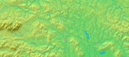
The municipality lies at an altitude of 481 metres and covers an area of 7.22 km². It has a population of about 340 people.