Midongy du sud National Park
| Midongy du sud National Park | |
|---|---|
|
IUCN category VI (protected area with sustainable use of natural resources) | |
|
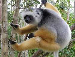
Prospithecus diadema | |
 Location of Midongy du sud National Park in Madagascar | |
| Location | Midongy-Atsimo District |
| Nearest city | Farafangana, Befotaka |
| Coordinates | 23°30′S 46°55′E / 23.500°S 46.917°ECoordinates: 23°30′S 46°55′E / 23.500°S 46.917°E |
| Area | 1922 km² |
| Established | 1997 |
| Governing body | Madagascar National Parks Association |
| http://www.parcs-madagascar.com/fiche-aire-protegee_en.php?Ap=24 www.parcs-madagascar.com | |
Midongy du sud National Park is a national park in the region Atsimo-Atsinanana in Madagascar. This National Park was inscribed in the World Heritage Site in 2007 as part of the Rainforests of the Atsinanana.[1]
Geography
It is situated at 42 km from Befotaka and 90 km from Vangaindrano on very bad, unpaved roads. These may not be practicable in the rain season from December to June.[2] It covers an area of in an altitude between 689 and 1679 meters. Its summit is the Mont Papango.
Flora and Fauna
This park is particularly rich in endemic medical plants. One can find there also 14 endagered plants that are listed in the IUCN red list for endangered species and the orchids Aeranthes caudata and Bulbophyllum vestitum (CITES (Annexe II)).
See also
- Kalambatritra Reserve at a distance of 20 km from the Midongy du sud National Park.
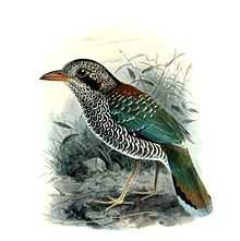
Picture gallery
-
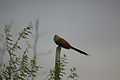
Centropus toulou, or Toloho
-
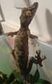
the Gecko Uruplatus fimbriatus
-
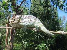
chameleon
-
-
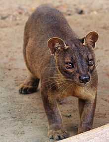
The Fossa
References
- ↑ "Africa, Rainforests of the Atsinanana, Madagascar" . UNESCO Organization.
- ↑ Madagascar National Parks
See also
| ||||||||||||||||
