Midden-Delfland
| Midden-Delfland | |||
|---|---|---|---|
| Municipality | |||
|
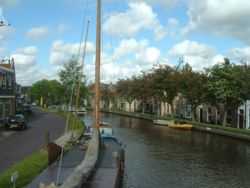
Canal through Zweth | |||
| |||
.svg.png) Location in South Holland | |||
| Coordinates: 51°59′N 4°19′E / 51.983°N 4.317°ECoordinates: 51°59′N 4°19′E / 51.983°N 4.317°E | |||
| Country | Netherlands | ||
| Province | South Holland | ||
| Established | 1 January 2004[1] | ||
| Government[2] | |||
| • Body | Municipal council | ||
| • Mayor | Arnoud Rodenburg (CDA) | ||
| Area[3] | |||
| • Total | 49.38 km2 (19.07 sq mi) | ||
| • Land | 47.35 km2 (18.28 sq mi) | ||
| • Water | 2.03 km2 (0.78 sq mi) | ||
| Elevation[4] | −2 m (−7 ft) | ||
| Population (May 2014)[5] | |||
| • Total | 18,514 | ||
| • Density | 391/km2 (1,010/sq mi) | ||
| Time zone | CET (UTC+1) | ||
| • Summer (DST) | CEST (UTC+2) | ||
| Postcode | 2635–2636, 3155 | ||
| Area code | 010, 015 | ||
| Website |
www | ||
_2.JPG)


Midden-Delfland (![]() pronunciation ) is a municipality (gemeente) in the Westland region in the province of South Holland in the Netherlands. It had a population of 18,514 in 2014, and covers an area of 49.38 km2 (19.07 sq mi) of which 2.03 km2 (0.78 sq mi) is water. Midden-Delfland is considered to be the main Cittaslow of The Netherlands.
pronunciation ) is a municipality (gemeente) in the Westland region in the province of South Holland in the Netherlands. It had a population of 18,514 in 2014, and covers an area of 49.38 km2 (19.07 sq mi) of which 2.03 km2 (0.78 sq mi) is water. Midden-Delfland is considered to be the main Cittaslow of The Netherlands.
It was formed on January 1, 2004, through the merger of the former municipalities:
- Maasland (population: 6,844), covered an area of 24.42 km2 (9.43 sq mi) of which 0.6 km2 (0.23 sq mi) water.
- Schipluiden (population: 11,173), covered an area of 30.00 km2 (11.58 sq mi) of which 0.39 km2 (0.15 sq mi) water.
The municipality comprises the population centres Hodenpijl, Den Hoorn, Gaag, Maasland, Negenhuizen, Schipluiden, 't Woudt, Zouteveen, and Zweth.
The green area that comprises the municipality of Midden-Delfland was named Midden-Delfland before 2004, and it referred to the green area surrounded by cities (such as The Hague and Rotterdam) and the horticulture area of Westland. The supporters of a continuous green area were lucky that the municipality of Midden-Delfland became a reality: the cities of Delft, Vlaardingen and Schiedam wanted to build new houses here, and the Westland gardeners also wanted to expand. Now, Midden-Delfland is designated as a recreation area for people from the surrounding cities.
References
- ↑ "Gemeentelijke indeling op 1 januari 2004" [Municipal divisions on 1 January 2004]. cbs.nl (in Dutch). CBS. Retrieved 13 August 2013.
- ↑ "Samenstelling college" [Members of the board] (in Dutch). Gemeente Midden-Delfland. Retrieved 14 August 2013.
- ↑ "Kerncijfers wijken en buurten" [Key figures for neighbourhoods]. CBS Statline (in Dutch). CBS. 2 July 2013. Retrieved 12 March 2014.
- ↑ "Postcodetool for 2636HX". Actueel Hoogtebestand Nederland (in Dutch). Het Waterschapshuis. Retrieved 13 August 2013.
- ↑ "Bevolkingsontwikkeling; regio per maand" [Population growth; regions per month]. CBS Statline (in Dutch). CBS. 26 June 2014. Retrieved 24 July 2014.
External links
| Wikimedia Commons has media related to Midden-Delfland. |
 |
Rijswijk | Delft | | |
| Westland | |
Rotterdam | ||
| ||||
| | ||||
| Maassluis | Vlaardingen | Schiedam |
