Midale
| Midale | |
|---|---|
| Town | |
|
Midale, Saskatchewan | |
 Midale Location of Midale in Saskatchewan | |
| Coordinates: 49°24′N 103°24′W / 49.400°N 103.400°W | |
| Country | Canada |
| Provinces and territories of Canada | Saskatchewan |
| Rural Municipalities (R.M.) | Cymri No. 36 |
| Post office Founded in NWT | 1903-08-01 |
| Government | |
| • Mayor | Allan Hauglum |
| • Federal Electoral District Souris-Moose Mountain M.P. | Ed Komarnicki |
| • Provincial Constituency Estevan M.L.A. | Doreen Eagles |
| Area | |
| • Total | 1.53 km2 (0.59 sq mi) |
| Population (2011) | |
| • Total | 562 |
| • Density | 368.5/km2 (954/sq mi) |
| Postal code | S0C 1S0 |
| Area code(s) | 306 |
| Highways | Highway 39 |
| Website | Official website |
| [1][2][3][4] | |
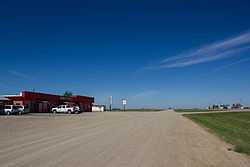
Midale, Saskatchewan is located on Highway 39, midway between the cities of Weyburn and Estevan. The population of Midale is 562. It is 100 miles southeast of Regina, Saskatchewan.
On July 5, 1937, during the great depression (and drought), Samuel Molberg recorded the highest temperature ever recorded in Canada at 45 degrees Celsius (113 degrees Fahrenheit). This temperature was also recorded that same day in Yellow Grass, Saskatchewan (64 kilometres northwest). Midale is a town in the rural municipality of Cymri No. 36, in the Canadian province of Saskatchewan. Midale is home to country musician Brad Johner.
Sites of interest
- Mainprize Regional Park is located just 12 kilometers away.
- Rafferty Dam Reservoir on the Souris River is just south of Midale
Demographics
| ||||||||||
Area statistics
- Lat (DMS) 49° 24' 00" N
- Long (DMS) 103° 24' 00" W
- Dominion Land Survey 22-5-11-W2
- Time zone (cst) UTC−6
Climate
Midale has a humid continental climate (Köppen '′Dfb′') with hot summers and very cold winters. Midale's highest temperature on record is 45.0 °C (113.0 °F), which is along with the village of Yellow Grass the highest temperature ever recorded in Canada.[6]
| Climate data for Midale | |||||||||||||
|---|---|---|---|---|---|---|---|---|---|---|---|---|---|
| Month | Jan | Feb | Mar | Apr | May | Jun | Jul | Aug | Sep | Oct | Nov | Dec | Year |
| Record high °C (°F) | 10.0 (50) |
17.8 (64) |
25.0 (77) |
33.5 (92.3) |
38.9 (102) |
39.4 (102.9) |
45.0 (113) |
41.7 (107.1) |
37.8 (100) |
32.2 (90) |
23.3 (73.9) |
17.2 (63) |
45.0 (113) |
| Average high °C (°F) | −9.6 (14.7) |
−6.1 (21) |
1.0 (33.8) |
11.4 (52.5) |
19.1 (66.4) |
24.0 (75.2) |
27.2 (81) |
26.2 (79.2) |
18.9 (66) |
12.0 (53.6) |
0.7 (33.3) |
−7.4 (18.7) |
9.8 (49.6) |
| Daily mean °C (°F) | −14.9 (5.2) |
−11.2 (11.8) |
−4.3 (24.3) |
4.8 (40.6) |
12.1 (53.8) |
16.8 (62.2) |
19.5 (67.1) |
18.5 (65.3) |
12.0 (53.6) |
5.3 (41.5) |
−4.5 (23.9) |
−12.6 (9.3) |
3.5 (38.3) |
| Average low °C (°F) | −20.2 (−4.4) |
−16.3 (2.7) |
−9.5 (14.9) |
−1.9 (28.6) |
5.0 (41) |
9.6 (49.3) |
11.9 (53.4) |
10.6 (51.1) |
5.0 (41) |
−1.4 (29.5) |
−9.6 (14.7) |
−17.8 (0) |
−2.9 (26.8) |
| Record low °C (°F) | −43.9 (−47) |
−48.3 (−54.9) |
−40.0 (−40) |
−26.1 (−15) |
−12.2 (10) |
−4.4 (24.1) |
−1.7 (28.9) |
−5.0 (23) |
−11.1 (12) |
−22.8 (−9) |
−34.0 (−29.2) |
−44.0 (−47.2) |
−48.3 (−54.9) |
| Average precipitation mm (inches) | 16.0 (0.63) |
16.2 (0.638) |
20.6 (0.811) |
30.5 (1.201) |
52.5 (2.067) |
67.1 (2.642) |
49.9 (1.965) |
53.2 (2.094) |
42.2 (1.661) |
24.5 (0.965) |
13.5 (0.531) |
19.0 (0.748) |
405.2 (15.953) |
| Average rainfall mm (inches) | 0 (0) |
0.2 (0.008) |
3.4 (0.134) |
20.4 (0.803) |
50.8 (2) |
67.1 (2.642) |
49.9 (1.965) |
53.2 (2.094) |
41.4 (1.63) |
17.2 (0.677) |
1.9 (0.075) |
0 (0) |
305.4 (12.024) |
| Average snowfall cm (inches) | 16.0 (6.3) |
15.9 (6.26) |
17.2 (6.77) |
10.1 (3.98) |
1.8 (0.71) |
0 (0) |
0 (0) |
0 (0) |
0.9 (0.35) |
7.3 (2.87) |
11.6 (4.57) |
19.0 (7.48) |
99.8 (39.29) |
| Avg. precipitation days (≥ 0.2 mm) | 5.2 | 4.8 | 4.8 | 6.0 | 10.1 | 11.1 | 8.1 | 8.4 | 7.4 | 5.2 | 3.6 | 4.1 | 78.6 |
| Avg. rainy days (≥ 0.2 mm) | 0 | 0.05 | 0.57 | 4.6 | 9.8 | 11.1 | 8.1 | 8.4 | 7.3 | 4.4 | 0.95 | 0 | 55.2 |
| Avg. snowy days (≥ 0.2 cm) | 5.3 | 4.7 | 4.4 | 1.5 | 0.35 | 0 | 0 | 0 | 0.24 | 1.0 | 2.8 | 4.1 | 24.3 |
| Source: Environment Canada[7] | |||||||||||||
See also
References
- ↑ "2011 Community Profiles". Statistics Canada. Government of Canada. Retrieved 2014-04-09.
- ↑ National Archives, Archivia Net. "Post Offices and Postmasters". Retrieved 2014-07-15.
- ↑ Government of Saskatchewan, MRD Home. "Municipal Directory System". Retrieved 2014-07-15.
- ↑ Commissioner of Canada Elections, Chief Electoral Officer of Canada (2005). "Elections Canada On-line". Retrieved 2014-07-15.
- ↑ "2006 Community Profiles". Canada 2006 Census. Statistics Canada. March 30, 2011. Retrieved 2009-02-24.
- ↑ "Top Weather Events of the 20th Century". Environment Canada. May 2010. Retrieved January 26, 2013.
- ↑ "Midale, Saskatchewan". Canadian Climate Normals 1971–2000 (in English and French). Environment Canada. Retrieved January 26, 2013.
External links
 |
Halbrite | | ||
| Goodwater-Souris River | |
Cullen-Lampman | ||
| ||||
| | ||||
| Souris River-Outram |
Coordinates: 49°24′N 103°24′W / 49.400°N 103.400°W