Michaelston-y-Fedw
| Michaelston-y-Fedw | |
 Michaelston-y-Fedw |
|
| Population | 365 (2001 census)[1] |
|---|---|
| OS grid reference | ST241845 |
| Principal area | Newport |
| Country | Wales |
| Sovereign state | United Kingdom |
| Post town | NEWPORT |
| Postcode district | NP10 8 |
| Post town | CARDIFF |
| Postcode district | CF3 6 |
| Dialling code | 01633 Castleton exchange |
| Police | Gwent |
| Fire | South Wales |
| Ambulance | Welsh |
| EU Parliament | Wales |
| UK Parliament | Newport West |
Coordinates: 51°33′15″N 3°05′46″W / 51.55426°N 3.09614°W
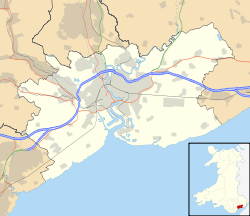
Michaelston-y-Fedw (Welsh: Llanfihangel-y-fedw) is a small rural village and community to the west of the city of Newport, Wales, on the border of Cardiff city and Caerphilly county borough.
The name, which is a partial Anglicization of the Welsh Llanfihangel-y-fedw – meaning "church enclosure (of) Michael (in) the birches" – may also be seen spelt "Michaelstone-y-Fedw", "Michaelston-y-Vedw" and "Michaelstone-y-Vedw", the parish church[2] being dedicated to Saint Michael.
There is a local pub called the Cefn Mably Arms. It first opened in 1824.
The community is bounded by the Rhymney River to the west, the A48(M) motorway to the south, and the Pound Hill road to the north and east. It contains Michaelston itself as well as a small cluster of houses known as Michaelstone Bridge about a mile to the north.
Government
The area is governed by the Newport City Council.