Miami, Queensland
| Miami Gold Coast, Queensland | |||||||||||||
|---|---|---|---|---|---|---|---|---|---|---|---|---|---|
|
Nobby Beach at Miami, looking north towards Surfers Paradise | |||||||||||||
| Population | 6,364 (2011)[1] | ||||||||||||
| • Density | 2,100/km2 (5,500/sq mi) | ||||||||||||
| Established | 1920s | ||||||||||||
| Postcode(s) | 4220 | ||||||||||||
| Area | 3 km2 (1.2 sq mi) | ||||||||||||
| Location |
| ||||||||||||
| LGA(s) | Gold Coast City (Division 12) | ||||||||||||
| State electorate(s) | Burleigh | ||||||||||||
| Federal Division(s) | Moncrieff | ||||||||||||
| |||||||||||||
Miami is a suburb on the Gold Coast in Queensland, Australia. Miami is located along the Gold Coast Highway, 7 kilometres (4.3 mi) south of Surfers Paradise and 17 kilometres (11 mi) north of the Queensland / New South Wales border at Coolangatta/Tweed Heads. It is part of the Gold Coast City local government area.
History

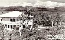
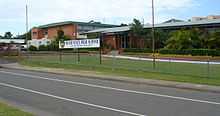
The history of Miami can be dated back to the early 1920s when prospective investors were looking over plans for a new real estate development called ‘Miami Shore’ at North Burleigh. The investors built their wooden or fibro bungalows on estates such as this, or rented their cottages to holiday makers. They could also stay in the Hotel Miami which opened in 1925 by E. H. Berry. After the Great Depression, the community developed with construction of tennis courts and the Pizzey Park Sporting Complex. The Miami State High School opened in 1963.
Australian Musician John Farnham's 1988 music video for the top-10 song "Two Strong Hearts" was filmed outside the famous "Miami Ice" factory at 2015 Gold Coast Highway, Miami.[2]
Demographics
Miami is a predominantly residential suburb with a population profile older than the state average. At the 2011 Australian Census the suburb recorded a population of 6,364.[1] Its commercial activity is mainly confined to the Gold Coast Highway and there is some light industry around Christine Avenue. It has an average salary of A$32,700 and 7.2% unemployment. (2003 ABS statistics).
| Age | Suburb of Miami | Queensland Average |
|---|---|---|
| Up to 14 years | 13.6% | 20.8% |
| 15 to 44 years | 45.6% | 43.4% |
| 45 to 64 years | 24.8% | 24.0% |
| 65 years plus | 16.0% | 11.9% |
Transport

The Gold Coast Highway runs north to south through Miami, with Christine Avenue and Pacific Avenue connecting to the west. The nearest train station is located at Robina, approximately 6 kilometres (3.7 mi) west of Miami.
The Gold Coast Airport is approximately 13 kilometres (8.1 mi) south of Miami.
Miami has frequent local bus services to the north and south operated by Surfside Buslines. This includes the all night route 700 that runs between Tweed Heads and Southport. The Gold Coast Tourist Shuttle also operates in Miami.
Sport and recreation

Pizzey Park is a major Gold Coast sporting and recreational located at 80 Pacific Avenue.[3]
A number of well-known sporting teams represent the local area, including the Burleigh Bears and Miami Beach Surf Life Saving Club.
References
- ↑ 1.0 1.1 Australian Bureau of Statistics (31 October 2012). "Miami (State Suburb)". 2011 Census QuickStats. Retrieved 17 January 2013.
- ↑ John Farnham - Two Strong Hearts. Youtube music video. Retrieved on 17 January 2013.
- ↑ "Pizzey Park". Gold Coast City Council. Retrieved 13 July 2014.
External links
Coordinates: 28°04′2″S 153°26′13″E / 28.06722°S 153.43694°E
