Mesquite Airport
| Mesquite Airport | |||||||||||
|---|---|---|---|---|---|---|---|---|---|---|---|
 | |||||||||||
| IATA: MFH – ICAO: none – FAA LID: 67L | |||||||||||
| Summary | |||||||||||
| Airport type | Public | ||||||||||
| Owner | City of Mesquite | ||||||||||
| Serves | Mesquite, Nevada | ||||||||||
| Elevation AMSL | 1,978 ft / 603 m | ||||||||||
| Coordinates | 36°49′59″N 114°03′21″W / 36.83306°N 114.05583°WCoordinates: 36°49′59″N 114°03′21″W / 36.83306°N 114.05583°W | ||||||||||
| Map | |||||||||||
 67L Location of airport in Nevada | |||||||||||
| Runways | |||||||||||
| |||||||||||
| Helipads | |||||||||||
| |||||||||||
| Statistics (2011) | |||||||||||
| |||||||||||
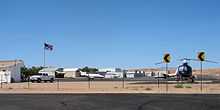
Mesquite Airport (IATA: MFH[2][3], FAA LID: 67L) is a public use airport located two nautical miles (4 km) north of the central business district of Mesquite, in Clark County, Nevada, United States.[1] It is owned by the City of Mesquite.[1]
The National Plan of Integrated Airport Systems for 2011–2015 categorized it as a general aviation facility.[4]
Facilities and aircraft
Mesquite Airport covers an area of 155 acres (63 ha) at an elevation of 1,978 feet (603 m) above mean sea level. It has one runway designated 1/19 with an asphalt surface measuring 5,121 by 75 feet (1,561 x 23 m). It also has one helipad designated H1 with a concrete surface measuring 20 by 20 feet (6 x 6 m).[1]
For the 12-month period ending January 31, 2011, the airport had 15,050 aircraft operations, an average of 41 per day: 99.7% general aviation and 0.3% military. At that time there were 22 aircraft based at this airport: 86% single-engine, 9% ultralight, and 5% jet.[1]
See also
References
- ↑ 1.0 1.1 1.2 1.3 1.4 FAA Airport Master Record for 67L (Form 5010 PDF). Federal Aviation Administration. Effective November 15, 2012.
- ↑ "IATA Airport Code Search (MFH: Mesquite)". International Air Transport Association. Retrieved June 13, 2014.
- ↑ "Mesquite, Nevada (IATA: MFH, FAA: 67L)". Great Circle Mapper.
- ↑ "2011–2015 NPIAS Report, Appendix A" (PDF, 2.03 MB). National Plan of Integrated Airport Systems. Federal Aviation Administration. October 4, 2010.
External links
- Diagram of Mesquite Airport (67L) PDF from Nevada DOT
- Aerial image as of June 1994 from USGS The National Map
- Resources for this airport:
- FAA airport information for 67L
- AirNav airport information for 67L
- FlightAware airport information and live flight tracker
- SkyVector aeronautical chart for 67L