Mesa de los Tres Reyes
| Mesa de los Tres Reyes | |
|---|---|
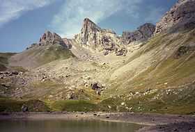 Mesa de los Tres Reyes viewed from Lac de Lhurs. | |
| Elevation | 2,428 m (7,966 ft) |
| Prominence | 392 m (1,286 ft) |
| Translation | Table of the Three Kings (Spanish) |
| Location | |
 Mesa de los Tres Reyes Location in Spain, on the border with France | |
| Location |
Aragon/Navarre, Spain; France |
| Range | Pyrenees |
| Coordinates | 42°56′42″N 0°43′20″W / 42.94500°N 0.72222°WCoordinates: 42°56′42″N 0°43′20″W / 42.94500°N 0.72222°W |
Mesa de los Tres Reyes (Basque: Hiru Erregeen Mahaia, Roncalese Basque: Iror Errege Maia, Aragonese: Meseta d'os Tres Reis, Gascon: Tabla d'eths Tros Rouyes, French: Table des Trois Rois) is a mountain of the Pyrenees. It is the highest point of Spanish Navarre and the Basque Country, with an elevation of 2,428 metres (7,965 ft).
Its name, "The Table of the Three Kings", derives from the fact that this mountain is located at the confluence of the ancient kingdoms of Aragon, Navarre and Béarn.
There is a similarly named mountain in the Ports de Beseit, at the eastern end of the Iberian System.
See also
External links
- "Mesa de los Tres Reyes" on Summitpost
- (French) Mesa de los Tres Reyes, CamptoCamp.