Meringandan West, Queensland
| Meringandan West Queensland | |||||||||||||
|---|---|---|---|---|---|---|---|---|---|---|---|---|---|
|
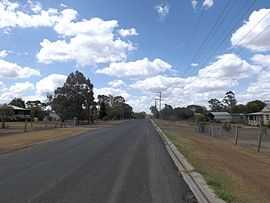
Clifford Street, 2014 | |||||||||||||
 Meringandan West | |||||||||||||
| Coordinates | 27°24′S 151°53′E / 27.400°S 151.883°ECoordinates: 27°24′S 151°53′E / 27.400°S 151.883°E | ||||||||||||
| Population | 1,977 (2011)[1] | ||||||||||||
| Postcode(s) | 4352 | ||||||||||||
| LGA(s) | Toowoomba Region | ||||||||||||
| State electorate(s) | Nanango | ||||||||||||
| Federal Division(s) | Groom | ||||||||||||
| |||||||||||||
Meringandan West is a locality in the Toowoomba Region local government area on the Darling Downs in southern Queensland, Australia. At the 2011 Australian Census Gowrie Little Plain and several other nearby localities recorded a population of 1,977.[1] The majority of the eastern boundary is aligned with Meringandan Creek
Mount Muniganeen is in the north of Meringandan West and rises to heights greater than 600 m above sea level. Central parts of the area have been developed into a residential estate. Meringandan cemetery is located in Peters Road. Meringandan West was part of a local planning scheme developed and adopted by the Toowoomba Region Council in August 2013.[2]
References
- ↑ 1.0 1.1 Australian Bureau of Statistics (31 October 2012). "Lilyvale (Toowoomba Region) (Gazetted Locality)". 2011 Census QuickStats. Retrieved 16 November 2014.
- ↑ "Highfields, Meringandan and Meringandan West Local Plan". Local plans. Toowoomba Regional Council. 22 August 2013. Retrieved 16 November 2014.
| ||||||||||||||||||