Meramec State Park
| Meramec State Park | |
| Missouri State Park | |
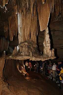 A stalactiflat in Fisher Cave | |
| Country | United States |
|---|---|
| State | Missouri |
| Counties | Franklin, Crawford, Washington |
| Elevation | 571 ft (174 m) [1] |
| Coordinates | 38°12′24″N 91°6′9″W / 38.20667°N 91.10250°WCoordinates: 38°12′24″N 91°6′9″W / 38.20667°N 91.10250°W |
| Area | 6,896.33 acres (2,791 ha) [2] |
| Established | 1927 |
| Management | Missouri Department of Natural Resources |
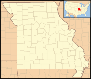 Location in Missouri
| |
| Website: Meramec State Park | |
Meramec State Park is located near Sullivan, Missouri, about 60 miles from St. Louis, along the Meramec River. The park has diverse ecosystems such as hardwood forests and glades. There are over 40 caves located throughout the park, the geology of which is a mixture of limestone and dolomite. The most famous is Fisher Cave, located near the campgrounds. The park borders the Meramec Conservation Area.
History
In the late 1970s, as part of the Meramec Basin Project, the U.S. Army Corps of Engineers began work on a dam in the park to impound the river. The resulting reservoir would have permanently flooded much of the park and imperiled many different species, including the endangered Indiana bat. However, in response to direct citizen action against the dam, the project was halted, marking a victory for the environmental movement.[3]
Features
The bottom southeast corner of the park includes the old Hamilton Ironworks, after which the Ozarks fiddle tune Hamilton Ironworks is named.[4][5] The Hamilton Iron Works Trail has interpretive signage about the history the blast furnace that once operated "around the clock, seven days a week."[6]
The park has a number of places on the National Register of Historic Places:
- Meramec State Park Lookout House/Observation Tower
- Meramec State Park Pump House
- Meramec State Park Shelter House
- Meramec State Park Beach Area Historic District
Activities and amenities
In addition to cave tours, the park offers opportunities for fishing, swimming and boating on the Meramec River, trails for hikers, and a campground.[7]
References
- ↑ "Meramec Park Lake". Geographic Names Information System. United States Geological Survey.
- ↑ "State parks...estimated acres". Revised Statewide Comprehensive Outdoor Recreation Plan: 2008-2012. Missouri Department of Natural Resources. pp. 142–143. Retrieved September 9, 2014.
- ↑ Watkins, Connor (2006). "The Meramec Basin Project: A Look Back 25 Years Later". Conor Watkins' Ozark Mountain Experience. Retrieved 2010-10-24.
- ↑ Lohraff, Kevin (2009). Map: Fisher Cave, Old Hamilton Ironworks. Hiking Missouri (Human Kinetics). p. 139. ISBN 9780736075886.
- ↑ Beisswenger, Drew; McCann, Gordon (2008). Ozarks Fiddle Music. Mel Bay Publications. p. 186. ISBN 9780786677306.
Cecil learned “Hamilton Ironworks” from Gene, who learned it in the 1950s from Roy Wooliver.
- ↑ "Park Trails at Meramec State Park". Missouri State Parks. Missouri Department of Natural Resources. Retrieved September 9, 2014.
- ↑ "Meramec State Park". Missouri State Parks. Missouri Department of Natural Resources. Retrieved September 9, 2014.
External links
- Meramec State Park Missouri Department of Natural Resources