Melandra, Cyprus
For the castle of the same name in Derbyshire, England, see Ardotalia.
| Melandra Μελάνδρα | |
|---|---|
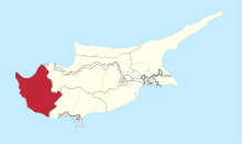
 Melandra Location in Cyprus | |
| Coordinates: 34°59′21″N 32°31′30″E / 34.98917°N 32.52500°ECoordinates: 34°59′21″N 32°31′30″E / 34.98917°N 32.52500°E | |
| Country |
|
| District | Paphos District |
| Population (2001)[1] | |
| • Total | 0 |
| Time zone | EET (UTC+2) |
| • Summer (DST) | EEST (UTC+3) |
| Postal code | 6319 |
Melandra (Greek: Μελάνδρα) is an abandoned Turkish Cypriot village in the Paphos District of Cyprus, located 2 kilometres (1.2 mi) southeast of Lysos. Prior to 1974, the village was inhabited by Turkish Cypriots.[2] The village is completely destroyed, apparently by shelling. The only two buildings that were not touched are the mosque and the orthodox chapel.