Mekhliganj
| Mekhliganj মেখলিগঞ্জ Mekliganj | |
|---|---|
| City | |
|
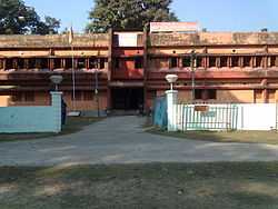
SDO Office, Mekhliganj | |
 Mekhliganj Location in West Bengal, India | |
| Coordinates: 26°21′N 88°55′E / 26.35°N 88.92°ECoordinates: 26°21′N 88°55′E / 26.35°N 88.92°E | |
| Country |
|
| State | West Bengal |
| District | Cooch Behar |
| Elevation | 58 m (190 ft) |
| Population (2001) | |
| • Total | 10,833 |
| Languages | |
| • Official | Bengali, English |
| Time zone | IST (UTC+5:30) |
| Lok Sabha constituency | Jalpaiguri |
| Vidhan Sabha constituency | Mekliganj |
| Website |
coochbehar |
Mekliganj is a city and a municipality in Jalpaiguri district in the Indian state of West Bengal.
Geography
Mekliganj is located at 26°21′N 88°55′E / 26.35°N 88.92°E.It adjoins the boundary of river Teesta.[1] It has an average elevation of 58 m (190 ft).
Gorachand basunia
Demographics
As of 2001 India census,[2] Mekliganj had a population of 10,833. Males constitute 52% of the population and females 48%. Mekliganj has an average literacy rate of 61%, higher than the national average of 59.5%: male literacy is 68%, and female literacy is 53%. In Mekliganj, 14% of the population is under 6 years of age.
Gorachand basunia
Administration
Presently Anirban Dutta, WBCS(Exe) is the Block Development Officer of Mekhliganj Block.He took the charge of the post in 2012 from his predecessor Shri Saptarshi Nag, WBCS(Exe), who had managed this block efficiently for over three years.Thinlay Phuntsok Bhutia is the Joint Block Development Officer of this block.With young administrators in the chairs, hopes are high on administration.The block comes under Mekhliganj Sub Division, where Shri Ranjan Kumar Jha is the present Sub Divisional Officer.
Mekliganj assembly constituency is part of Jalpaiguri (Lok Sabha constituency).[3]
References
- ↑ Falling Rain Genomics, Inc - Mekliganj
- ↑ "Census of India 2001: Data from the 2001 Census, including cities, villages and towns (Provisional)". Census Commission of India. Archived from the original on 2004-06-16. Retrieved 2008-11-01.
- ↑ "Assembly Constituencies - Corresponding Districts and Parliamentary Constituencies" (PDF). West Bengal. Election Commission of India. Retrieved 2008-10-02.