Meander Valley Council
| Meander Valley Council | |||||||||||||
|---|---|---|---|---|---|---|---|---|---|---|---|---|---|
|
Meander Valley Council | |||||||||||||
| Coordinates | 41°32′24″S 146°31′12″E / 41.54000°S 146.52000°ECoordinates: 41°32′24″S 146°31′12″E / 41.54000°S 146.52000°E | ||||||||||||
| Population | 19,694 (2010 est.)[1] | ||||||||||||
| • Density | 5.1541/km2 (13.3492/sq mi) | ||||||||||||
| Established | 1993 | ||||||||||||
| Area | 3,821 km2 (1,475.3 sq mi) | ||||||||||||
| Mayor | Craig Perkins [2] | ||||||||||||
| Council seat | Westbury | ||||||||||||
| Region | Great Western Tiers | ||||||||||||
| State electorate(s) | Lyons, Bass | ||||||||||||
| Federal Division(s) | Lyons, Bass | ||||||||||||
| Website | Meander Valley Council | ||||||||||||
| |||||||||||||
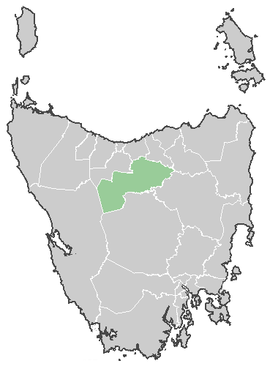
The Meander Valley Council is a local government area of Tasmania. As its name suggests, it covers a large area of the Meander River in the central north of the state, which flows through the municipality's major centre of Deloraine. The council was created when the Westbury and Deloraine municipalities merged in 1993.[3]
Smaller towns in the area include Bracknell, Carrick, Chudleigh, Hagley, Meander, Mole Creek, and Westbury. Smaller populated areas include Elizabeth Town, Caveside, Exton and Travellers Rest. The council area also covers the outer west Launceston suburbs of Blackstone Heights and Prospect Vale, and the satellite town of Hadspen.
A majority of the Great Western Tiers mountain range is within the Meander Valley municipal area.
References
- ↑ "3218.0 - Regional Population Growth, Australia, 2009-10". Australian Bureau of Statistics. 31 March 2011. Retrieved 23 August 2011. Estimated resident population (ERP) at 30 June 2010.
- ↑ "Your Council". Meander Valley Council. Retrieved 30 May 2012.
- ↑ "Council Profile". Meander Valley Council. Retrieved 30 May 2012.