Meall Greigh
| Meall Greigh | |
|---|---|
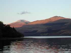 Ben Lawers (left) and Meall Greigh (right) above Loch Tay, November 2003 | |
| Elevation | 1,001 m (3,284 ft)[1] |
| Listing | Munro, Marilyn |
| Translation | Hill of the Horse Studs (Gaelic) |
| Pronunciation | Scottish Gaelic: [ˈmjalˠ̪ ˈkɾʲe] |
| Location | |
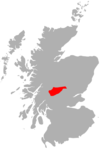
| Location | Perth and Kinross, Scotland |
| OS grid | NN674438 |
| Topo map | OS Landranger 51 |
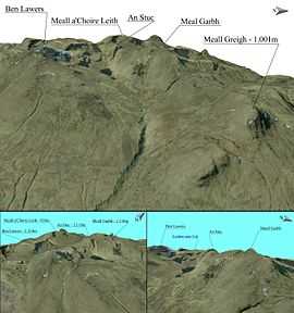
Meall Greigh 3D map
Meall Greigh is a mountain in the southern part of the Scottish Highlands. With Meall Garbh it forms the north-eastern end of the Ben Lawers range.
References
- ↑ "walkhighlands Meall Greigh". walkhighlands.co.uk. 2013. Retrieved 26 October 2013.
| Wikimedia Commons has media related to Meall Greigh. |

Coordinates: 56°34′03″N 4°09′34″W / 56.56737°N 4.15956°W