McNab/Braeside
| McNab/Braeside | |
|---|---|
| Township (lower-tier) | |
| Township of McNab/Braeside | |
|
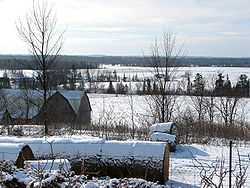
Countryside near Braeside | |
| Motto: "Fair Is The Land, Strong The People" | |
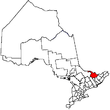
 McNab/ Braeside | |
| Coordinates: 45°27′N 76°30′W / 45.450°N 76.500°WCoordinates: 45°27′N 76°30′W / 45.450°N 76.500°W | |
| Country |
|
| Province |
|
| County | Renfrew |
| Incorporation | January 1, 1998 |
| Government | |
| • Type | Township |
| • Mayor | Tom Peckett |
| Area[1] | |
| • Land | 255.74 km2 (98.74 sq mi) |
| Population (2011)[1] | |
| • Total | 7,371 |
| • Density | 28.8/km2 (75/sq mi) |
| Time zone | EST (UTC−5) |
| • Summer (DST) | EDT (UTC−4) |
| Area code(s) | 613, 343 |
| Website |
www |
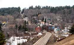
Burnstown along the Madawaska River.
McNab/Braeside is a township in eastern Ontario, Canada, on the south shore of Lac des Chats (part of the Ottawa River), straddling the lower Madawaska River in Renfrew County.
The township was created on January 1, 1998, when the Village of Braeside amalgamated with McNab Township.
Mayor Tom Peckett was elected in October 2014.[2]
Communities
- Braeside
- Burnstown
- Clay Bank
- Clay Valley
- Dewars
- Glasgow Station
- Goshen
- Lochwinnoch
- Lundys Corners
- Pinegrove
- Sand Point
- Stewartville
- Waba
- White Lake
Mayors
Demographics
| |||||||||||||||||||
- Population in 2011: 7371
- Population in 2006: 7222
- Population in 2001: 6843
- Population in 1996:
- McNab (township): 5765
- Braeside (village): 715
- Population in 1991:
- McNab (township): 5464
- Braeside (village): 562
See also
External links
References
- ↑ 1.0 1.1 1.2 "McNab/Braeside census profile". 2011 Census of Population. Statistics Canada. Retrieved 2012-02-10.
- ↑ 2.0 2.1 2.2 Carter, John (2014-10-27). "McNab-Braeside council ousted". Arnprior Chronicle-Guide. Retrieved 2015-02-15.
- ↑ "2011 Community Profiles". Canada 2011 Census. Statistics Canada. July 5, 2013. Retrieved 2012-02-10.
- ↑ 4.0 4.1 "2006 Community Profiles". Canada 2006 Census. Statistics Canada. March 30, 2011. Retrieved 2012-02-10.
- ↑ 5.0 5.1 "2001 Community Profiles". Canada 2001 Census. Statistics Canada. February 17, 2012. Retrieved 2012-02-10.
- ↑ Statistics Canada: 1996 census
 |
Horton | Bristol, Quebec Ottawa River |
| |
| Greater Madawaska | |
Arnprior | ||
| ||||
| | ||||
| Lanark Highlands | Mississippi Mills |
| |||||||||||||||||||||||||