McClave, Colorado
| McClave, Colorado | |
|---|---|
| Unincorporated community | |
|
Entering McClave from the south. | |
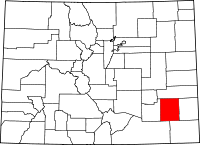
 Location in Bent County and the state of Colorado | |
| Coordinates: 38°09′40″N 102°53′56″W / 38.16111°N 102.89889°WCoordinates: 38°09′40″N 102°53′56″W / 38.16111°N 102.89889°W | |
| Country |
|
| State |
|
| County | Bent[1] |
| Elevation[1] | 3,868 ft (1,179 m) |
| Time zone | MST (UTC-7) |
| • Summer (DST) | MDT (UTC-6) |
| ZIP code[2] | 81057 |
| Area code(s) | 719 |
| GNIS feature ID | 0195421 |

McClave is an unincorporated community and a U.S. Post Office in Bent County, Colorado, United States. The McClave Post Office has the ZIP Code 81057.[2]
Geography
McClave is located at 38°09′40″N 102°53′56″W / 38.16111°N 102.89889°W (38.161016,-102.898808).
Climate
The Köppen Climate system classifies the weather as semi-arid, abbreviated as BSk.[3]
| Climate data for McClave, Colorado | |||||||||||||
|---|---|---|---|---|---|---|---|---|---|---|---|---|---|
| Month | Jan | Feb | Mar | Apr | May | Jun | Jul | Aug | Sep | Oct | Nov | Dec | Year |
| Average high °C (°F) | 45 (7) |
51 (11) |
59 (15) |
70 (21) |
78 (26) |
89 (32) |
94 (34) |
92 (33) |
84 (29) |
72 (22) |
57 (14) |
46 (8) |
69.8 (21) |
| Average low °C (°F) | 14 (−10) |
19 (−7) |
26 (−3) |
37 (3) |
47 (8) |
57 (14) |
63 (17) |
61 (16) |
51 (11) |
37 (3) |
24 (−4) |
16 (−9) |
37.7 (3.3) |
| Average precipitation mm (inches) | 0.4 (10) |
0.4 (10) |
0.8 (20) |
1.4 (36) |
2.3 (58) |
2.2 (56) |
2.4 (61) |
2.1 (53) |
1.2 (30) |
0.9 (23) |
0.5 (13) |
0.5 (13) |
15.1 (383) |
| Source: Weatherbase [4] | |||||||||||||
References
- ↑ 1.0 1.1 "US Board on Geographic Names". United States Geological Survey. 2007-10-25. Retrieved 2008-01-31.
- ↑ 2.0 2.1 "ZIP Code Lookup" (JAVASCRIPT/HTML). United States Postal Service. January 2, 2007. Retrieved January 2, 2007.
- ↑ Climate Summary for McClave, Colorado
- ↑ "Weatherbase.com". Weatherbase. 2013. Retrieved on September 5, 2013.
| |||||||||||||||||||||