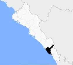
Mazatlán
| Mazatlán | ||
|---|---|---|
 | ||
| ||
| Nickname(s): Pacific Pearl | ||
|
Mazatlán Mazatlán in Mexico | ||
| Coordinates: 23°13′12″N 106°25′12″W / 23.22000°N 106.42000°WCoordinates: 23°13′12″N 106°25′12″W / 23.22000°N 106.42000°W | ||
| Country | Mexico | |
| State | Sinaloa | |
| Municipality | Mazatlán | |
| Settled | May 14, 1531 | |
| Government | ||
| • Mayor | Carlos Felton | |
| Area | ||
| • Municipality | 3,068.5 km2 (1,184.75 sq mi) | |
| Population (2010) | ||
| • Total | 438,434 | |
| • Demonym | Mazatleco, Mazatleca | |
| Time zone | MST (UTC-7) | |
| Postal code | 82000- | |
| Area code(s) | 669 | |
| Website | http://www.mazatlan.gob.mx | |

Mazatlán (Spanish pronunciation: [masaˈtɬan]) is a city in the Mexican state of Sinaloa. The city serves as the municipal seat for the surrounding municipio, known as the Mazatlán Municipality. It is located at 23°13′N 106°25′W / 23.217°N 106.417°W on the Pacific coast, across from the southernmost tip of the Baja California peninsula.
Mazatlán is a Nahuatl word meaning "place of deer".[1] The city was founded in 1531 by an army of Spaniards and indigenous settlers.[2] By the mid-19th century a large group of immigrants had arrived from Germany. These new citizens developed Mazatlán into a thriving commercial seaport, importing equipment for the nearby gold and silver mines. It served as the capital of Sinaloa from 1859 to 1873. The German settlers also influenced the local music, banda, which is an alteration of Bavarian folk music. The settlers also established the Pacifico Brewery on March 14, 1900.
With a population of 438,434 (city) and 489,987 (municipality) as of the 2010 census, Mazatlán is the second-largest city in the state. It is also a popular tourist destination, with its beaches lined with resort hotels. A car ferry plies its trade across the Gulf of California from Mazatlán to La Paz, Baja California Sur. The municipality has a land area of 3,068.48 km² (1,184.75 sq mi) and includes smaller outlying communities such as Villa Unión, La Noria, El Quelite, El Habal and many other small villages. Mazatlán is served by General Rafael Buelna International Airport.
Neighboring Communities


The town of Mazatlan is organized territorially into nine sindicaturas:
Mazatlan. Municipal capital, largest and most important tourist destination nationally receivership.
Villa Union. Located 25 km from Mazatlan, second most important town of the municipality. It is said that the first settlers belonged to a Spanish family who arrived there in 1576. Among its economic activities are fishing, agriculture, livestock, fruit growing, aquaculture and brick making.[3]
El Recodo. So he called for the shape of square shaped current Rio Presidio at this point, is 45 km in Mazatlan. Cradle of Don Cruz Lizarraga, founder of the international Banda El Recodo. Economic activities are livestock, agriculture, fruit growing, tanning and saddlery.[4]
El Quelite. Picturesque and attractive tourist town located 38 kilometers northwest of Mazatlan. It crosses a river which is called River El Quelite. Their houses contain the Spanish classical influence predominated in the eighteenth century. Charrería practiced here, the prehispanic game Ulama and their main economic activities are: livestock, agriculture, farming and fruit growing Gamecocks.[5]
Mármol de Salcido. It is 32 km. Mazatlan. It was an important production center of cement and lime. Its current economic activity is production of chile, fodder and tomato; its coast has a large number of pristine beaches.[6]
El Roble. Founded in 1867, is 32 km. Mazatlan. It became the largest sugar mill in the south of the state. Its main economic activities are agriculture and the production of cheese and honey.[7]
Siqueiros. Originally called Penitas, then adopted the name of San José de Siqueiros in honor of the patron saint of the town and the name of its founder. Founded in 1749, it is located 29 km from Mazatlan, located on the Rio Presidio. Among its economic activities in agriculture, livestock and planting vegetables.[8]
La Noria. Located 35 km northwest of Mazatlan. The first settlers from the late sixteenth century. Among its economic activities are livestock, agriculture and saddlery. Near here is the Presa Picachos.[9] A few miles away, is the famous Vinata de Los Osuna, a major producer of blue agave Spanish belonging to the family of the same name.[10]
El Habal. Village located 10 km north of Mazatlan. Its inhabitants are engaged in animal husbandry, farming and fruit growing.[11]
Geography
The town of Mazatlan is located in the southern portion of the State of Sinaloa, between the meridians 105 ° 56'55 "and 106 ° 37'10" west of Greenwich and between parallels 23 ° 04'25 "and 23 ° 50'22 "north latitude. The height above sea level is 10 m.
Its land area amounts to 3068.48 square kilometers, ie 5.3% of the total area of the State of Sinaloa, therefore classified as the ninth largest municipality.
Bordered on the north by the municipality of San Ignacio and the state of Durango, south to the town of Rosario and the Pacific Ocean, on the east by the town of Concordia and west by the coast of the Pacific Ocean.
Edaphology
The formation of soils present two types: The first type podzólico are characterized by a strongly-white river skyline with an outer shell on a bed of brown organic detritus; These soils are principal basis a spodic horizon, which for study is classified into 5 classes: a) Smoke-ferric podzol, b) humic, c) placid, d) ferric and e) gleyic.
The smoke-ferrous are identified by a percentage ratio between free iron and carbon of 6 or less over 6 respectively; humic are grouped by a dispersed organic matter and aluminum; the placid defined by a thin "bread" iron at or above the horizon.
The Spodic sometimes you have characteristics that indicate saturation with water at some time of year, ferric soil as its name suggests, consists mostly of iron; the gleyic podzol besides the spodic horizon that occurs in it, you see a picture of gley, which shows particularly saturated with water at some time of year.
The latter are lateritic soils, which are located on the southeast side of town, where the foothills of the Sierra Madre Occidental reach the sea, these soils are typical of the rainy tropics, presenting them small tiles of two types: (red and yellow) typical of temperate humid subtropical environment.
Geomorphology
The orography is determined by the ramifications of the Sierra Madre Occidental in the region of the northwestern coastal plain bearing as the Pacific Ocean, where the hills rise Vigia, Punta de Materén and Monte chair; This orographic before entering the municipality of San Ignacio takes the name of Sierra del Metate, whose characteristic is the formation of Peak Metate.
In the limit of Mazatlan and Concordia runs the Sierra del Metate and Panuco in this county the Sierra Madre Occidental is diverted to penetrate Durango, leaving before some detachments, such as the Sierra de San Juan and the Friars and constitutes, in of its topography, the following hilly areas.
To the north end of town saw the Friars extending northwest with elevations ranging from 150 to 1,900 meters above sea level in the northwestern portion El Quelite saw that branches are located in northwest with elevations of 50–700 meters above sea level in the south-east and north sides, born Arroyo de La Noria and some tributaries of the River El Quelite; in this same part of the mountain town of La Noria extending in a northwesterly direction at altitudes above sea level between 300 and 500 meters is located; on its western side birth Zapote Brook originates; territory north of the Sierra de San Marcos that records altitudes between 50 and 700 meters above sea level is located; in forming the southeastern and northwestern slopes Brook Copala and some tributaries of the Rio Presidio born.
Geology

The geological nature of the municipality is based on sedimentary rocks, features the east of the Republic, thus giving rise to the outcrop of fragments of marine and consolidated rocks and volcanic and metamorphic rocks. Mazatlan generally consists of tonalite and monsonitas belonging to the Middle Tertiary, comprising rhyodacites, rhyolites and ignimbrites with tuffaceous sediments at the base outcrops; andesitic rocks and felsitic late Early Cretaceous conglomerate, sandstone, tuff, sandy tuff tobalítica, conglomeratic sandstone, arkose storm origin and late Tertiary rhyolitic tuffs, limestones, shales, sandstones and quartzites of coal, gravel and conglomerates that make fans alluvial and slope deposits; rhyolite and rhyodacite tuffs of the same composition, dacite and Lower Tertiary andecita medium; volcanic and pyroclastic spills andecítica composition of Cretaceous; plutonic rocks of basic composition and basic ultra late Paleozoic, Cretaceous limestones, conglomerates of igneous and metamorphic songs; sediments own course of rivers and streams and sandy sediments, gravel, silt and orange.
Hydrology
El Quelite River, Brooks of Zapote, La Noria and Los Cocos part of the water resources of the municipality in the southwestern and southeastern slopes; these streams during the rainy season increase its volume considerably.
The current of the river El Quelite recorded a catchment of 835 square kilometers where drained annually an average of 107 million cubic meters with variations ranging from 78 to 163 million cubic meters. This hydrological passing through the town of Mazatlan touches the towns of El Castillo, Las Juntas, Amapa, Los Naranjos, Milkweed, Modesto Station and El Recreo including current. After traveling a distance of 100 kilometers from its source discharges into the Pacific Ocean. The streams of El Zapote and Los Cocos, drain in a southeasterly direction to end at the Presidio River up to the villages from which they take their names.
On the southeast slope of the Sierra del Quelite born stream de La Noria and on the north side of it, some tributaries of the River El Quelite. The creek drains La Noria playing in a southeasterly direction in its course the town of the same name finally ends on the River Presidio.
El Zapote stream is formed on the western slope of the Sierra de La Noria and moving in a southwesterly direction, passing touches peoples of Zapote and El Recreo, and empties into the Pacific Ocean.
On the northern slopes of the Sierra del Salto, near the village of the same name in the state of Durango, born Presidio River southeastward made a journey of 167 kilometers. Its catchment area is 5,614 square kilometers, with an average annual expenditure of 900 million cubic meters, a maximum of 2,225 and a minimum of 550 million cubic meters. Populations in margin are Los Cocos, El Zapote, El Placer, El Tecomate, Copala, El Recodo, Porras, Villa Unión, Alley Ostial and Alley Rosa.
Coast


The coasts of the municipality extending over 80 kilometers and own sandy beach sediments are formed in the northwestern flank of the head of the municipality a substance classified as berms soft sediment formation, the coast consists of gravel is located and conglomerates that form alluvial fans and slope deposits.
In the southwestern corner Huizache Lagoon occupies an area of 4,000 hectares 40.0 square miles) which receives the maritime influence through the estuary The Ostial and Freshwater diversion channel for receiving water from the Presidio River is located.
The coastline of the municipality receives fields preferably three fishing vessels fishing for shrimp and small scale fishing flake.
Cooperatives are distributed in the estuaries of the Escopama, Salinitas, El Veintinueve, Estero Uriah Huizache Lagoon.
Most of the islands of the municipality are formed by ignimbrites, rhyolitic tuffs and tuffaceous sandstones of altered and deformed light color.
The Bird Island is located between the extreme equatorial coordinates of 106 ° 28'34 "west longitude and 23 ° 15'25" north latitude; area is about 0.4 square kilometers, 1.1 kilometers long and maximum and minimum range of 800–650 meters respectively.
Deer Island is located between 106 ° 27'60 "west longitude and 23 ° 14'03" north latitude; its approximate length of 1.850 meters and a width that varies between 250 and 700 meters.
Creston Island located on the western edge of the outer bay of Mazatlan, has a length of 700 meters and a maximum width of 800 meters; northwest of the training, about 3 miles away small islands among which the "Brother South" and "North Brother" (the first with 46.3 meters in elevation) and the Rock of Turtle rise 1.5 meters above sea level at its highest ridge.
The Goats Island is similar to Creston appearance, has a height above sea level of a little over 50 meters.
The Stone Island is the most important part of the municipality coastline, its size is the largest of all because it has 30 square kilometers and is approximately 14.5 miles long by 2.5 wide. Despite its name the Stone Island is a peninsula that connects to contiente near the international airport of Mazatlan.
Weather

The climate regime the municipality of Mazatlan is dry-wet-wet tropical type, with a marked dry season lightly with an average annual temperature of 26 °C.

Note that during the summer months and the humidity factor, temperatures usually feel well above what the thermometer shows.
During the period 1940-1980, in the municipality an annual average of 748 mm of precipitation, with a maximum of 215.4 mm in 24 hours, and 90.4 mm was observed in one hour; During the same period the average evaporation rate per year was 2146.80 mm; the prevailing winds are northwesterly direction at an average speed of 5.0 meters Thermal sensation in summer is quite marked.
| Climate data for Mazatlan (1981–2000) | |||||||||||||
|---|---|---|---|---|---|---|---|---|---|---|---|---|---|
| Month | Jan | Feb | Mar | Apr | May | Jun | Jul | Aug | Sep | Oct | Nov | Dec | Year |
| Record high °C (°F) | 33.0 (91.4) |
35.7 (96.3) |
33.0 (91.4) |
38.9 (102) |
33.8 (92.8) |
38.1 (100.6) |
37.0 (98.6) |
36.0 (96.8) |
39.0 (102.2) |
35.4 (95.7) |
35.1 (95.2) |
31.4 (88.5) |
39.0 (102.2) |
| Average high °C (°F) | 25.4 (77.7) |
25.7 (78.3) |
26.2 (79.2) |
27.8 (82) |
29.5 (85.1) |
32.1 (89.8) |
32.8 (91) |
32.9 (91.2) |
32.7 (90.9) |
32.2 (90) |
29.5 (85.1) |
26.8 (80.2) |
29.5 (85.1) |
| Daily mean °C (°F) | 20.1 (68.2) |
20.4 (68.7) |
21.1 (70) |
22.9 (73.2) |
25.4 (77.7) |
28.6 (83.5) |
29.1 (84.4) |
29.1 (84.4) |
29.0 (84.2) |
27.9 (82.2) |
24.5 (76.1) |
21.8 (71.2) |
25.0 (77) |
| Average low °C (°F) | 14.9 (58.8) |
15.1 (59.2) |
16.0 (60.8) |
18.1 (64.6) |
21.3 (70.3) |
25.0 (77) |
25.5 (77.9) |
25.3 (77.5) |
25.2 (77.4) |
23.6 (74.5) |
19.4 (66.9) |
16.7 (62.1) |
20.5 (68.9) |
| Record low °C (°F) | 7.5 (45.5) |
9.5 (49.1) |
10.4 (50.7) |
7.9 (46.2) |
12.8 (55) |
19.0 (66.2) |
20.4 (68.7) |
14.9 (58.8) |
20.3 (68.5) |
17.8 (64) |
12.0 (53.6) |
9.3 (48.7) |
7.5 (45.5) |
| Average precipitation mm (inches) | 41.9 (1.65) |
8.8 (0.346) |
2.4 (0.094) |
5.2 (0.205) |
1.9 (0.075) |
20.6 (0.811) |
175.8 (6.921) |
230.6 (9.079) |
174.1 (6.854) |
68.5 (2.697) |
46.6 (1.835) |
25.9 (1.02) |
800.2 (31.504) |
| Avg. precipitation days (≥ 0.1 mm) | 2.3 | 1.0 | 0.5 | 0.6 | 0.1 | 2.0 | 10.2 | 11.0 | 10.5 | 3.5 | 2.1 | 2.2 | 45.9 |
| Average relative humidity (%) | 74 | 73 | 72 | 72 | 73 | 72 | 75 | 76 | 78 | 76 | 73 | 74 | 74 |
| Mean monthly sunshine hours | 215.6 | 224.8 | 257.3 | 255.1 | 297.0 | 271.5 | 223.4 | 233.6 | 215.3 | 248.0 | 241.5 | 205.7 | 2,888.8 |
| Source #1: Servicio Meteorológico Nacional[12] | |||||||||||||
| Source #2: NOAA (sun 1961–1990)[13] | |||||||||||||
Flora and Fauna

Its flora is tabachines, eucalyptus, laurels and poplars. Its fauna birds like ducks, herons, pelicans, there are armadillos, raccoons and a variety of marine species such as whales, dolphins, turtles and fish, white-tailed deer is one of the main animals that characterize mazatlan. Today there are fewer animals and plants than before, because the man has changed the ecosystem. Mazatlan has several protected areas, one of which is the area of Protection of Flora and Fauna (APFF) CACAXTLA Plateau is located between the towns of Mazatlan and San Ignacio in the central part of the state of Sinaloa and contains a portion of the coastal habitats of the state and is the AP-largest in Sinaloa. His wealth of habitats favors the presence of 66 species of flora and fauna listed in NOM-059-ECOL-2001 and CITES[14] and 47.5% of endemism reported for Sinaloa, plus charismatic and commercially important species. At the same time, the Protected Area is home to a population of 7,964 inhabitants, whose livelihood depends entirely on the extraction of natural resources in this area. The relationship between nature and society in APFF Cacaxtla Plateau, is the focus of this program.
Etymology
Mazatlan etymologically comes from the Náhuatl language and means "Land of deer" (mazatl "deer" Tlan: "earth" or "place").
Originally, the name Presidio of Mazatlan was possessed by the population is now called Villa Unión. The port of Mazatlán served as a reference to arrive by sea Presidio, and was called Islands of Mazatlan. By decree of the Estado de Occidente, of September 11, 1828, Presidio of Mazatlan was called Villa of the Union. This vacated this name, Mazatlán (land of deer), and since the port was known as Islas de Mazatlan adopted that name.
Economy


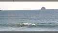
Tourism and fishing are the main industries in Mazatlan. The city houses the main beach resorts and has the second largest fleet of Mexico. Most processed seafood products in the city are shrimp and tuna. The first Mazatlan hotel with a restaurant inside was named Canton La Fonda and became operational in 1850. It was owned by a Chinese immigrant, Luen-Sing, which relate to the establishment as the Hotel Luen-Sing. In 1864 there were three Mazatlan hotels and three restaurants, with more opening in the late nineteenth century. Today, more than twenty miles of beaches are the main attraction, and the city contains a large number of hotels, restaurants, bars and shops. The city is also home to a brewery, a coffee factory and two power plants.
-
Nightlife in Mazatlán.
-
Kitesurfing in Mazatlán.
-
Flyboard in Mazatlán.


Gastronomy

In Mazatlan, you can enjoy a variety of fresh seafood preparation favoring especially the ceviches, cocktails, zarandeado fish and aguachile. It is traditional in the port developing Smoked Marlin and Tuna, the chilorio and roast chicken sinaloa style has transcended borders.

Some other regional dishes that have become famous are the tamales bearded (made with shrimp), the Governor tacos and fish crush it.
But the local cuisine offers much variety for all tastes. It's easy to find places to enjoy international cuisine, Japanese, Chinese, fast, vegetarian, snacks, meats and a variety of taquerias with their own specialties food.
Drinks in the city are as varied as the tastes of visitors, as you can find a huge variety of fresh water as horchata, barley, coconut, called CocoHorchata and Tejuino; good wines and of course, an excellent range of beers, in which the best known is the local beer called Beer Pacific has its factory in the harbor. Another well known in the region drink is a drink vanilla flavor called "tonicol".
Typical sweet you can taste the coconut candies, jamoncillos, Blackcap white and soft, made with coconut marshmallows in the region.
The Malecón of Mazatlán


It is considered one of the longest in the world, has a length of about 21 km, along the Pacific coast, among which you can find from high cliffs, monuments, gazebos, old buildings, hotels, etc.
The Malecon from Mazatlan is composed of a series of scenic roads with pedestrian space whose name varies along the route by stage or time of construction; from south to north the streets that compose it are:

- Calz. Joel Montes Camarena: a small road that connects the lighthouse, which used to be an island, with the rest of the city.
- Paseo del Centenario: starts in the previous street and borders the west to the lookout hill where cliffs are seen, was built to commemorate the centenary of the Independence of Mexico.
- Paseo Olas Altas: It is the oldest section of the boardwalk, was originally a dike to prevent flooding problems in the city in the 1830s, then an embankment which was used as urban space and recreation was built, was the first spaces city with street lighting, this section of the boardwalk is the most representative of the city is among the hills of the ice cream shop and lookout hill.
- Paseo Claussen: It was built at the same centenary ride, about 1910. It borders the hill of the ice cream parlor and ends at bay Puerto Viejo. It was named in honor of George Claussen, who was in command of Works Agency Mazatlan and promoted the project rides centenary and that would bear his name.
- Avenida del Mar: It is and therefore the more representative the longest section of the boardwalk; extends along the bay Puerto Viejo and comprises just over half of all the boardwalk. The panoramic tour ends at the tip of shrimp, which initiates the hotel zone and avenue changes name twice and continues several parallel to the coastline kilometers, yet maintain some distance and hotels involved.
Aquarium of Mazatlán


Since its opening on September 13, 1980, Mazatlan Aquarium is one of the most complete and best of its kind in Latin America, besides being the largest in Mexico. According to the institution "has as its primary objective the public to learn to respect the marine ecosystem on which we depend and are an intrinsic part through knowledge of marine species."
It is divided into two main areas that are the Aquarium and Botanic Garden; together, contain the following facilities:
Aquarius: Section 1: Marine Fish and Jellyfish, Section 2: Marine Fish and Dive Exhibition, Section 3: Freshwater Fish and Central Fishbowl: Fishbowl Sharks
- Diving -Exhibición Activity: Swim with Sharks. 2 Sharks Species Gata, 2 Turtle Species Carey, 50 different fish species, 2 Stripes Raya Tecolote, 1 Sparrowhawk.
- Museum of the Sea: Temporary exhibitions and permanent display shells, snails and materials relating to the Marine Ecosystem.
Botanical Garden: 1 hectare. It consists of 75 species of trees from around the world and regional species of Sinaloa.
- Pond Sea Lions: Sea Lions doing fantastic numbers Frog Pond: 21 aquaterrariums in which about 13 species and a total of approximately 120 organisms is. Grass Frog, Toad Rams, Green Tree Frog, Rana Pinta, and Toad Giant Toad Mazatleco.
- Oceanic Fishbowl: A total of 50 species among which the Lemon Sharks, The Giant Grouper Fish, Olive Ridley, Hawksbill, Rays, Snappers, Butterfly Fish, mackerel, among others.
- Aviary: about 13 species of birds that inhabit the State of Sinaloa are displayed: Pavorreales, Mallards, White Pelican, Brown Pelican, Quail, Duck Pichichin, White Wing Dove, among others.
- Cactario and Crocodile
Lighthouse of Mazatlan


The Mazatlan lighthouse, named El Faro Lighthouse, [15] is located at the peak of Cerro del Creston, at the southern end of the peninsula city of Mazatlan. The lighthouse has the distinction of being settled in what was formerly an island and has a length of 641 meters by 321 meters wide and a height of 157 meters, making it the highest natural lighthouse in the Americas and one of the highest operating lighthouses in the world.
In 1821, the Cortes of Cadiz issued a decree certifying the City of Mazatlan as the first port of height of the Mexican Pacific. This introduced Mazatlan as a viable destination for international trade. The decree, along with the rapid growth of large mining and commercial consortia, led to an intensified level of ship traffic. In those days, it was not uncommon for over 60 ships from Europe and the Far East, loaded with different types of merchandise, to reach the port each year. After several days of travel and trading of supplies, these boats would depart Mazatlan loaded with bars of gold and silver from the rich mines of the region.
While the exponential amount of growth in boat traffic into and out of the port undoubtedly was of benefit to the region, it also presented a problem at night. At that time there was no way to indicate to boats in the dark where the marina was located or how to enter and dock making it hard for ships to be accurate, which often led to sailors endangering their boats.
The first use of the Isla de Creston as a lighted marine signal was 1828. The light facilities, located on top of an imposing hill, were very modest, consisting of only a small stone structure on which fires, fueled by whale oil and wood, or coconut chips, were lit. The fires were fed wood and coal allowing them to produce a dim light that could only be seen within walking distance, making it of little help to seafarers, especially in bad weather.
El Faro became the answer to the problem, first lit over the Pacific Ocean in 1879. The lighthouse's original lamp was constructed in Paris, made of an oil lamp surrounded by mirrors and Fresnel lens to focus the light. [16] This allowed El Faro's light to be seen from a much further distance and thus give better navigation services leading to approaches being made with greater precision.
In 1905, the lamp was converted to hydrogen gas and was made to be able to revolve completely around. The final update of the light source came in 1933 when it was converted to electricity, which is what is still there today. In order to emit it's powerful light, El Faro uses a 1,000 watt bulb, which is focused by a Fresnel lens.
It is now one of the top tourist attractions in the city of Mazatlan seeing that one may hike up to see it close up. The view from the lighthouse is also a big draw for visiting it.
Band Sinaloense
The Band Sinaloense or Tambora is a type of musical ensemble, traditional and popular musical genre, which is culturally established in the early twenties in the state of Sinaloa, northwestern region of Mexico. It is a genus of Europeans to organological European style Fanfare remaining, however, like many other ensembles traditional wind in Mexico, performs a varied musical forms, repertoire that dominate traditional sones, rancheras, corridos, polkas, waltzes, mazurkas, chotis, all tailored to the sensitivity of the inhabitants of this Mexican region; music as well as popular romantic ballad and cumbia.

The unique sound of the Sinaloa band is very similar to the bands German and French wind, which is the difference in running musical bands Sinaloa north-central and south of this state. In the north central area, the musical phrasing is lighter and nuanced, most western European style and in the south, the style has a very strong phrasing and a little less nuanced performance, more influenced by the Bavarian style German, which made several researchers, their origin be located in these regions, especially considering foreign intervention in the state and in Mazatlan early in the century it was inhabited mostly by German immigrants. However, the Swiss ethnomusicologist Helena Simonett explains that the first sinaloenses bands formed by people who deserted the military bands and the municipal and went to live in the mountain villages, adding credence to the Sinaloa founders, with the rhythmic influence Mayo-Yoreme have contributed to its esencia.15 Nevertheless, there is an historic agreement, which puts the musical influence dates before mazatlán German trade boom (1870-1890), as it not only would be the distribution of instruments through marketing, but was also required a cultural disclosure that could only happen in a close relationship between the carriers of such traditions and the people of the region, and this circumstance only occurred in Mazatlan. That is why the theory of French and Spanish influence on the German influence in other regions of Sinaloa, is reinforced as the development of the music of Sinaloa drum has records and previous history in distant places in the mountains of Sinaloa where there was no influence Germany, however, did post-war French influence intervention and Spanish cultural remnants. Well as evidence of the formation of the first organological Mazatlan clusters and clusters of other Sinaloa, for example: La Banda El Recodo de Cruz Lizarraga 1938 that had a strong German influence in his playing style, which included his instumentación stringed instruments, in contrast with La Banda Los Tacuichamona 1888, La Banda Los Sirolas Culiacan (1920) and The Band of Brothers Rubio (1929) Mocorito, which were exclusively instrumental integration of wind instruments and percussion to Galo style -Ibérico fanfare, as well as execution.
Main Beaches
- Olas Altas. It is the beach with greater historical reference of Mazatlán, is located in the southern part of the city, a few meters from downtown. In the section of the boardwalk that passes through Olas Altas you can see various monuments, such as The Shield, which contains the shields of Sinaloa and Mazatlan; The Deer, statue of a deer concerning the etymology of the name of the city; Monument to Pedro Infante; Monument to The Continuity of Life; Monument Mazatleca Women; is also the famous restaurant "Puerto Viejo".
-

Monument to women Mazatleca
-

monument continuity to life
-

Coat of Sinaloa in Olas Altas
- Playa Norte. It is located in the downtown area of the city. Here you can find the Monument to the fishermen; Monument pneumonia and Pacific Brewery. The second of these concerns taxis characteristic of this city.
- Playa Sábalo. It is located in the north of the city.
- Playa Cerritos. It is an extension of Playa Sábalo.
- Playa El Delfin. Located north of the tourist area of the city.
- Playa Isla de la Piedra. Located in the southern part of the city.
Tourism and Culture
Historic Center

The Historic Center of Mazatlan, among its former inhabitants are French, German, Chinese, Italian, Spanish and Americans (whose inhabitants descend much of Mazatlan population), was named Heritage of the Nation on March 12, 2001. A civil association composed of a group of Mazatlan, have managed to revive this area along with the support of various organizations, companies and government authorities. Among the buildings and areas of high cultural value are the Plazuela Machado, the Angela Peralta Theater, the old Hotel Iturbide (today Municipal Arts Centre), Mansion of Redo, Melchers House, House of Retes, Corvera Building, Building Bank of London and Mexico, Haas House, Temple of San José, among others.[17]
Culture and Art


Mazatlan hosts several events annually, the most important is the International Carnival of Mazatlan, who in 2012 turned 114 years.[18] Other important events are the Mazatlan Cultural Festival and the Festival of Dance José Limón,[19][20] celebrated year year in winter and spring, respectively. Book Fair and Arts of Mazatlán (Feliart) and Mazatlan Book Fair (FELIMAZ).[21][22]
Another important event is the International Motorcycle Week, which attracts thousands of motorcyclists from around the country and abroad and is held each year during the Week of Pascua.[23]
In sports, Mazatlan is home to the Pacific International Triathlon held in April, and the Pacific International Marathon, which is held every year in late November and early December and attended by athletes from around the world.[24]
In 2012, Mazatlan was chosen as the host city for the tenth installment of Premios Oye!, prizes awarded by the National Academy of Music in Mexico23 and Volleyball Olympic qualifiers for the Olympic Games in London 2012.[25]
Mazatlán Carnival


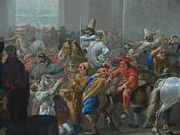
It is currently one of the most important carnivals in Mexico since the first parade on Sunday brings together more than 600,000 people over three hours in the coastal area of the city on the "Avenida del Mar" figure not always is exceeded in its second parade on the following Tuesday. A novelty that offers tourists coming from all over the world to witness this festival is called "Burning of humor" where tradition says burn a character role (Monigote) representing someone who people think has made some misdeed that are usually politicians, presidents or 2013 that was burned "Influenza" that both affected the image of the country in recent years, followed by the famous "Naval Combat" depicting the battle that took place against vessels French seeking land at the port.
A very representative element of this carnival are the great "Monigotes" that are placed along the important areas of the city such as decoration, which happen to be giant figures made of papier mache supported by large structures. The central events of the party have to do with the crowning of the queen of the carnival, which are massive events held with a selection of world-class artists. During these days, the mazatleco people recognize the carnival one of the central moments of celebration, fundamental act in which all the elements of the party is summarized. From its origins are scheduled two parades, one on Sunday and another on Mardi Gras (to dismiss the celebration). The superb save composed of colorful floats, floats and superb real environment, covers a good part of the coastal walk, with an estimated several hundred thousand spectators assistance. It royal courts, ambassadors from around the country and abroad, special guests like athletes, entertainers TV and various showbiz personalities involved; in addition, of course, hundreds of mazatlecos of all ages and social conditions.
Carnival Mazatlan is distinguished from other carnivals in the country and the world, because in this carnival fun is offered to the rhythm of the "banda"; Music Sinaloa regional Tambora that has transcended the world through what is today called "la onda grupera". The program of this event, as an exceptional case, includes cultural activities (poetry contests, prize for literature and shows enormous artistic quality), with which the party extends to all sectors of the population and covers all range of tastes of locals and tourists.
Sports

Baseball is very popular among mazatlecos.25 The representative team called Venados de Mazatlán is integrated into the Mexican Pacific League. The league begins in mid-October and ends in late December. Then in January are the playoffs and the eight teams that make up the league, one is the representative of Mexico in the Caribbean Series, but that place has to make the final.
Mazatlan is a major sporting center of the country, as important activities and renowned also carry such as the marathon and triathlon peaceful, in which not only domestic but also foreign participating athletes.
Another sport that has been practiced for over 25 years in the port is football, with major achievements both statewide and nationally. One of the initiators cricket teams were Redskins Mazatlan.
Media

It has an international airport (IATA Code: MZT) denominated Rafael Buelna who has daily domestic and international flights to the United States and Canada.
By land, Mazatlan is connected to the north and south Culiacan to Tepic and Guadalajara via highway 15 and the corresponding Federal Highway 15D. To the east is connected to Durango Highway 40 and the corresponding Federal Highway 40D.
Ferries make the daily journey to La Paz, Baja California Sur, while a varied number of cruise ships visiting the port every week from the United States.
Durango-Mazatlán highway


The Durango-Mazatlán Highway is a highway linking the cities of Mazatlan and Durango crossing the Sierra Madre Occidental.
With an investment of over 28 billion pesos, Durango-Mazatlán Highway is one of the boldest projects and Mexico complexes.
Key Features
- 230 km in length.
- 63 tunnels.
- 115 bridges including the Baluarte Bridge.
- Track width for two lanes to four lanes sections.
- Initial estimated cost for the work of 8218.5 million, 2 with a final estimate of 28,600 million pesos.
- Generating 4,500 direct jobs and 10,000 indirect.
- Stretch of 7.7 km of 4 lanes (including the Baluarte Bridge)
Main sections
- Tunnel "The Sinaloa" with 2.794 meters.
- Baluarte bridge with a center span of 520 meters and a total length of 1.124 meters.
- Bridge Parlors.
Time
Reduction of 6 to 8 hours to 3 hours.
Political Situation
In the municipality of Mazatlán two electoral preferences are distinguished. While the inhabitants of the receiverships, police stations and other villages in the municipality continue voting traditionally by the Institutional Revolutionary Party, in this city a phenomenon of electoral alternation shown.
Mazatlán was governed by municipal presidents arisen from the ruling Institutional Revolutionary Party. It was from the municipal elections of 1989 when he won the municipal presidency candidate of the National Action Party (PAN), Rice Humberto García (1990-1992). However the Institutional Revolutionary Party regained the municipality when in the elections of 1992 he won the Mr. Martin Gavica Garduño (1993-1995). However, for the period 1996-1998 the PAN Alejandro Camacho Mendoza reclaimed the municipality for his party, and he held it in the next period (1999-2001) Alejandro Higuera Osuna through.
In elections for the 2002-2004 period both the National Action Party and the Institutional Revolutionary Party (PRI) were defeated by the Labour Party candidate, Jorge Alberto Rodriguez Steps. However, a few months after taking oath as mayor, Rodriguez Steps was deposed by the State Congress faced a charge for domestic violence that which he was accused by his own wife. His place was taken by Gerardo Ramirez Rosete, the same party. Shortly thereafter, in a move seen as a ruse of the PRI state government was replaced by Ricardo Ramírez González, a member of the Institutional Revolutionary Party.
In elections for the 2005-2007 period new account Alejandro Higuera Osuna PAN occupied the Municipal Presidency until June 2007 when he resigned to contest elections for local deputy; the 12th of that month and year was replaced by Isaac Lopez Arregui.
In elections for the period 2008-2010 the Institutional Revolutionary Party regained the town with its candidate Jorge Abel Lopez Sanchez.
Since April 2010, the town of Mazatlan is in a political situation very <cross> with great influences both the Institutional Revolutionary Party (PRI) and National Action Party , since the last election to mayor which was won by PRI Jorge Abel Lopez Sanchez, who defeated a former PAN and petetista government (PT), that was the last time that Mazatlan has had a PRI government.
In July 2010, in the election for Governor, Local And Municipal Presidents Deputies for the first loss occurred in PRI governor of Sinaloa. Mario López Valdez, hitherto Sinaloa Senator and member of the PRI, PRI giving both its membership and the senate, defeated the PRI representing one of the controversial alliances PAN and the PRD. This PRI hegemony in the state was completed. Another important event is the third choice Alejandro Higuera Osuna PAN won the municipal presidency of Mazatlan. In addition, the PAN won a historic vote statewide.
Educational Institutions
Notes French explorer Duflot de Mofras that by 1840's, based foreign traders in Mazatlán impelled the opening of the first public school in the city. Still in 1872 there were only two schools of primary instruction. In 1873 the Liceo Rosales, which over time would become the Autonomous University of Sinaloa was founded.
Currently in Mazatlan, plus preschool, elementary, middle and high schools, colleges and faculties of both public and private institutions are based. Of those, the main ones are the Autonomous University of Sinaloa, Mazatlan Institute of Technology, the University of the West, the Polytechnic University of Sinaloa and Nautical School of Mazatlán. Of these universities, only the Autonomous University of Sinaloa is public. Those belonging to the private sector, in addition to those mentioned above, also excel campuses TecMilenio University, Universidad Autónoma de Durango and Sinaloa Superior Institute of Technology.
The National Autonomous University of Mexico, UNAM, counts in the city with an academic unit specializing in science sea. The Center for Food Research and Development.
History
Mazatlan early settlers
According to historians, Indigenous groups were in the region of Mazatlan prior to the arrival of the Spanish. These groups included the Totorames, who lived from the south bank of the River Piaxtla, to the Río de las Cañas, as well as the Xiximes, who lived in the mountains in the bordering the state of Durango.
Until the early 19th century, Mazatlán was a collection of huts inhabited by indigenous people whose major occupation was fishing, according to Abel Aubert du Petit-Thouars, a French explorer. In 1829 a Filipino banker named Juan Nepomuceno Machado arrived and established commercial relations with vessels coming to Mazatlán from far off places such as Chile, Peru, the United States, Europe, and Asia Pacific. By 1836 the city had a population of between 4,000 and 5,000.
Foundation of the city, colonial period
During the early years of the Spanish conquest in Sinaloa, the region currently occupied by the municipality of Mazatlan remained uninhabited. The nearest town was Chametla, which was occupied by the Spanish in 1531, and lent its name to the province, despite being abandoned shortly afterward.
In 1534 the Valley of Mazatlan was divided into 25 Castellanos by an unknown person who did not stay for long. In 1576, Don Hernando de Bazán, Governor and Captain General of Nueva Vizcaya, sent Captain Martin Hernandez with his father, brothers and soldiers to occupy the site of Mazatlan, granting them land and titles in return. The Captain's claims were ratified in the City of Durango in 1639 and endorsed in the same city in 1650.
The entry of Nuño de Guzmán to Sinaloa in 1531, and the appointment of the conquered lands as provinces prompted the internal territorial division in the State. Chametla was occupied by the Spanish and listed as a province spanning from the River to the Rio Cañas Elota to the boundary with the province of Culiacan. Both provinces belonged to the kingdom of New Galicia.
In 1565 the town of Chametla was gradually diminished by ongoing Indian raids. That year, Captain Francisco de Ibarra recovered the territory south of the state, rebuilt Chametla and founded the Villa de San Sebastian (known as Concordia today), and awarded the region to New Vizcaya. The provinces under his jurisdiction included the villages of San Sebastián, Mazatlan and its port, and Charcas Copala Royals and Finance Panuco.
During the last years of the seventeenth century and early eighteenth centuries, the territory within Sinaloa remained unchanged, until, in 1732, the provinces of Sonora and Ostimuri were united, as were the provinces of Sinaloa, Culiacan, and Rosario with San Felipe and Santiago being the principal cities.
In 1749 Sinaloa was divided into five provinces with their mayors and lieutenancy: Maloya, with jurisdiction over Chametla Rosario, San Jose, Copala, with jurisdiction over San Ignacio, Piaxtla and Mazatlán, Culiacán, with jurisdiction over Badiraguato, and Sinaloa that bordered the Rio Mayo.
In 1786, the intendant system was implemented because of the need to establish a provincial government. Arizpe Municipality was formed out of the territories of Sonora and Sinaloa. That year, the first mayor, Garrido Durán subdelagaciones, established eleven, eight of them in Sinaloa Mazatlan being within the sub Copala, later called San Sebastian.
Independent Mexico
Among the first decrees that the legislature enacted, it has the addition of each of the eleven districts, the name of one of the leading insurgents, corresponds to the Union Villa Mariano Balleza, parish priest Dolores Hidalgo joined the night of September 15, 1810.
In 1813, the Cadiz constitution came into effect. Article 310 of that constitution provided for the installation of local councils in towns that had more than 1,000 inhabitants. In 1814 Fernando VII repealed that constitution but it was later reinstated in 1820, and the first municipalities in Sinaloa were founded.
In the late eighteenth and early nineteenth century, Mazatlán was a native fishing village located north of Cerro de la Aduana. In 1821 it was declared the first port of Mazatlan on Mexico's Pacific coast.
Jurisdictionally, Mazatlan remained dependent on the sub-delegation of San Sebastian, unaffected by the divisions between the states of Sonora and Sinaloa. In 1824 they got together to form the State of West. After the imposition of new internal division of five departments and municipalities divided into parties, Mazatlan was in the department of San Sebastian, which was formed with the parties of its name, San Ignacio and the Rosary, with a limit to the River of Reeds.
In 1830 he decreed the dissolution of the West in two states. The first constitution of the state of Sinaloa, promulgated on December 12, 1831 divided the territory into eleven districts with their respective parties, leaving the district town of La Union separated from Concord and San Ignacio.
According to the French navigator Abel Aubert du Petit-Thouars a Spanish banker named Machado, through his commercial activities, gave impetus to that village to make it in 1836, a village where there lived between four and five thousand people. It then became the largest port on the Mexican Pacific.
Invasions
Between 1847 and 1848, Mazatlan was invaded and occupied by the U.S. military. Ten years later, in 1859, the port was blockaded by the British warship Amethyst. On November 13, 1864 the French Army and the Imperialist forces took possession of Mazatlan, until they were deported on November 13, 1866 by the forces of General Ramón Corona. After customs officials seized twenty-three ounces of gold to the payer of British warship Chanticleer,the June 18, 1868 he blockaded the port, and its captain, William H. Bridge, threatened to bomb the city on November 22.
The Gold Rush
During the California Gold Rush, Mazatlan, attracted prospective miners from as far away as the United States east coast. Many of them arrived at Mexican ports on the Gulf and then rode for weeks to get to Mazatlan. However, they did not spend much time in Mazatlan before boarding a ship to San Francisco.
Mazatlan Plan
When Félix Zuloaga Tacubaya proclaimed the Plan of ignoring the Constitution of 1857, the garrison of the Plaza de Mazatlán not remained outside this proclamation, and the first of January 1858 proclaimed the Plan of Mazatlan, which seconded Felix Zuloaga.
Mazatlan, Sinaloa capital Until the year 1853 had been the capital Culiacan, Sinaloa state. However, this year the powers were transferred to Mazatlan. On July 22, 1867 the federal government passed a law that forbade the state capitals were at the ports. As a result of this law, the September 20, 1873 the State Legislature decreed that declared capital Culiacan state again.
City Bombing
On the morning of November 13, 1864 the French Navy ships fired twelve cannon shots into the city, causing minor damage to several homes but causing no deaths. The attack stopped when the prefect of the city made known to the invaders that the Mexican Army had left the square and he formally handed them.
On June 26, 1880 Jesus Ramirez former general in command of 400 men stormed the garrison of the square and appropriated Mazatlan. After imposing a compulsory loan traders, had to leave the city when it was bombed again by theDemocraticMexican warship, which during its attack, caused a high number of women and children to be killed or wounded. Of the 24 cannon shots fired, only three hit the headquarters of the sharp and the rest landed on the neighboring houses.
Mazatlán Lighthouse
Mazatlán's famous lighthouse began operating in mid-1879. The maritime signals were manufactured in Paris, France, and consisted of a large oil lamp with mirrors to reflect and enhance light. Because the light was static, from a distance it was often mistaken for a star. It was not until 1905, that the lamp was replaced and incorporated a revolving turntable. At that time period, the Mazatlan lighthouse was considered the highest in the world.
The Mazatlan Times
Mazatlan The Times was a weekly published by the American A. D. Jones The first issue appeared on May 12, 1863. The publisher boasted that his was the only weekly English language not only of Mazatlan and Sinaloa, but throughout Mexico.
Siglo XIX The constitution of 1852 decreed a new internal division in Sinaloa, which reduced it to nine Districts, by deleting the San Ignacio which was annexed to the Cosalá, and Choix which is annexed to El Fuerte, and amending the name of the district Villa de la Union, the port of Mazatlan. That same constitution decrees the headquarters facility policies and councils in each district.
In 1861 political headquarters are deleted and become prefectures, the same year the State Legislature adopted Act on Municipalities. For 1868 the district had five municipalities Mazatlan, one in the central header and the other in Villa Union, Siqueiros, La Noria and The Milkweed.
In 1873, according to the census of the State, the District of Mazatlán 26.298 inhabitants had been reduced to three the number of municipalities: its name, Villa Union and La Noria. Siqueiros had annexed in 1870 to the central hall and the Milkweed for mayor of La Noria.
Porfiriato
Prefectures in 1880 changed its name and become political directorate subdivided into municipalities and guardhouse.
The growth of towns influenced the subdivisions within districts. Thus, in 1882 the village of El Venadillo is elevated to the category of people. In 1883 Siqueiros with the municipal government and the bend stands a header directorship Siqueros policy, however, the reforms enacted in May 1887, abolishing the mayor of Siqueros being attached to their people for mayor of Mazatlan. A year later, the village of El chilillos stands in town, belonging to the central hall.
Mexican Revolution
In 1912 the municipalities enact law No.21 as a form of internal division of the State, however it is until 1915 when it abolished by law the political directorate, when erected the first free communes.
With the publication of the decree creating the municipality of Mazatlan, in the official newspaper of April 8, 1915, independent life begins in the region. The Constitution of 1917, culminating in the first constitutional governor, General Ramón F. Iturbe, born in Mazatlan, confirms the sixteen municipalities in which they divided the State, which would be subdivided into receiverships and police stations.
Wonder of Mexico
In September 2007, Mazatlan was considered one of the 13 Wonders of Mexico made by man.
The city has seen some turbulent times. During the Mexican-American War (1846–48) the U.S. Army took the city and, in order to avoid the shelling of the city, the Mexican army abandoned it. Almost twenty years later, on the morning of November 13, 1864, a French man-of-war fired on the city twelve times but there were no casualties; Mazatlán then became part of the Second Mexican Empire under Maximilian (vestiges of French influence may still be found in the architecture of many buildings in Centro Historico). On November 13, 1866, the Mexican general Ramon Corona expelled the imperialists from Mazatlán.
On June 18, 1868, William H. Bridge, captain of HMS Chanticleer, blockaded the port and threatened to shell the city on June 22. The captain had taken umbrage after local Customs Authorities seized 23 ounces of gold from the paymaster of his ship.
The City of Mazatlán has the dubious distinction of being the second city in the world after Tripoli, Libya, to suffer aerial bombardment (although the local historical display at the plazuela claims that Mazatlán was the first). During the Mexican revolution of 1910–17 General Venustiano Carranza (later president), intent on taking the city of Mazatlán, ordered a biplane to drop a crude bomb of nails and dynamite wrapped in leather on the target of Neveria Hill adjacent to the downtown area of Mazatlán. The crude bomb landed off target on the city streets of Mazatlán, killing two citizens and wounding several others.
During the Gold Rush, fortune hunters from the United States East Coast sailed from New York Harbor and other Atlantic ports to Mexican ports in the Gulf of Mexico. Debarking, the aspiring miners travelled overland for weeks to Mazatlán, where they would embark from the port to arrive in San Francisco in another four to five weeks.

Mazatlán's lighthouse (El Faro) began to shine by mid-1879. The lamp had been handcrafted in Paris, containing a large oil lamp with mirrors and a Fresnel lens to focus the light. Since the light was static, in the distance it was often mistaken for a star. By 1905 this lamp was converted to a revolving lamp. Today, the 1000 watt bulb can be seen for 30 nautical miles (60 km). Near the lighthouse shore, famous "divers" (called this even by the Spanish speaking inhabitants of Mazatlán) perform daring jumps off high rocks into the Pacific Ocean for tips from onlooking tourists.
Angela Peralta (1845–1883), a Mexican opera diva famed throughout the world, died of yellow fever in Mazatlán shortly after her arrival in the port. Legend has it she sang one last aria from her hotel balcony overlooking the Plazuela Machado. Her memory is held dear by Mazatlécos to this day, and the restored Teatro Angela Peralta by the Plazuela keeps her memory alive.
Mazatlán is also the hometown of Pedro Infante, one of the most popular actors and singers of the golden years of the Cinema of Mexico.
Mazatlán was well regarded by film stars such as John Wayne, Gary Cooper, John Huston, and others of their generation as a sportfishing mecca. The hotels along Olas Altas flourished during the 1940s, 1950s and 1960s supporting this vibrant trade.
In the 1970s, tourism in Old Mazatlán declined as newer venues catering to Western tourists opened on the expanses of beach to the north of the city ("Zona Dorada"). As an example of Mazatlán's tourism expansion, one of the largest timeshare providers in Mexico, Mayan Resorts was founded in 1975 with the inauguration of Paraíso Mazatlán (Mazatlán Paradise). This time also saw the expansion of the Hotel Playa Mazatlán and the construction of many others, a trend that continues to this day.
Next to Infante, Lorena Herrera, one of the most famous actresses and singers in Mexico and Latin America during the final decades of the 20th Century and the first decades of the 21st century, is Mazatlan's most famous native. German-born telenovela star Sabine Moussier, a stablemate of Herrera's—both have been under Televisa contract since the 1990s—also grew up in Mazatlan. Hollywood and Broadway actress Sara Ramirez is also a Mazatlan native.
As the 21st century begins, the Centro Histórico has been rediscovered by newcomers and locals alike, spurring a renaissance of restoration and entrepreneurial endeavors. Once-fine homes that had fallen into literal ruin are being restored to their former glory as family homes and boutique businesses. The city has assisted in upgrading infrastructure, such as better water, sewer and electrical services.
Images
- Mazatlán
-

Easter Sunset
-

Easter Sunset at Playa Mazatlan
-

Sunset at Monument El Pescador Playa Norte
-

Parasailing near the Hotel Playa Mazatlan
-

Main entrance to the Hotel Playa Mazatlan
-

Church El Centro Mazatlan
Sister Cities
|
References
- ↑ Ayuntamiento Municipal de Mazatlán]
- ↑ Benchwick, G & Hecht, J (2009). Puerto Vallarta and Pacific Mexico. Lonely Planet. p. 320. ISBN 1-74104-806-0.
- ↑ "Villa Unión: Localización e Historia". Ayuntamiento de Mazatlán. Retrieved 2012-05-31.
- ↑ "El Recodo: Localización e Historia". Ayuntamiento de Mazatlán. Retrieved 2012-05-31.
- ↑ "El Quelite: Localización e Historia". Ayuntamiento de Mazatlán. Retrieved 2012-05-31.
- ↑ "Mármol de Salcido: Localización e Historia". Ayuntamiento de Mazatlán. Retrieved 2012-05-31.
- ↑ "El Roble: Localización e Historia". Ayuntamiento de Mazatlán. Retrieved 2012-05-31.
- ↑ "Siqueros: Localización e Historia". Ayuntamiento de Mazatlán. Retrieved 2012-05-31.
- ↑ "La Noria: Localización e Historia". Ayuntamiento de Mazatlán. Retrieved 2012-05-31.
- ↑ "Los Osuna". Los Osuna 100% Agave Azul. Retrieved 2012-05-31.
- ↑ "El Habal: Localización e Historia". Ayuntamiento de Mazatlán. Retrieved 2012-05-31.
- ↑ "NORMALES CLIMATOLÓGICAS 1981-2000" (PDF) (in Spanish). Servicio Meteorológico Nacional. Retrieved April 22, 2015.
- ↑ "Mazatlan Climate Normals 1961–1990". NOAA. Retrieved April 22, 2015.
- ↑ "NORMA Oficial Mexicana NOM-059-ECOL-2001, Protección ambiental-Especies nativas de México de flora y fauna silvestres" (PDF). Secretaría de Medio Ambiente y Recursos Naturales. 6 March 2002. Retrieved 16 January 2012.
- ↑ http://www.mazatlantoday.net/el_faro_lighthouse_mazatlan.html
- ↑ http://www.mazatlantoday.net/el_faro_lighthouse_mazatlan.html
- ↑ "Centro Histórico Mazatlán".
- ↑ "Página Oficial Carnaval Mazatlán".
- ↑ "Festival Cultural Mazatlán".
- ↑ "Festival Jose Limón".
- ↑ "Feria del Libro Mazatlan".
- ↑ "Feria de Libro y las Artes Mazatlan".
- ↑ "Página Oficial Semana de la Moto Mazatlán".
- ↑ "Maratón Pacífico".
- ↑ "Preolímpico reunirá a 10 países en Mazatlán".
Additional sources
- (Spanish) Link to tables of population data from Census of 2005, Instituto Nacional de Estadística y Geografía (INEGI)
- (Spanish) Sinaloa Enciclopedia de los Municipios de México
External links
| Wikimedia Commons has media related to Mazatlan. |
| |||||||||||||

| ||||||||||||||||||||||||