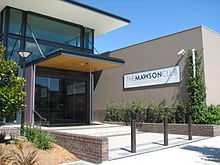
Mawson, Australian Capital Territory
| Mawson Canberra, Australian Capital Territory | |||||||||||||
|---|---|---|---|---|---|---|---|---|---|---|---|---|---|
 | |||||||||||||
| Population | 2,920 (2011 census)[1] | ||||||||||||
| • Density | 1,390/km2 (3,600/sq mi) | ||||||||||||
| Established | 1967 | ||||||||||||
| Postcode(s) | 2607 | ||||||||||||
| Area | 2.1 km2 (0.8 sq mi) | ||||||||||||
| District | Woden Valley | ||||||||||||
| Territory electorate(s) | Molonglo | ||||||||||||
| Federal Division(s) | Canberra | ||||||||||||
| |||||||||||||


Mawson (postcode 2607) is a suburb in the Canberra, Australia district of Woden Valley.
The suburb was gazetted in 1966 and named after the Antarctic explorer Sir Douglas Mawson. The theme for street names is Antarctic exploration.[2]
Mawson is next to the suburbs of Phillip, O'Malley, Isaacs, Farrer, Torrens and Pearce. It is bounded by Yamba Drive, Beasley Street and Athlon Drive. The neighbourhood of Swinger Hill on the other side of Ainsworth Street is often associated with Mawson but is in fact part of the suburb of Phillip.
Suburb amenities
Southlands Centre is a commercial and retail centre located in Mawson. It contains a shopping centre, Serbian Club, Leagues Club, Southlands Tennis Club, and The Mawson Club. Nearby are the Mawson district playing fields, Woden Golf Driving Range and Dyraaba Court Retirement Village. The Mandir Hindu Temple is located in the suburb.
Mawson has two schools, Mawson Primary School and Canberra Christian School, both located on Ainsworth Street. Mawson Primary School has about 150 students. It is notable for its Mandarin Immersion Program.
Geology
Deakin Volcanics green-grey and purple rhyodacite fill the suburb.
Mawson Schools
Mawson has two schools, Mawson Primary School and Canberra Christian School, both located on Ainsworth Street. Mawson Primary School has about 150 students. It is notable for its Mandarin Immersion Program.
References
- ↑ Australian Bureau of Statistics (31 October 2012). "Mawson (State Suburb)". 2011 Census QuickStats. Retrieved 5 February 2014.
- ↑ "Suburb Name search results". ACT Environment and Sustainable Development. Retrieved 5 February 2014.
Coordinates: 35°21′54″S 149°5′40″E / 35.36500°S 149.09444°E
