Mavrovo National Park
| Mavrovo National Park | |
|---|---|
|
IUCN category II (national park) | |
|
Mavrovo NP with Lake Mavrovo in summer | |
 | |
| Coordinates | 41°41′N 20°42′E / 41.683°N 20.700°ECoordinates: 41°41′N 20°42′E / 41.683°N 20.700°E |
| Area | 73,088 hectares (730.88 km2) |
| Established | 19 April 1949 |
| http://www.npmavrovo.org.mk/ | |

Mavrovo National Park (Macedonian: Национален парк Маврово) is the largest of the three national parks of the Republic of Macedonia. It was founded in 1949 and is located in the western part of the country between the Lake Mavrovo and the Albanian border.
The national park, the lake, and the Mavrovo region are named after the village of Mavrovo.
-

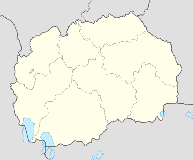
Mavrovo National Park marked on a map (left)
-
.JPG)
A welcome gate to Mavrovo National Park
-

Mount Bistra within the national park
-

View of the lake in winter
-

Submerged St Nicholas church in the Mavrovo lake
See also
- List of national parks in Macedonia
- Lukovo pole hydro power project
External links
| Wikimedia Commons has media related to National Park Mavrovo. |
| ||||||||||