Mauch Chunk Ridge
| Mauch Chunk Ridge or Mauch Chunk Mountain | |
|---|---|
| Elevation | 1,501 ft (458 m)displayed map |
| Location | |
| Location | Carbon County, Pennsylvania, U.S. |
| Range | Appalachian Mountains |
| Topo map | USGS 40075G8, 1947&'83 Tamaqua (PA) Quadrangle (?) |

Mauch Chunk Ridge (on older USGS Maps) or Mauch Chunk Mountain is a historically important barrier ridgeline paralleling Pisgah Ridge[1] in the ridge and valley formation of the Anthracite coal bearing Appalachian formations of Northeastern Pennsylvania. The northslopes of the long series of worn peaks feed the minor tributary Mauch Chunk Creek's mouth which opens out easterly into the Lehigh River, and where from ca. 1792 on, enabled the earliest mines of the southern Anthracite region at Summit Hill, Pennsylvania to be conveyed to the water transport available on the Lehigh River at what is now Packerton, Pennsylvania. A number of early pack mule routes traveled in part along the north faces of the mountain's long ridgeline (12.5 miles (20.1 km)) from Summit Hill and points west.
The ridge is a succession of peaks exceeding 1,501 feet (457.5 m) looming 300–540 feet above the rural bedroom communities now along in the Mauch Chunk Creek valley. The ridge forms the right bank drainage divide on the south and the streams source in the west. The west end of the ridge is named TBDL Geologically, the Mauch Chunk Ridge divide is classed as of minor degree, the watersheds north and south of the ridge enter the same body, the Lehigh, and do so only a few miles apart
Geology
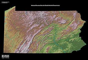
The Mountain is but one average folded mountain in a succession of near parallel ridgelines, where each are made by a succession of peaks of nearly the same height. This Ridge and Valley province is a geological feature that extends from New Jersey into Virginia forming a great barrier of successive valleys. Pisgah Mountain-just across the valley and creek, is located along the southern fringe of northeastern Pennsylvania's Poconos region but is also central to the Southern Anthracite Region of Pennsylvania— known as the site of the Richest Anthracite Seam, in the heart of the Southern Pennsylvania Anthracite Field and the geological province known as the Anthracite Upland section. The ridgeline parallels the escarpment of the Blue Mountain region.
Notes
- ↑ USGS MRC: 40075-D6 (1893), Hazelton Quadrangles, Southernmost ridge on USGS topological map of Schuylkill-Lehigh River Drainage Divides, 1893, rev 1893.
References
- Alan R. Geyer (1979) "Outstanding Geologic Features of Pennsylvania", Geological Survey of Pennsylvania
- Tom Thwaites (1997) "50 hikes in Eastern Pennsylvania", Third edition
- Art Michaels (2003) "Pennsylvania Overlooks a guide for Sightseers and Outdoor People", Penn State Press
Coordinates: 41°48′35″N 76°42′57″W / 41.80984°N 76.71591°W