Mathbaria Upazila
| Mathbaria মঠবাড়িয়া | |
|---|---|
| Upazila | |
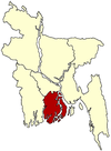
 Mathbaria Location in Bangladesh | |
| Coordinates: 22°17.2′N 89°58′E / 22.2867°N 89.967°ECoordinates: 22°17.2′N 89°58′E / 22.2867°N 89.967°E | |
| Country |
|
| Division | Barisal Division |
| District | Pirojpur District |
| Area | |
| • Total | 353.25 km2 (136.39 sq mi) |
| Population (1991) | |
| • Total | 253,915 |
| • Density | 719/km2 (1,860/sq mi) |
| Time zone | BST (UTC+6) |
| Website | Official Map of the Mathbaria Upazila |
Mathbaria (Bengali: মঠবাড়িয়া ) is an Upazila of Pirojpur District in the Division of Barisal, Bangladesh.
Geography
Mathbaria is located at 22°17′13″N 89°58′00″E / 22.2869°N 89.9667°E . It has 48,139 households and a total area of 353.25 km².
Demographics
According to the 2011 Bangladesh census, the population of Mathbaria Upazila was 262,841. Males constituted 49.0% of the population, and females 51.0%. Mathbaria has an average literacy rate of 61.7% (7+ years), compared to the national average is 51.8%.[1]
Administration
Mathbaria has 11 Unions/Wards, 69 Mauzas/Mahallas, and 94 villages.
See also
References
- ↑ "Population and Housing Census, 2011." Bangladesh Bureau of Statistics. Retrieved July 29, 2013
| |||||||||||||||||||||||||||||||||