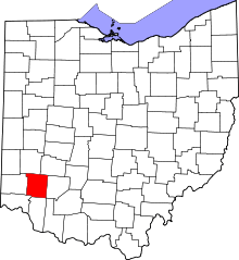
Massie Township, Warren County, Ohio
| Massie Township, Ohio | |
|---|---|
| Township | |
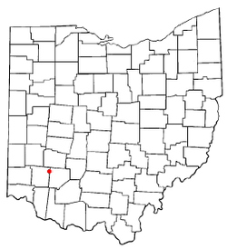 Location of Harveysburg, Ohio | |
| Coordinates: 39°29′34″N 84°0′43″W / 39.49278°N 84.01194°WCoordinates: 39°29′34″N 84°0′43″W / 39.49278°N 84.01194°W | |
| Country | United States |
| State | Ohio |
| County | Warren |
| Area | |
| • Total | 21.2 sq mi (55.0 km2) |
| • Land | 16.9 sq mi (43.8 km2) |
| • Water | 4.3 sq mi (11.2 km2) |
| Elevation[1] | 889 ft (271 m) |
| Population (2000) | |
| • Total | 1,061 |
| • Density | 62.7/sq mi (24.2/km2) |
| Time zone | Eastern (EST) (UTC-5) |
| • Summer (DST) | EDT (UTC-4) |
| ZIP code | 45032 |
| Area code(s) | 513 |
| FIPS code | 39-48216[2] |
| GNIS feature ID | 1087118[1] |
Massie Township, one of the eleven townships of Warren County, Ohio, United States, is located in the northeast part of the county and the least populous of Warren County's townships. In 2000, the population was 1,061 up from 885 in 1990; of this total, 498 lived in the unincorporated portions of the township.[3] The third smallest township in the county with 13,622 acres (55 km²), it was named for General Nathaniel Massie; it is the only Massie Township statewide.[4] It is the home of the Ohio Renaissance Festival and Caesar Creek State Park.
Geography

Located in the northeastern part of the county, it borders the following townships:
- Chester Township, Clinton County - northeast
- Washington Township - south
- Adams Township, Clinton County - southeast
- Wayne Township - northwest
The village of Harveysburg is the only municipality within the township.
History
It was created by the Warren County Commissioners on October 10, 1850 from parts of Wayne and Washington Townships. From 1806 to 1815 it was part of Eaton Township. The original boundary was "commencing at the point where the road from Wilmington to Lebanon crosses the Warren and Clinton County line, thence with said road to the line between Paul Vandervert and John Wilkinson; thence north, 80½ degrees west to the southwest corner of THomas J. Fryer's 50 acre (200,000 m²) lot, in the line of Peter Mullenburgh's west survey; thence on said line to the corner of James Currie's survey; thence north, 30 degrees east to a sugar tree on the bank of Caesars Creek, opposite to the mouth Flat Fork; thence north, 10 degrees east to the Little Miami River, thence up said river to the Greene County line." On June 11, 1851, the boundary was changed to "commencing at the township line between Massie and Wayne, where it crosses Clement Reed's survey, thence running in a northeastern direction on the back line of the river survey, to the corner of Richard Anderson's survey, and thence on the southwest line of said survey to Caesars Creek, thence up said creek to the Clinton County line, and the part taken from Massie township to be attached to Wayne, where it formerly belonged."
A large part of the township was submerged in the 1960s and 1970s with the damming of Caesars Creek by the U.S. Army Corps of Engineers.
Government
The township is governed by a three-member board of trustees, who are elected in November of odd-numbered years to a four-year term beginning on the following January 1. Two are elected in the year after the presidential election and one is elected in the year before it. There is also an elected township fiscal officer,[5] who serves a four-year term beginning on April 1 of the year after the election, which is held in November of the year before the presidential election. Vacancies in the fiscal officership or on the board of trustees are filled by the remaining trustees.
Public services
The township is mostly in the Clinton-Massie Local School District but a part is in the Wayne Local School District.
Massie Township is in the Waynesville and Clarksville telephone exchanges.
Massie Township Fire Department, a volunteer fire department, serves Massie Township. It is composed of sixteen firefighters based at a single station.[6]
References
- Elva R. Adams. Warren County Revised. [Lebanon, Ohio]: Warren County Historical Society, 1989.
- The Centennial Atlas of Warren County, Ohio. Lebanon, Ohio: The Centennial Atlas Association, 1903.
- Josiah Morrow. The History of Warren County, Ohio. Chicago: W.H. Beers, 1883. (Reprinted several times)
- Ohio Atlas & Gazetteer. 6th ed. Yarmouth, Maine: DeLorme, 2001. ISBN 0-89933-281-1
- William E. Smith. History of Southwestern Ohio: The Miami Valleys. New York: Lewis Historical Publishing, 1964. 3 vols.
- Warren County Engineer's Office. Official Highway Map 2003. Lebanon, Ohio: The Office, 2003.
- ↑ 1.0 1.1 "US Board on Geographic Names". United States Geological Survey. 2007-10-25. Retrieved 2008-01-31.
- ↑ "American FactFinder". United States Census Bureau. Retrieved 2008-01-31.
- ↑ Warren County, Ohio — Population by Places Estimates Ohio State University, 2007. Accessed 15 May 2007.
- ↑ "Detailed map of Ohio" (PDF). United States Census Bureau. 2000. Retrieved 2007-02-16.
- ↑ §503.24, §505.01, and §507.01 of the Ohio Revised Code. Accessed 4/30/2009.
- ↑ Massie Township Fire Department - Harveysburg, Ohio, firedepartments.net. Accessed 2007-09-11.
External links
| |||||||||||||||||||||||||||||||||