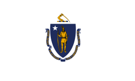
Massachusetts
| Commonwealth of Massachusetts | |||||
|---|---|---|---|---|---|
| |||||
| Nickname(s): The Bay State,[1] The Old Colony State,[2] The Codfish State[3] | |||||
|
Motto(s): Ense petit placidam sub libertate quietem (Latin) By the sword we seek peace, but peace only under liberty | |||||
| State song(s): "All Hail to Massachusetts" | |||||
 | |||||
| Official language | English[4] | ||||
| Demonym | Bay Stater (official)[5] Massachusite (traditional)[6][7] Massachusettsian (archaic)[8] | ||||
| Capital | Boston | ||||
| Largest city | Boston | ||||
| Largest metro | Greater Boston | ||||
| Area | |||||
| - Total |
10,555[9] sq mi (27,336 km2) | ||||
| - Width | 183 miles (295 km) | ||||
| - Length | 113 miles (182 km) | ||||
| - % water | 25.7 | ||||
| - Latitude | 41° 14′ N to 42° 53′ N | ||||
| - Longitude | 69° 56′ W to 73° 30′ W | ||||
| Population | |||||
| - Total | 6,745,408 (2014 est) [10] | ||||
| - Density |
840/sq mi (324/km2) Ranked 3rd | ||||
| - Median household income | $65,401 (2008) (7th) | ||||
| Elevation | |||||
| - Highest point |
Mount Greylock[11][12][13] 3,489 ft (1063.4 m) | ||||
| - Mean | 500 ft (150 m) | ||||
| - Lowest point |
Atlantic Ocean[12] sea level | ||||
| Before statehood | Province of Massachusetts Bay | ||||
| Admission to Union | February 6, 1788 (6th) | ||||
| Governor | Charlie Baker (R) | ||||
| Lieutenant Governor | Karyn Polito (R) | ||||
| Legislature | |||||
| - Upper house | Senate | ||||
| - Lower house | House of Representatives | ||||
| U.S. Senators |
Elizabeth Warren (D) Ed Markey (D) | ||||
| U.S. House delegation | 9 Democrats (list) | ||||
| Time zone | Eastern: UTC -5/-4 | ||||
| Abbreviations | MA, Mass. US-MA | ||||
| Website |
www | ||||

| Massachusetts state symbols | |
|---|---|
| Animal and Plant insignia | |
| Bird(s) | Black-capped chickadee,[14] wild turkey[15][16] |
| Fish | Cod[17][16] |
| Flower(s) | Mayflower[18][16] |
| Insect | Ladybug[19][16] |
| Mammal(s) | Right whale,[20] Morgan horse,[21] Tabby cat,[22] Boston Terrier[23] |
| Reptile | Garter snake[16][24] |
| Tree | American elm[16][25] |
| Inanimate insignia | |
| Beverage | Cranberry juice[16][26] |
| Colors | Blue, green, cranberry[16][27] |
| Dance | Square dance[16][28] |
| Food | Cranberry,[29] corn muffin,[16][30] navy bean,[31] Boston cream pie,[32] chocolate chip cookie,[33] Boston cream donut[34] |
| Fossil | Dinosaur Tracks[35] |
| Gemstone | Rhodonite[16][36] |
| Mineral | Babingtonite[16][37] |
| Poem | "Blue Hills of Massachusetts"[16][38] |
| Rock | Rolling Rock[16][39] |
| Shell | New England Neptune, Neptunea lyrata decemcostata[16][40] |
| Ship(s) | Schooner Ernestina [16] |
| Slogan(s) |
Make It Yours, The Spirit of America [41] |
| Soil | Paxton[16] |
| Song(s) | All Hail to Massachusetts[16] |
| Sport | Basketball[42] |
| Route marker(s) | |
 | |
| State Quarter | |
|
Released in 2000[43] | |
| Lists of United States state symbols | |

Massachusetts ![]() i/ˌmæsəˈtʃuːsɨts/, officially the Commonwealth of Massachusetts, is a state in the New England region of the northeastern United States. It is bordered by Rhode Island and Connecticut to the south, New York to the west, Vermont and New Hampshire to the north and the Atlantic Ocean to the east. Massachusetts is the 6th smallest by land area,[44] but the 14th most populous[44] and the 3rd most densely populated[44] of the 50 United States. It is the most populous of the six New England states[44] and has the nation's sixth highest GDP per capita.[45] The state features two separate metropolitan areas: the Greater Boston area in the east and the Springfield metropolitan area in the west. Approximately two-thirds of Massachusetts' population currently lives in Greater Boston.[46]
i/ˌmæsəˈtʃuːsɨts/, officially the Commonwealth of Massachusetts, is a state in the New England region of the northeastern United States. It is bordered by Rhode Island and Connecticut to the south, New York to the west, Vermont and New Hampshire to the north and the Atlantic Ocean to the east. Massachusetts is the 6th smallest by land area,[44] but the 14th most populous[44] and the 3rd most densely populated[44] of the 50 United States. It is the most populous of the six New England states[44] and has the nation's sixth highest GDP per capita.[45] The state features two separate metropolitan areas: the Greater Boston area in the east and the Springfield metropolitan area in the west. Approximately two-thirds of Massachusetts' population currently lives in Greater Boston.[46]
Massachusetts has played a significant historical, cultural, and commercial role in American history. Plymouth was the site of the first colony in New England, founded in 1620 by the Pilgrims, passengers of the Mayflower.[47] Harvard University, founded in 1636, is the oldest institution of higher learning in the United States.[48] In 1692, the town of Salem and surrounding areas experienced one of America's most infamous cases of mass hysteria, the Salem witch trials.[49] In the 18th century, the Protestant First Great Awakening, which swept the Atlantic world, originated from the pulpit of Northampton, Massachusetts preacher Jonathan Edwards.[50] In the late 18th century, Boston became known as the "Cradle of Liberty"[51] for the agitation there that led to the American Revolution and the independence of the United States from Great Britain. In 1777, General Henry Knox founded the Springfield Armory, which during the Industrial Revolution catalyzed numerous important technological advances, including interchangeable parts.[52] In 1786, Shays' Rebellion, a populist revolt led by disaffected Revolutionary War veterans, influenced the United States Constitutional Convention.[53]
Before the American Civil War, Massachusetts was a center for the temperance,[54] transcendentalist,[55] and abolitionist movements.[56] In the late 19th century, the Olympic sports of basketball[57] and volleyball[58] were invented in the Western Massachusetts cities of Springfield[57] and Holyoke,[58] respectively. In 2004, Massachusetts became the first U.S. state to legally recognize same-sex marriage as a result of the decision of the state's Supreme Judicial Court.[59] Massachusetts has contributed many prominent politicians to national service, including members of the Adams family and the Kennedy family.
Originally dependent on fishing, agriculture, and trade,[60] Massachusetts was transformed into a manufacturing center during the Industrial Revolution.[61] During the 20th century, Massachusetts' economy shifted from manufacturing to services.[62] In the 21st century, Massachusetts is an economic leader in life science, the finance industry, information technology, manufacturing, renewable energy, the defense industry, and maritime trade.[63]
Etymology

The Massachusetts Bay Colony was named after the indigenous population, the Massachusett, whose name can be segmented as mass-adchu-s-et, where mass- is "large", -adchu- is "hill", -s- is a diminutive suffix meaning "small", and -et is a locative suffix, identifying a place. It has been translated as "near the great hill",[64] "by the blue hills", "at the little big hill", or "at the range of hills", referring to the Blue Hills, or in particular the Great Blue Hill which is located on the boundary of Milton and Canton.[65][66] Alternatively, Massachusett has been represented as Moswetuset, from the name of the Moswetuset Hummock (meaning "hill shaped like an arrowhead") in Quincy where Plymouth Colony commander Miles Standish and Squanto, a Native American, met Chief Chickatawbut in 1621.[67][68]
The official name of the state is the "Commonwealth of Massachusetts".[69] Colloquially, it is often referred to simply as "the Commonwealth". While this designation is part of the state's official name, it has no practical implications.[70] Massachusetts has the same position and powers within the United States as other states.[71]
Geography

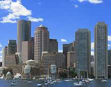
Massachusetts is the 7th smallest state in the United States. It is located in the New England region of the northeastern United States, and has an area of 10,555 square miles (27,340 km2). Several large bays distinctly shape its coast. Boston is the largest city, at the inmost point of Massachusetts Bay, and the mouth of the Charles River.
Despite its small size, Massachusetts features numerous distinctive regions. The large coastal plain of the Atlantic Ocean in the eastern section of the state contains Greater Boston along with most of the state's population,[46] as well as the distinctive Cape Cod peninsula. To the west lies the rural-hilly region of Central Massachusetts and beyond that the Connecticut River Valley. Along the western border of Western Massachusetts lies the highest elevated part of the state, the Berkshire Mountains range.
The National Park Service administers a number of natural and historical sites in Massachusetts.[72] Along with twelve national historic sites, areas, and corridors, the National Park Service also manages the Cape Cod National Seashore and the Boston Harbor Islands National Recreation Area.[72] In addition, the Massachusetts Department of Conservation and Recreation maintains a number of parks, trails, and beaches throughout Massachusetts.[73]
Ecology
The primary biome of inland Massachusetts is temperate deciduous forest.[74] Although much of Massachusetts had been cleared for agriculture, leaving only traces of old growth forest in isolated pockets, secondary growth has regenerated in many rural areas as farms have been abandoned[75] Currently, forests cover around 62% of Massachusetts.[76] The areas most affected by human development include the Greater Boston area in the east and the Springfield metropolitan area in the west, although the latter includes agricultural areas throughout the Connecticut River Valley.[77] There are currently 219 endangered species in Massachusetts.[78]
A number of species are doing well in the increasingly urbanized Massachusetts. Peregrine falcons utilize office towers in larger cities as nesting areas,[79] and the population of coyotes, whose diet may include garbage and roadkill, has been increasing in recent decades.[80] White-tailed deer, raccoons, wild turkeys and eastern gray squirrels are also found throughout Massachusetts.[81] In more rural areas in the western part of Massachusetts, larger mammals such as moose and black bears have returned, largely due to reforestation following the regional decline in agriculture.[82]
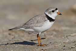
Massachusetts is located along the Atlantic Flyway, a major route for migratory waterfowl along the Atlantic coast.[83] Lakes in central Massachusetts provide habitat for many species of fish and waterfowl, but some species such as the common loon are becoming rare.[84] A significant population of long-tailed ducks winter off Nantucket.[85] Small offshore islands and beaches are home to roseate terns and are important breeding areas for the locally threatened piping plover.[86][87] Protected areas such as the Monomoy National Wildlife Refuge provide critical breeding habitat for shorebirds and a variety of marine wildlife including a large population of gray seals.[88]
Freshwater fish species in Massachusetts include bass, carp, catfish, and trout,[89] while saltwater species such as Atlantic cod, haddock and American lobster populate offshore waters.[90] Other marine species include Harbor seals, the endangered North Atlantic right whales, as well as humpback whales, fin whales, minke whales and Atlantic white-sided dolphins.[81]
History
Pre-Colonization
Massachusetts was originally inhabited by tribes of the Algonquian language family such as the Wampanoag, Narragansett, Nipmuc, Pocomtuc, Mahican, and Massachusett.[91][92] While cultivation of crops like squash and corn supplemented their diets, these tribes were generally dependent on hunting, gathering and fishing for most of their food supply.[91] Villages consisted of lodges called wigwams as well as long houses,[92] and tribes were led by male or female elders known as sachems.[93]
Colonial period
In the early 1600s after contact had been made with Europeans, large numbers of the indigenous people in the northeast of what is now the United States were killed by virgin soil epidemics such as smallpox, measles, influenza, and perhaps leptospirosis.[94][95] Between 1617 and 1619, smallpox killed approximately 90% of the Massachusetts Bay Native Americans.[96]
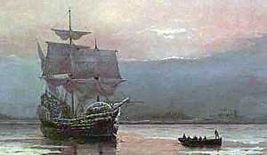
The first English settlers in Massachusetts, the Pilgrims, who established their settlement at Plymouth in 1620, and developed friendly relations with the native Wampanoag people.[97] This was the second successful permanent English colony in North America, after the Jamestown Colony. The Pilgrims were soon followed by other Puritans, who established the Massachusetts Bay Colony at present-day Boston in 1630.[98]
The Puritans, who believed the Church of England needed to be purified and experienced harassment from English authority because of their beliefs,[99] came to Massachusetts with the goal of establishing an ideal religious society.[100] Unlike the Plymouth colony, the bay colony was founded under a royal charter in 1629.[101] Both religious dissent and expansionism resulted in several new colonies being founded shortly after Plymouth and Massachusetts Bay elsewhere in New England. The Massachusetts Bay banished dissenters such as Anne Hutchinson and Roger Williams who were banished due to religious and political disagreements. In 1636, Williams founded the colony of Rhode Island and Hutchinson joined him there several years later.[102]
In 1641, Massachusetts expanded inland significantly, acquiring the Connecticut River Valley settlement of Springfield, which had recently disputed with, and defected from its original administrators, the Connecticut Colony..[103] This established Massachusetts' southern border in the west,[104] though surveying problems resulted in disputed territory until 1803-04.
In 1691, the colonies of Massachusetts Bay and Plymouth were united (along with present-day Maine, which had previously been divided between Massachusetts and New York) into the Province of Massachusetts Bay.[105] Shortly after the arrival of the new province's first governor, Sir William Phips, the Salem witch trials took place, where a number of men and women were hanged for alleged witchcraft.[106]
The most destructive earthquake yet known in New England occurred in 1755, causing considerable damage across Massachusetts.[107][108]
The Revolutionary War

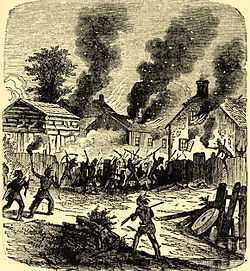
Massachusetts was a center of the movement for independence from Great Britain; colonists in Massachusetts had long uneasy relations with the British monarchy, including open rebellion under the Dominion of New England in the 1680s.[105] Protests against British attempts to tax the colonies after the French and Indian War ended in 1763 led to the Boston Massacre in 1770, and the 1773 Boston Tea Party escalated tensions.[109] In 1774, the Intolerable Acts targeted Massachusetts with punishments for the Boston Tea Party and further decreased local autonomy, increasing local dissent.[110] Anti-Parliamentary activity by men such as Samuel Adams and John Hancock, followed by reprisals by the British government, were a primary reason for the unity of the Thirteen Colonies and the outbreak of the American Revolution in 1775.[111]
The Battles of Lexington and Concord initiated the American Revolutionary War and were fought in the homonymous Massachusetts towns.[112] Future President George Washington took over what would become the Continental Army after the battle. His first victory was the Siege of Boston in the winter of 1775–76, after which the British were forced to evacuate the city.[113] The event is still celebrated in Suffolk County as Evacuation Day.[114] On the coast, Salem, Massachusetts, became a center for privateering. Although the documentation is incomplete, about 1,700 Letters of Marque, issued on a per-voyage basis, were granted during the American Revolution. Nearly 800 vessels were commissioned as privateers and are credited with capturing or destroying about 600 British ships.[115]
Federal period
Bostonian John Adams, known as the "Atlas of Independence",[116] was an important figure in both the struggle for independence as well as the formation of the new United States.[117] Adams was highly involved in the push for separation from Britain and the writing of the Massachusetts Constitution in 1780 which, in the Elizabeth Freeman and Quock Walker cases, effectively made Massachusetts the first state to have a constitution that declared universal rights and, as interpreted by Supreme Judicial Court Chief Justice William Cushing, abolished slavery.[117][118][lower-alpha 1] Later, Adams was active in early American foreign affairs and succeeded Washington as the second United States President.[117] His son John Quincy Adams, also from Massachusetts,[121] would go on to become the sixth United States President.[117]
From 1786 to 1787, an armed uprising led by Revolutionary War veteran Daniel Shays wrought havoc throughout Massachusetts, and ultimately attempted to seize the U.S. Federal Armory at Springfield.[53] The rebellion was one of the major factors in the decision to draft a stronger national constitution to replace the Articles of Confederation.[53] On February 6, 1788, Massachusetts became the sixth state to ratify the United States Constitution.[122]
19th century
In 1820, Maine separated from Massachusetts and entered the Union as the 23rd state as a result of the ratification of the Missouri Compromise.[123]
%2C_Lowell%2C_Massachusetts.JPG)
During the 19th century, Massachusetts became a national leader in the American Industrial Revolution, with factories around cities such as Lowell and Boston producing textiles and shoes, and factories around Springfield producing tools, paper, and textiles.[124][125] The economy transformed from one based primarily on agriculture to an industrial one, initially making use of water-power and later the steam engine to power factories. Canals and railroads were used for transporting raw materials and finished goods.[126] At first, the new industries drew labor from Yankees on nearby subsistence farms, and later relied upon immigrant labor from Europe and Canada.[127][128]
In the years leading up to the Civil War, Massachusetts was a center of progressivism and abolitionist activity. Horace Mann made the state's school system a national model.[129] Henry David Thoreau and Ralph Waldo Emerson made major contributions to American philosophy.[130] Members of the transcendentalist movement emphasized the importance of the natural world and emotion to humanity.[130]
Although significant opposition to abolitionism existed early on in Massachusetts, resulting in anti-abolitionist riots between 1835 and 1837,[131] opposition to slavery gradually increased throughout the next few decades.[132][133] Abolitionists John Brown and Sojourner Truth lived in Springfield and Northampton, respectively, while Frederick Douglass lived in Boston. The works of such abolitionists contributed to Massachusetts' actions during the Civil War. Massachusetts was the first state to recruit, train, and arm a Black regiment with White officers, the 54th Massachusetts Volunteer Infantry.[134]
20th century

The industrial economy began a decline in the early 20th century with the exodus of many manufacturing companies. By the 1920s competition from the South and Midwest, followed by the Great Depression, led to the collapse of the three main industries in Massachusetts: textiles, shoemaking, and precision mechanics.[135] This decline would continue into the later half of the century; between 1950 and 1979, the number of Massachusetts residents involved in textile manufacturing declined from 264,000 to 63,000.[136] The 1969 closure of the Springfield Armory, in particular, spurred an exodus of high-paying jobs from Western Massachusetts, which suffered greatly as it de-industrialized during the last 40 years of the 20th century.[137]
Massachusetts manufactured 3.4 percent of total United States military armaments produced during World War II, ranking tenth among the 48 states.[138] In Eastern Massachusetts, following World War II, the economy was transformed from one based on heavy industry into a service based economy.[139] Government contracts, private investment, and research facilities led to a new and improved industrial climate, with reduced unemployment and increased per capita income. Suburbanization flourished, and by the 1970s, the Route 128 corridor was dotted with high-technology companies who recruited graduates of the area's many elite institutions of higher education.[140]
The Kennedy family was prominent in Massachusetts politics in the 20th century. Children of businessman and ambassador Joseph P. Kennedy Sr. included John F. Kennedy, who was a senator and US president before his assassination in 1963, Robert F. Kennedy, who was a senator, US attorney general and presidential candidate before his assassination in 1968, Ted Kennedy, a senator from 1962 until his death in 2009,[141] and Eunice Kennedy Shriver, a co-founder of the Special Olympics.[142] In 1966 Massachusetts became the first state to popularly elect an African American to the US senate with Edward Brooke.[143] George H. W. Bush, 41st President of the United States (1989–1993) was born in Milton, Massachusetts in 1924.[144]
Recent history
In 1987, the state received federal funding for the Central Artery/Tunnel Project. Commonly known as "the Big Dig", it was, at the time, the biggest federal highway project ever approved.[145] The project included making the Central Artery a tunnel under downtown Boston, in addition to the re-routing of several other major highways.[146] Often controversial, with numerous claims of graft and mismanagement, and with its initial price tag of $2.5 billion increasing to a final tally of over $15 billion, the Big Dig has nonetheless changed the face of Downtown Boston.[145] It has connected areas that were once divided by elevated highway, (much of the raised old Central Artery was replaced with the Rose Fitzgerald Kennedy Greenway) and improved traffic conditions along a number of routes.[145][146]
On May 17, 2004, Massachusetts became the first state in the U.S. to legalize same-sex marriage after a Massachusetts Supreme Judicial Court ruling in November 2003 determined that the exclusion of same-sex couples from the right to a civil marriage was unconstitutional.[59]
Demographics

| Historical population | |||
|---|---|---|---|
| Census | Pop. | %± | |
| 1790 | 378,787 | — | |
| 1800 | 422,845 | 11.6% | |
| 1810 | 472,040 | 11.6% | |
| 1820 | 523,287 | 10.9% | |
| 1830 | 610,408 | 16.6% | |
| 1840 | 737,699 | 20.9% | |
| 1850 | 994,514 | 34.8% | |
| 1860 | 1,231,066 | 23.8% | |
| 1870 | 1,457,351 | 18.4% | |
| 1880 | 1,783,085 | 22.4% | |
| 1890 | 2,238,947 | 25.6% | |
| 1900 | 2,805,346 | 25.3% | |
| 1910 | 3,366,416 | 20.0% | |
| 1920 | 3,852,356 | 14.4% | |
| 1930 | 4,249,614 | 10.3% | |
| 1940 | 4,316,721 | 1.6% | |
| 1950 | 4,690,514 | 8.7% | |
| 1960 | 5,148,578 | 9.8% | |
| 1970 | 5,689,170 | 10.5% | |
| 1980 | 5,737,037 | 0.8% | |
| 1990 | 6,016,425 | 4.9% | |
| 2000 | 6,349,097 | 5.5% | |
| 2010 | 6,547,629 | 3.1% | |
| Est. 2014 | 6,745,408 | 3.0% | |
| [10][147][148][149] | |||
The United States Census Bureau estimated that the population of Massachusetts was 6,745,408 on July 1, 2014, a 3.02% increase since the 2010 United States Census.[10]
As of 2014, Massachusetts was estimated to be the third most densely populated U.S. state, with 839.4 people per square mile,[10] behind New Jersey and Rhode Island. In 2014, Massachusetts had 1011811 foreign-born residents or 15% of the population.[10]
Most Bay Staters live within the Boston Metropolitan Area, also known as Greater Boston which includes Worcester and Greater Lowell. The Springfield Metropolitan Area is also a major center of population. Geographically, the center of population of Massachusetts is located in the town of Natick.[150][151]
Like the rest of the northeastern United States, the population of Massachusetts has continued to grow in the past few decades. Massachusetts is the fastest growing state in New England and the 25th fastest growing state in the United States.[152] Population growth was largely due to a relatively high quality of life and a large higher education system in the state.[152]
Foreign immigration is also a factor in the state's population growth, causing the state's population to continue to grow as of the 2010 Census (particularly in Massachusetts gateway cities where costs of living are lower).[153][154] 40% of foreign immigrants were from Central or South America, according to a 2005 Census Bureau study. Many residents who have settled in Greater Springfield claim Puerto Rican descent.[153] Many areas of Massachusetts showed relatively stable population trends between 2000 and 2010.[154] Exurban Boston and coastal areas grew the most rapidly, while Berkshire County in far Western Massachusetts and Barnstable County on Cape Cod were the only counties to lose population as of the 2010 Census.[154]
In 2005, 79% of the state population spoke English, 7% spoke Spanish, 3.5% spoke Portuguese, and 1% spoke either French or Chinese.[155]
According to the U.S. Census projections, the population was 6,745,408 in 2014, of which 3,264,777 (48.4%) were male and 3,480,631 (51.6%) were female. In terms of age, 79.2% were over 18 years old and 14.8% were over 65 years old.[10]
Race and ancestry
As of 2014, in terms of race and ethnicity, Massachusetts was 83.2% White (75.1% Non-Hispanic White), 8.1% Black or African American, 0.5% American Indian and Alaska Native, 6.0% Asian American, <0.1% Native Hawaiian and Other Pacific Islander, 2.1% from Some Other Race, and 2.1% from Two or More Races. Hispanics and Latinos of any race made up 10.5% of the population. [10]
The state's most populous ethnic group, non-Hispanic white, has declined from 95.4% in 1970 to 75.1% in 2014.[156][10] As of 2011, non-Hispanic whites were involved in 63.6% of all the births.[157]
As late as 1795, the population of Massachusetts was nearly 95% of English ancestry.[158] During the early and mid 19th century, immigrant groups began arriving to Massachusetts in large numbers; first from Ireland in the 1840s;[159] today the Irish and part-Irish are the largest ancestry group in the state at nearly 25% of the total population. Others arrived later from Quebec as well as places in Europe such as Italy and Poland.[160] In the early 20th century, a number of African Americans migrated to Massachusetts, although in somewhat fewer numbers than many other Northern states.[161] Later in the 20th century, immigration from Latin America, Africa, and East Asia increased considerably. Massachusetts has the fourth largest population of Haitians in the United States.[162]
Massachusetts has a relatively large population of Irish descent (22.5% of the population) and also significant populations of Italians (13.5%), and English (11.4%), and French (8%).[163] Lowell is home to the second-largest Cambodian (Khmer) community in the nation.[164] The Wampanoag tribe maintains reservations at Aquinnah on Martha's Vineyard, at Grafton, and at Mashpee on Cape Cod,[165][166] while the Nipmuck maintain two state-recognized reservations in the central part of the state. Massachusetts had avoided many of the more violent forms of racial strife seen elsewhere in the US, examples such as the successful electoral showings of the nativist (mainly anti-Catholic) Know Nothings in the 1850s,[167] the controversial Sacco and Vanzetti executions in the 1920s,[168] and Boston's opposition to desegregation busing in the 1970s[169] show that the ethnic history of Massachusetts was not completely harmonious.
Languages
The most common varieties of American English spoken in Massachusetts, other than General American English, are the cot-caught distinct, rhotic, western Massachusetts dialect and the cot-caught merged, non-rhotic, eastern Massachusetts dialect (popularly known as a "Boston accent").[170]
| Language | Percentage of population (as of 2010)[171] |
|---|---|
| Spanish | 7.50% |
| Portuguese | 2.97% |
| Chinese (including Cantonese and Mandarin) | 1.59% |
| French (including New England French) | 1.11% |
| French Creole | 0.89% |
| Italian | 0.72% |
| Russian | 0.62% |
| Vietnamese | 0.58% |
| Greek | 0.41% |
| Arabic and Cambodian (including Mon-Khmer) (tied) | 0.37% |
As of 2010, 78.93% (4,823,127) of Massachusetts residents age 5 and older spoke English at home as a primary language, while 7.50% (458,256) spoke Spanish, 2.97% (181,437) Portuguese, 1.59% (96,690) Chinese (which includes Cantonese and Mandarin), 1.11% (67,788) French, 0.89% (54,456) French Creole, 0.72% (43,798) Italian, 0.62% (37,865) Russian, and Vietnamese was spoken as a main language by 0.58% (35,283) of the population over the age of five. In total, 21.07% (1,287,419) of Massachusetts's population age 5 and older spoke a mother language other than English.[10][171]
Religion
Massachusetts was founded and settled by the Puritans in 1620[99][97] and most people in Massachusetts today remain Christians.[10] The descendants of the Puritans belong to many different churches; in the direct line of inheritance are the Congregational/United Church of Christ and the congregations of Unitarian Universalist Association. The headquarters of the Unitarian Universalist Association, long located on Beacon Hill, is now located in South Boston.[172][173]
Today, Protestants make up about one-quarter of the state's population. Roman Catholics now predominate because of massive immigration from primarily Catholic countries and regions - chiefly Ireland, Italy, Portugal, Quebec, and Latin America. A significant Jewish population immigrated to the Boston and Springfield areas between 1880 and 1920. Mary Baker Eddy made the Boston Mother Church of Christian Science the world headquarters. Buddhists, Pagans, Hindus, Seventh-day Adventists, Muslims, and Mormons also can be found. Kripalu Center in Stockbridge, the Shaolin Meditation Temple in Springfield, and the Insight Meditation Center in Barre are examples of non-Abrahamic religious centers in Massachusetts. According to 2010 data from The Association of Religion Data Archives (ARDA) the largest single denominations are the Roman Catholic Church with 2,940,199 adherents; the United Church of Christ with 86,639 adherents; and the Episcopal Church with 81,999 adherents.[174]
The religious affiliations of the people of Massachusetts, according to a 2001 survey, are shown below:[175]

- Christian – 69%
- Catholic – 44%
- Protestant denominations – 25%
- Non-specific Protestant – 4%
- Baptist – 4%
- Episcopal – 3%
- Congregational/United Church of Christ – 3%
- Other denominations (2% or less each) – 11%
- Jewish – 3%
- Muslim – 1%
- Other – 7%
- No religion – 15%
- Refused to answer – 7%
Economy
The United States Bureau of Economic Analysis estimates that the Massachusetts gross state product in 2013 was US$446 billion.[177] The per capita personal income in 2012 was $53,221, making it the third highest state in the nation.[178] Thirteen Fortune 500 companies are located in Massachusetts, the largest of which are the Liberty Mutual Insurance Group of Boston and MassMutual Financial Services of Springfield.[179] CNBC's list of "Top States for Business for 2010" has recognized Massachusetts as the fifth best state in the nation.[180] According to a 2013 study by Phoenix Marketing International, Massachusetts had the sixth-largest number of millionaires per capita in the United States, with a ratio of 6.73 percent.[181]
Sectors vital to the Massachusetts economy include higher education, biotechnology, finance, health care, and tourism. Route 128 was a major center for the development of minicomputers and electronics[140] and high technology remains an important sector. In recent years tourism has played an ever-important role in the state's economy, with Boston and Cape Cod being the leading destinations. Other popular tourist destinations include Salem, Plymouth, and the Berkshires. Massachusett's is the 6th most popular tourist destination for foreign travelers.[182] As of April 2015, the state's unemployment rate was 4.8%,[183] below the national level of 5.5%.[184]

As of 2012, there were 7,755 farms in Massachusetts encompassing a total of 523,517 acres (2,120 km2), averaging 67.5 acres (0.273 km2) apiece.[185] Particular agricultural products of note include green house products making up more than one third of the states agricultural output, cranberries, sweet corn and apples are also large sectors of production.[186]Massachusetts is the second-largest cranberry-producing state in the union after Wisconsin.[187]
Taxation
The overall state and local tax burden in Massachusetts ranks 4th highest in the United States.[188] Massachusetts has a flat-rate personal income tax of 5.2%,[189] after a 2002 voter referendum to eventually lower the rate to 5.0%.[190] There is an exemption for income below a threshold that varies from year to year. The corporate income tax rate is 8.8%,[188] and the short-term capital gains tax rate is 12%.[191]
The state imposes a 6.25% sales tax[188] on certain system design/computer software services[192] and retail sales of tangible personal property—except for groceries, clothing (up to $175.00), and periodicals.[193] The sales tax is charged on clothing that costs more than $175.00, for the amount exceeding $175.00.[193] All real and tangible personal property located within the Commonwealth of Massachusetts is taxable unless specifically exempted by statute. Property taxes in the state were the eighth highest in the nation.[188] There is no inheritance tax and limited Massachusetts estate tax related to federal estate tax collection.[191]
Energy
Massachusetts' electricity generation market was made competitive in 1998, enabling retail customers to change suppliers without changing utility companies.[194] In 2012, Massachusetts consumed 1374.4 trillion BTU,[195] making it the 5th lowest state in terms of consumption of energy per capita and 63% of that energy came from Natural Gas.[195] In 2011, Massachusetts was ranked as the most energy efficient state in America,[196] but it has the third highest electricity prices of any state.[195]
Transportation

Massachusetts has 10 regional metropolitan planning organizations and three non-metropolitan planning organizations covering the remainder of the state;[197] statewide planning is handled by the Massachusetts Department of Transportation.
Rail service
Amtrak operates inter-city rail, including the high-speed Acela service to cities such as Providence, New Haven, New York City, and Washington, DC from South Station. From North Station the Amtrak Downeaster serves Portland ME, and Freeport, ME.[198]
Regional services
The Massachusetts Bay Transportation Authority (MBTA), also known as "The T", operates public transportation in the form of subway,[199] bus,[200] and ferry[201] systems in the Metro Boston area. It also operates longer distance commuter rail services throughout the larger Greater Boston area, including service to Worcester and Providence, Rhode Island.[202] As of the summer of 2013 the Cape Cod Regional Transit Authority in collaboration with the Massachusetts Bay Transportation Authority and the Massachusetts Department of Transportation (MassDOT) is operating the CapeFLYER providing passenger rail service between Boston and Cape Cod.[203][204]
Fifteen other regional transit authorities provide public transportation in the form of bus services in their local communities.[205] Two heritage railways are in operation: the Cape Cod Central Railroad and the Berkshire Scenic Railway.[206][207]
As of 2006, a number of freight railroads were operating in Massachusetts, with CSX being the largest carrier. Massachusetts has a total of 1,079 miles (1,736 km) of freight trackage in operation.[208] The Woods Hole, Martha's Vineyard and Nantucket Steamship Authority regulates freight and passenger ferry service to the islands and operates some of those lines.[209]
Air service
The major airport in the state is Logan International Airport. The airport served over 28 million passengers in 2007 and is used by around 50 airlines.[210] Logan International Airport has service to numerous cities throughout the United States, as well as international service to Canada, Mexico, the Caribbean, Europe, and Asia. Logan, Hanscom Field in Bedford, and Worcester Regional Airport are operated by Massport, an independent state transportation agency.[210] Massachusetts has approximately 42 public-use airfields, and over 200 private landing spots.[211] Some airports receive funding from the Aeronautics Division of the Massachusetts Department of Transportation and the Federal Aviation Administration; the FAA is also the primary regulator.
Road
There are a total of 31,300 miles (50,400 km) of interstates and other highways in Massachusetts.[212] Interstate 90 (I-90, also known as the Massachusetts Turnpike), is the longest interstate in Massachusetts. The route travels 136 mi (219 km) generally west to east from the New York state line near the town of West Stockbridge and passes just north of Springfield, just south of Worcester and through Framingham before terminating near Logan International Airport in Boston. Other major interstates include I-91, which travels generally north and south along the Connecticut River, I-93, which travels north and south through central Boston, then passes Methuen before entering New Hampshire. I-95, which follows most of the US Atlantic coastline, connects Providence, Rhode Island with Greater Boston, forming a loop around the more urbanized areas (for some distance concurrent with Route 128) before continuing north along the coast.
I-495 forms a wide loop around the outer edge of Greater Boston. Other major interstates in Massachusetts include I-291, I-391, I-84, I-195, I-395, I-290, and I-190. Major non-interstate highways in Massachusetts include U.S. Routes 1, 3, 6, and 20, and state routes 2, 3, 24, and 128. A great majority of interstates in Massachusetts were constructed during the mid 20th century, and at times were controversial, particularly the routing of I-95 through central Boston. Opposition to continued construction grew, and in 1970 Governor Francis W. Sargent issued a general prohibition on most further freeway construction within the I-95/Route 128 loop in the Boston area.[213] A massive undertaking to bring I-93 underground in downtown Boston, called the Big Dig, brought the city's highway system under public scrutiny for its high cost and construction quality.[145]
Government and politics
Massachusetts has a long political history; earlier political structures included the Mayflower Compact of 1620, the separate Massachusetts Bay and Plymouth colonies, and the combined colonial Province of Massachusetts. The Massachusetts Constitution was ratified in 1780 while the Revolutionary War was in progress, four years after the Articles of Confederation was drafted, and eight years before the present United States Constitution was ratified on June 21, 1788. Drafted by John Adams, the Massachusetts Constitution is currently the oldest functioning written constitution in continuous effect in the world.[214][215][216][217]
In recent decades, Massachusetts politics have been generally dominated by the Democratic Party, and the state has a reputation for being one of the most liberal in the country. In 1974, Elaine Noble became the first openly lesbian or gay candidate elected to a state legislature in US history.[218] The state housed the first openly gay member of the United States House of Representatives, Gerry Studds, in 1972[219] and in 2004, Massachusetts became the first state to allow gay marriage.[59]
Government
The Government of Massachusetts is divided into three branches: Executive, Legislative, and Judicial. The governor of Massachusetts heads the executive branch; duties of the governor include signing or vetoing legislation, filling judicial and agency appointments, granting pardons, preparing an annual budget, and commanding the Massachusetts National Guard.[220] Massachusetts governors, unlike those of most other states, are addressed as His/Her Excellency.[220] The current governor is Charlie Baker, a Republican from Swampscott. The executive branch also includes the Executive Council, which is made up of eight elected councilors and the Lieutenant Governor.[220]
Abilities of the Council include confirming gubanatorial appointments and certifying elections.[220] The Massachusetts House of Representatives and Massachusetts Senate comprise the legislature of Massachusetts, known as the Massachusetts General Court.[220] The House consists of 160 members while the Senate has 40 members.[220] Leaders of the House and Senate are chosen by the members of those bodies; the leader of the House is known as the Speaker while the leader of the Senate is known as the President.[220] Each branch consists of several committees.[220] Members of both bodies are elected to two-year terms.
The Judicial branch is headed by the Supreme Judicial Court, which serves over a number of lower courts.[220] The Supreme Judicial Court is made up of a chief justice and six associate justices.[220] Judicial appointments are made by the governor and confirmed by the executive council.[220]
The Congressional delegation from Massachusetts is entirely Democratic.[221][222] Currently, the US senators are Democrats Ed Markey and Elizabeth Warren. The members of the state's delegation to the US House of Representatives (all Democrats) are Richard Neal, Jim McGovern, Niki Tsongas, Joseph Kennedy III, Katherine Clark, Seth Moulton, Mike Capuano, Stephen Lynch, and Bill Keating.[222]
Federal court cases are heard in the United States District Court for the District of Massachusetts, and appeals are heard by the United States Court of Appeals for the First Circuit.[223] In U.S. presidential elections since 2012, Massachusetts has been allotted 11 votes in the electoral college, out of a total of 538.[224] Like most states, Massachusetts's electoral votes are granted in a winner-take-all system.[225]
International relations
Massachusetts has had a diplomatic relationship with the Japanese prefecture of Hokkaido since 1988.[226][227]
Politics
| Year | Democratic | Republican |
|---|---|---|
| 1988 | √ 53% 1,401,416 | 46% 1,194,635 |
| 1992 | √ 48% 1,318,662 | 29% 805,049 |
| 1996 | √ 62% 1,571,763 | 28% 718,107 |
| 2000 | √ 60% 1,616,487 | 33% 878,502 |
| 2004 | √ 62% 1,803,801 | 37% 1,070,109 |
| 2008 | √ 62% 1,904,098 | 36% 1,108,854 |
| 2012 | √ 61% 1,906,319 | 38% 1,178,510 |
Throughout the mid 20th century, Massachusetts has gradually shifted from a Republican-leaning state to one largely dominated by Democrats; the 1952 victory of John F. Kennedy over incumbent Senator Henry Cabot Lodge, Jr. is seen as a watershed moment in this transformation. His younger brother Edward M. Kennedy held that seat until his death from a brain tumor in 2009.[228] Massachusetts has since gained a reputation as being a politically liberal state and is often used as an archetype of modern liberalism, hence the usage of the phrase "Massachusetts liberal".[229]
Massachusetts routinely votes for the Democratic Party, with the core concentrations in the Boston metro area, the Cape and Islands, and Western Massachusetts outside Hampden County. Pockets of Republican strength are in the central areas along the I-495 crescent, Hampden Country, and communities on the south and north shores,[230] but the state as a whole has not given its Electoral College votes to a Republican in a presidential election since Ronald Reagan carried it in 1984. Additionally, Massachusetts provided Reagan with his smallest margins of victory in both the 1980 and 1984 elections.
As of the 2006 election, the Republican party holds less than 13% of the seats in both legislative houses of the General Court: in the House, the balance is 141 Democratic to 19 Republican, and in the Senate, 35–5.[231]
Although Republicans held the governor's office continuously from 1991 to 2007, they have been among the more moderate Republican leaders in the nation.[232][233] In the 2004 election, Massachusetts gave native son John Kerry 61.9% of the vote, his best showing in any state.[234] In 2008, President Barack Obama carried the state with 61.8% of the vote.[235] In the 2010 special election for the U.S. Senate, Republican Scott Brown defeated Democrat Martha Coakley in a come-from-behind victory, by a 52% to 47% margin only to lose the seat in the 2012 Senate election to Elizabeth Warren, the first female senator to represent Massachusetts, on November 6, 2012.[236][237]
A number of contemporary national political issues have been influenced by events in Massachusetts, such as the decision in 2003 by the state Supreme Judicial Court allowing same-sex marriage[238] and a 2006 bill which mandated health insurance for all Bay Staters.[239] In 2008, Massachusetts voters passed an initiative decriminalizing possession of small amounts of marijuana.[240] Voters in Massachusetts also approved a ballot measure in 2012 that legalized the medical use of marijuana.[241]
Cities, towns, and counties
| | |||||||||
|---|---|---|---|---|---|---|---|---|---|
| Rank | Name | County | Pop. | ||||||
 Boston Worcester |
1 | Boston | Suffolk | 645,966 |  Springfield  Lowell | ||||
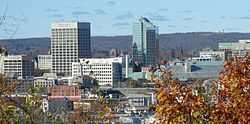
| 2 | Worcester | Worcester | 182,544 | ||||||
| 3 | Springfield | Hampden | 153,703 | ||||||
| 4 | Lowell | Middlesex | 108,861 | ||||||
| 5 | Cambridge | Middlesex | 107,289 | ||||||
| 6 | New Bedford | Bristol | 95,078 | ||||||
| 7 | Brockton | Plymouth | 94,089 | ||||||
| 8 | Quincy | Norfolk | 93,494 | ||||||
| 9 | Lynn | Essex | 91,589 | ||||||
| 10 | Fall River | Bristol | 88,697 | ||||||
There are 50 cities and 301 towns in Massachusetts, grouped into 14 counties.[243] The fourteen counties, moving roughly from west to east, are Berkshire, Franklin, Hampshire, Hampden, Worcester, Middlesex, Essex, Suffolk, Norfolk, Bristol, Plymouth, Barnstable, Dukes, and Nantucket. Eleven communities which call themselves "towns" are, by law, cities since they have traded the town meeting form of government for a mayor-council or manager-council form.[244]
Boston is the state capital and largest city in Massachusetts. The population of the city proper is 645,966,[245] and Greater Boston, with a population of 4,684,299, is the 10th largest metropolitan area in the nation.[246] Other cities with a population over 100,000 include Worcester, Springfield, Lowell, and Cambridge.[247] Plymouth is the largest municipality in the state by land area.[243]
Massachusetts, along with the five other New England states, features the local governmental structure known as the New England town.[248] In this structure, incorporated towns—as opposed to townships or counties—hold many of the responsibilities and powers of local government.[248] Some of the county governments were abolished by Massachusetts beginning in 1997, and their voters elect only Sheriffs and Registers of Deeds, who are part of the state government.[249] Other counties have been reorganized, and a few still retain county councils.[249]
Education

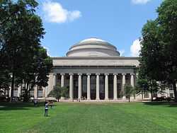
Massachusetts was the first state in North America to require municipalities to appoint a teacher or establish a grammar school with the passage of the Massachusetts Education Law of 1647,[250] and 19th century reforms pushed by Horace Mann laid much of the groundwork for contemporary universal public education.[251][252] Massachusetts is home to the oldest school in continuous existence in North America (The Roxbury Latin School, founded in 1645), as well as the country's oldest public elementary school (The Mather School, founded in 1639), oldest high school (Boston Latin School, founded in 1635),[253] oldest boarding school (The Governor's Academy, founded in 1763), oldest college (Harvard University, founded in 1636),[254] and oldest women's college (Mount Holyoke College, founded in 1837).[255]
In 1852, Massachusetts became the first state to pass compulsory school attendance laws.[256] The per-student public expenditure for elementary and secondary schools (kindergarten through grade 12) was fifth in the nation in 2004, at $11,681.[257] In 2007, Massachusetts scored highest of all the states in math on the National Assessments of Educational Progress.[258]
Massachusetts is home to 121 institutions of higher education.[259] Harvard University and the Massachusetts Institute of Technology, both located in Cambridge, consistently rank among the world's best universities.[260][261] In addition to Harvard and MIT, several other Massachusetts universities currently rank in the top 50 at the national level in the widely cited rankings of U.S. News and World Report: Tufts University (#27), Boston College (#31), Brandeis University (#35), Boston University (#42) and Northeastern University (#42).
Among liberal arts colleges, three of the top handful in the nation are within the Commonwealth of Massachusetts: Williams College (#1 in the liberal arts ranking of USNWR), Amherst College (#2), and Wellesley College (#6). Others regularly placing in the top 40 are Smith College (#19), College of the Holy Cross (#29), and Mount Holyoke College (also #29). According to this "granddaddy of the college rankings", roughly five (12.5%) of the top 40 research universities and six (15%) of the top 40 liberal arts colleges reside in this state that contains only 2% of the U.S. population.
The public University of Massachusetts (nicknamed UMass) features five campuses in the state, with its flagship campus in Amherst that enrolls over 25,000 students.[262][263]
Arts and culture
Massachusetts has contributed much to American arts and culture. Drawing from its Native American and Yankee roots, along with later immigrant groups, Massachusetts has produced a number of writers, artists, and musicians. A number of major museums and important historical sites are also located there, and events and festivals throughout the year celebrate the state's history and heritage.
Massachusetts was an early center of the Transcendentalist movement, which emphasized intuition, emotion, human individuality and a deeper connection with nature.[130] Ralph Waldo Emerson, who was from Boston but spent much of his later life in Concord, largely created the philosophy with his 1836 work Nature, and continued to be a key figure in the movement for the remainder of his life. Emerson's friend, Henry David Thoreau, who was also involved in Transcendentalism, recorded his year spent alone in a small cabin at nearby Walden Pond in the 1854 work Walden; or, Life in the Woods.[264]
Other famous authors and poets born or strongly associated with Massachusetts include Nathaniel Hawthorne, John Updike, Emily Dickinson, Henry Wadsworth Longfellow, E.E. Cummings, Sylvia Plath, and Theodor Seuss Geisel, better known as "Dr. Seuss".[265][266][267] Famous painters from Massachusetts include Winslow Homer and Norman Rockwell;[267] many of the latter's works are on display at the Norman Rockwell Museum in Stockbridge.[268]

Massachusetts is also an important center for the performing arts. Both the Boston Symphony Orchestra and Boston Pops Orchestra are based in Massachusetts.[269] Other orchestras in Massachusetts include the Cape Cod Symphony Orchestra in Barnstable and the Springfield Symphony Orchestra.[270][271] Tanglewood, in western Massachusetts, is a music venue that is home to both the Tanglewood Music Festival and Tanglewood Jazz Festival, as well as the summer host for the Boston Symphony Orchestra.[272][273] Jacob's Pillow in the Berkshires hosts a number of traditional and contemporary musical and dance events.[274]
Other performing arts and theater organizations in Massachusetts include the Boston Ballet,[275] the Boston Lyric Opera,[269] and the Lenox-based Shakespeare & Company.[276] In addition to classical and folk music, Massachusetts has produced musicians and bands spanning a number of contemporary genres, such as the classic rock band Aerosmith, the proto-punk band The Modern Lovers, the new wave band The Cars, and the alternative rock band Pixies.[277] Film events in the state include the Boston Film Festival, the Boston International Film Festival, and a number of smaller film festivals in various cities throughout Massachusetts.[278]

Massachusetts is home to a large number of museums and historical sites. The Boston Museum of Fine Arts, the Institute of Contemporary Art and the DeCordova contemporary art and sculpture museum in Lincoln are all located within Massachusetts,[279][280] and the Maria Mitchell Association in Nantucket includes several observatories, museums, and an aquarium.[281] Historically themed museums and sites such as the Springfield Armory National Historic Site in Springfield,[72] Boston's Freedom Trail and nearby Minute Man National Historical Park, both of which preserve a number of sites important during the American Revolution,[72][282] the Lowell National Historical Park, which focuses on some of the earliest mills and canals of the industrial revolution in the US,[72] the Black Heritage Trail in Boston, which includes important African-American and abolitionist sites in Boston,[283] and the New Bedford Whaling National Historical Park[72] all showcase various periods of Massachusetts's history.
Plimoth Plantation and Old Sturbridge Village are two open-air or "living" museums in Massachusetts, recreating life as it was in the 17th and early 19th centuries, respectively.[284][285] Boston's annual St. Patrick's Day parade and "Harborfest", a week-long Fourth of July celebration featuring a fireworks display and concert by the Boston Pops as well as a turnaround cruise in Boston Harbor by the USS Constitution,[286] are popular events. The New England Summer Nationals, an auto show in Worcester, draws tens of thousands of attendees every year.[287]
Media
There are two major television media markets located in Massachusetts. The Boston/Manchester market is the fifth largest in the United States.[288] All major networks are represented. The other market surrounds the Springfield area. WGBH-TV in Boston is a major public television station and produces national programs such as Nova, Frontline, and American Experience.[289][290]
The Boston Globe, Boston Herald, Springfield Republican, and the Worcester Telegram & Gazette are Massachusetts's largest daily newspapers.[291] In addition, there are many community dailies and weeklies. There are a number of major AM and FM stations which serve Massachusetts,[292] along with many more regional and community-based stations. Some colleges and universities also operate campus television and radio stations, and print their own newspapers.[293][294][295][296][297]
Health
Massachusetts generally ranks highly among states in most health and disease prevention categories. In 2009, the United Health Foundation ranked the state as third healthiest overall.[298] However, the study also pointed to several areas in which Massachusetts ranked below average, such as the state's rate of binge drinking, which was the 11th highest in the country.[298] Massachusetts has the most doctors per 100,000 residents,[299] the second-lowest infant mortality rate,[300] and the lowest percentage of uninsured residents (for both children as well as the total population).[301] According to Businessweek, commonwealth residents have an average life expectancy of 78.4 years, the fifth longest in the country.[302] 37.2% of the population is overweight and 21.7% is obese,[303] and Massachusetts ranks sixth highest in the percentage of residents who are considered neither obese nor overweight (41.1%).[303]
The nation's first Marine Hospital was erected by federal order in Boston in 1799.[304][305] The Massachusetts Board of Registration in Medicine lists a total of 132 hospitals in the state.[306] According to rankings by US News & World Report, Massachusetts General Hospital in Boston is the top ranked overall hospital in the nation;[307] the hospital also ranked in the top ten in fifteen specialties.[308] Massachusetts General was founded in 1811 and serves as the largest teaching hospital for nearby Harvard University.[309]
Other teaching and medical institutions affiliated with Harvard include Brigham and Women's Hospital, Beth Israel Deaconess Medical Center, and Dana-Farber Cancer Institute, among others.[310] Boston is also the location of New England Baptist Hospital, Tufts Medical Center, and Boston Medical Center, the latter of which is the primary teaching hospital for Boston University.[311] The University of Massachusetts Medical School is located in Worcester.[312] The Massachusetts College of Pharmacy and Health Sciences has campuses in both Boston and Worcester.[313]
Sports and recreation
Organized sports
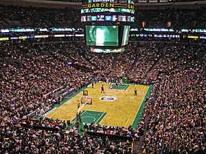
Massachusetts is home to five major league professional sports teams: seventeen-time NBA Champions Boston Celtics,[314] eight-time World Series winners Boston Red Sox,[315] six-time Stanley Cup winners Boston Bruins,[316] and four-time Super Bowl winners New England Patriots.[317] The New England Revolution is the Major League Soccer team in Massachusetts.[318]
Basketball and volleyball were invented in Western Massachusetts (in Springfield at Springfield College and Holyoke, respectively). The Basketball Hall of Fame, a shrine to the sport's history, is a major tourist destination in the City of Springfield. The Volleyball Hall of Fame is located in Holyoke.[319]
The American Hockey League (AHL), the NHL's development league, is headquartered in Springfield. Other minor league professional sports teams in Massachusetts include the Springfield Falcons AHL team, the Worcester Sharks AHL team, and the Springfield Armor NBA Development League team. The Boston Cannons are the Major League Lacrosse team.[320] The Boston Breakers are the Women's Professional Soccer in Massachusetts. Massachusetts is also the home of the Cape Cod Baseball League.
Several universities in Massachusetts are notable for their collegiate athletics. Boston College fields teams in the nationally televised Atlantic Coast Conference, while Harvard University competes in the famed Ivy League. Boston University, Northeastern University, College of the Holy Cross, UMass Lowell, and UMass Amherst also participate in Division I athletics.[321][322] Many other Massachusetts colleges compete in lower divisions such as Division III, where MIT, Tufts University, Amherst College, Williams College, and others field competitive teams.
Massachusetts is also the home of rowing events such as the Eastern Sprints on Lake Quinsigamond in Worcester and the Head of the Charles Regatta,[323][324] and the Boston Marathon.[325] A number of major golf events have taken place in Massachusetts, including nine U.S. Opens and two Ryder Cups.[326][327][328]
Massachusetts has produced several internationally successful gymnasts, such as Olympic silver medalist and vault world champion Alicia Sacramone, 2011 world champion and two time Olympic Gold medalist Aly Raisman, and Canadian national team member Talia Chiarelli.
Outdoor recreation
Long-distance hiking trails in Massachusetts include the Appalachian Trail, the New England National Scenic Trail, the Metacomet-Monadnock Trail, the Midstate Trail, and the Bay Circuit Trail.[329][330] Other outdoor recreational activities in Massachusetts include sailing and yachting, freshwater and deep-sea fishing,[331] whale watching,[332] downhill and cross-country skiing,[333] and hunting.
See also
Ecology
- Climate of Massachusetts
- Climate change in Massachusetts
- Geology of Massachusetts
- List of reptiles of Massachusetts
- List of amphibians of Massachusetts
- List of birds of Massachusetts
- List of mammals of Massachusetts
- List of mammals of New England
Government
- Government of Massachusetts
- Governor of Massachusetts
- List of colonial governors of Massachusetts
- Massachusetts Governor's Council
- List of municipalities in Massachusetts
- List of counties in Massachusetts
History and Archives
- General history of Massachusetts
- History of Massachusetts by periods, settlements, or subject
- History of New England
- Massachusetts Archives
Notes
- ↑ The Constitution of the Vermont Republic, adopted in 1777, represented the first partial ban on slavery. Vermont became a state in 1791, but did not fully ban slavery until 1858 with the Vermont Personal Liberty Law. The Pennsylvania Gradual Abolition Act of 1780[119] made Pennsylvania the first state to abolish slavery by statute.[120]
References
- ↑ "50 States". Net state. Retrieved November 3, 2012.
|chapter=ignored (help) - ↑ "Encyclopædia Britannica" (online ed.).
|chapter=ignored (help) - ↑ "A Colorful Battle Is Lodge vs. Curley". The Milwaukee Journal. October 18, 1936. Retrieved November 3, 2012.
One of the Codfish State...
- ↑ Schwarz, Hunter (August 12, 2014). "States where English is the official language". The Washington Post. Retrieved December 29, 2014.
- ↑ "Massachusetts General Laws, Chapter 2, Section 35: Designation of citizens of commonwealth". The Commonwealth of Massachusetts. Retrieved February 29, 2008.
- ↑ "Collections". Boston: Massachusetts Historical Society. 1877. p. 435.
- ↑ Jones, Thomas (1879). DeLancey, Edward Floyd, ed. History of New York During the Revolutionary War. New York: New York Historical Society. p. 465.
- ↑ wiktionary:Massachusettsian.
- ↑ "Population, Housing Units, Area, and Density (geographically ranked by total population): 2000". United States Census Bureau. Retrieved May 30, 2010.
- ↑ 10.0 10.1 10.2 10.3 10.4 10.5 10.6 10.7 10.8 10.9 "Massachusetts Quick Facts". census.gov. Retrieved 26 April 2015.
- ↑ "Greylock RM 1 Reset". NGS data sheet. U.S. National Geodetic Survey.
- ↑ 12.0 12.1 "Elevations and Distances in the United States". United States Geological Survey. 2001. Retrieved October 21, 2011.
- ↑ Elevation adjusted to North American Vertical Datum of 1988.
- ↑ "Black-Capped Chickadee:Massachusetts State Bird". StateSymbolsUSA.org. Retrieved 17 April 2015.
- ↑ "Wild Turkey:Massachusetts State Game Bird". StateSymbolsUSA.org. Retrieved 17 April 2015.
- ↑ 16.0 16.1 16.2 16.3 16.4 16.5 16.6 16.7 16.8 16.9 16.10 16.11 16.12 16.13 16.14 16.15 16.16 16.17 "Massachusetts Facts". Secretary of the Commonwealth of Massachusetts. Retrieved 21 April 2015.
- ↑ "Cod: Massachusetts State Fish". StateSymbolsUSA.org. Retrieved 18 April 2015.
- ↑ "Mayflower: Massachusetts State Flower". StateSymbolsUSA.org. Retrieved 18 April 2015.
- ↑ "Ladybug: Massachusetts State Insect". StateSymbolsUSA.org. Retrieved 18 April 2015.
- ↑ "Right Whale: Massachusetts State Marine Mammal". StateSymbolsUSA.org. Retrieved 18 April 2015.
- ↑ "Morgan Horse: Massachusetts State Horse". StateSymbolsUSA.org. Retrieved 18 April 2015.
- ↑ "Tabby Cat: Massachusetts State Cat". StateSymbolsUSA.org. Retrieved 18 April 2015.
- ↑ "Boston Terrier: Massachusetts State Dog". StateSymbolsUSA.org. Retrieved 18 April 2015.
- ↑ "Garter Snake: Massachusetts State Reptile". StateSymbolsUSA.org. Retrieved 18 April 2015.
- ↑ "American Elm: Massachusetts State Tree". StateSymbolsUSA.org. Retrieved 18 April 2015.
- ↑ "Cranberry Juice: Massachusetts State Beverage". StateSymbolsUSA.org. Retrieved 18 April 2015.
- ↑ "Blue - Green - Cranberry: Massachusetts State Colors". StateSymbolsUSA.org. Retrieved 18 April 2015.
- ↑ "Square Dance: Massachusetts State Folk Dance". StateSymbolsUSA.org. Retrieved 18 April 2015.
- ↑ "Cranberry: Massachusetts State Berry". StateSymbolsUSA.org. Retrieved 18 April 2015.
- ↑ "Corn Muffin: Massachusetts State Muffin". StateSymbolsUSA.org. Retrieved 20 April 2015.
- ↑ "Baked Navy Bean: Massachusetts State Bean". StateSymbolsUSA.org. Retrieved 20 April 2015.
- ↑ "Boston Creme Pie: Massachusetts State Dessert". StateSymbolsUSA.org. Retrieved 20 April 2015.
- ↑ "Chocolate Chip Cookie: Massachusetts State Cookie". StateSymbolsUSA.org. Retrieved 20 April 2015.
- ↑ "Boston Cream Donut: Massachusetts State Donut". StateSymbolsUSA.org. Retrieved 18 April 2015.
- ↑ "Dinosaur Tracks: Massachusetts State Fossil". StateSymbolsUSA.org. Retrieved 20 April 2015.
- ↑ "Rhodonite: Massachusetts State Gem". StateSymbolsUSA.org. Retrieved 20 April 2015.
- ↑ "Babingtonite: Massachusetts State Mineral". StateSymbolsUSA.org. Retrieved 20 April 2015.
- ↑ "Blue Hills of Massachusetts: Massachusetts State Poem". StateSymbolsUSA.org. Retrieved 20 April 2015.
- ↑ "Rolling Rock: Massachusetts State Glacial Rock". StateSymbolsUSA.org. Retrieved 20 April 2015.
- ↑ "New England Neptune: Massachusetts State Shell". StateSymbolsUSA.org. Retrieved 23 April 2015.
- ↑ "State Slogans". Ereferencedesk.com. Retrieved 21 April 2015.
- ↑ Levenson, Michael (August 9, 2006). "Can you guess the state sport of Massachusetts?". Boston Globe. Retrieved February 14, 2012.
- ↑ "The Official Massachusetts State Quarter". theus50.com. Retrieved 21 April 2015.
- ↑ 44.0 44.1 44.2 44.3 "U. S. States by size". WorldAtlus.com. Retrieved 21 April 2015.
- ↑ "Advance 2013 and Revised 1997—2012 Statistics of GDP by State". bea.gov. Retrieved 21 April 2015.
- ↑ 46.0 46.1 Douglas, Craig. "Greater Boston gains population, remains 10th-largest region in U.S.". bizjournals.com. Retrieved 21 April 2015.
- ↑ "THE PILGRIMS". History.com. Retrieved 21 April 2015.
- ↑ "History of Harvard University". Harvard.edu. Retrieved 21 April 2015.
- ↑ "The 1692 Salem Witch Trials". SalemWitchTrialsMuseum.com. Retrieved 21 April 2015.
- ↑ "The First Great Awakening - Jonathan Edwards". revival-library.org. Retrieved 21 April 2015.
- ↑ "Faneuil Hall". Celebrateboston.com. Retrieved 21 April 2015.
- ↑ "Springfield Armory: Technology in Transition" (PDF). nps.gov. National Park Service U.S. Department of the Interior. Retrieved 21 April 2015.
- ↑ 53.0 53.1 53.2 "Shays' Rebellion". ushistory.org. Retrieved 21 April 2015.
- ↑ "The Temperance Issue in the Election of 1840: Massachusetts". Teachushistory.org. Retrieved 21 April 2015.
- ↑ Packer, Barbara. The Transcendentalists. University of Georgia Press; First Edition edition (April 25, 2007). ISBN 978-0820329581.
- ↑ "Images of the Antislavery Movement in Massachusetts". Masshist.org. Retrieved 21 April 2015.
- ↑ 57.0 57.1 "Springfield College: The Birthplace of Basketball". Springfieldcollege.edu. Retrieved 21 April 2015.
- ↑ 58.0 58.1 "The International Volleyball Hall of Fame". Volleyball.org. Retrieved 21 April 2015.
- ↑ 59.0 59.1 59.2 "Massachusetts court strikes down ban on same-sex marriage". Reuters. November 18, 2003. Retrieved 21 April 2015.
- ↑ "Maritime Commerce". nps.org. National Parks Service. Retrieved 21 April 2015.
- ↑ "History of Lowell, Massachusetts". lowell.com. Retrieved 21 April 2015.
- ↑ "Staying Power: The Future of Manufacturing in Massachusetts" (PDF). Masstech.org. The Center for Urban and Regional Policy School of Social Science, Urban Affairs, and Public Policy Northeastern University. Retrieved 21 April 2015.
- ↑ "Housing and Economic Development:Key Industries". mass.gov. Retrieved 21 April 2015.
- ↑ Tooker, William Wallace (1904). Algonquian Names of some Mountains and Hills.
- ↑ Salwen, Bert, 1978. Indians of Southern New England and Long Island: Early Period. In "Northeast", ed. Bruce G. Trigger. Vol. 15 of "Handbook of North American Indians", ed. William C. Sturtevant, pp. 160–76. Washington DC: Smithsonian Institution. Quoted in: Campbell, Lyle. 1997. American Indian Languages: The Historical Linguistics of Native America. Oxford: Oxford University Press, p. 401
- ↑ Bright, William (2004). Native American Place Names of the United States. Norman: University of Oklahoma Press, p. 270
- ↑ "East Squantum Street (Moswetuset Hummock)". Quincy, Mass. Historical and Architectural Survey. Thomas Crane Public Library. 1986. Retrieved June 24, 2009.
- ↑ Neal, Daniel (1747). "XIV: The Present State of New England". The history of New-England 2 (2 ed.). London: A. Ward. p. 216. OCLC 8616817. Retrieved June 24, 2009.
- ↑ "Part One: Concise Facts – Name". Secretary of the Commonwealth of Massachusetts. Retrieved May 22, 2010.
- ↑ "Why is Massachusetts a Commonwealth?". mass.gov. Retrieved 21 April 2015.
- ↑ "Kentucky as a Commonwealth". Kentucky Department for Libraries and Archives. Archived from the original on January 31, 2011. Retrieved May 22, 2010.
- ↑ 72.0 72.1 72.2 72.3 72.4 72.5 "Massachusetts". National Park Service. Retrieved May 26, 2010.
- ↑ "Mission". mass.gov. Retrieved 22 April 2015.
- ↑ Ricklefs, Robert (December 17, 2008). The Economy of Nature (6th ed.). W. H. Freeman. p. 96. ISBN 978-0716786979. Retrieved 22 April 2015.
- ↑ Stocker, Carol (November 17, 2005). "Old growth, grand specimens drive big-tree hunters". The Boston Globe. Retrieved October 17, 2009.
- ↑ "Current Research — Working Landscapes". The Center for Rural Massachusetts — The University of Massachusetts Amherst. Retrieved March 19, 2009.
- ↑ "Northeastern Coastal Zone — Ecoregion Description". United States Geological Survey. Retrieved October 17, 2009.
- ↑ "MESA List Overview". Mass.gov. Department of Energy and Environmental Affairs. Retrieved 22 April 2015.
- ↑ "Peregrine Falcon" (PDF). Massachusetts Division of Fisheries & Wildlife. Retrieved May 26, 2010.
- ↑ "Eastern Coyote in Massachusetts". Massachusetts Division of Fisheries & Wildlife. Retrieved May 26, 2010.
- ↑ 81.0 81.1 "State Mammal List". Massachusetts Division of Fisheries & Wildlife. Retrieved October 17, 2009.
- ↑ "Forests lure moose to Massachusetts". ChristianScienceMonitor.com. Retrieved 22 April 2015.
- ↑ "Atlantic Flyway". University of Nebraska. Retrieved May 22, 2010.
- ↑ "Chasing loons: Banding the elusive birds at night on the Quabbin Reservoir". masslive.com. Retrieved April 23, 2015.
- ↑ "Telemetry Research:Long-Tailed Ducks". Mass Audubon. Retrieved May 28, 2010.
- ↑ "Roseate Tern" (PDF). Massachusetts Division of Fisheries & Wildlife. Retrieved May 28, 2010.
- ↑ "Coastal Waterbird Program". Mass Audubon. Retrieved May 28, 2010.
- ↑ "Monomoy National Wildlife Refuge – Wildlife and Habitat". United States Fish and Wildlife Service. Retrieved May 26, 2010.
- ↑ "Best Bets for Fishing". Massachusetts Division of Wildlife & Fisheries. Retrieved May 30, 2010.
- ↑ "Species Profiles". Massachusetts Division of Marine Fisheries. Retrieved May 30, 2010.
- ↑ 91.0 91.1 Brown & Tager 2000, pp. 6–7.
- ↑ 92.0 92.1 "Origin & Early Mohican History". Stockbridge-Munsee Community — Band of Mohican Indians. Retrieved October 21, 2009.
- ↑ Brown & Tager 2000, p. 7.
- ↑ Hoxie, Frederick E (1996). Encyclopedia of North American Indians. Boston: Houghton Mifflin Harcourt. p. 164. ISBN 978-0-395-66921-1. OCLC 34669430. Retrieved July 30, 2009.
- ↑ Marr, JS; Cathey, JT (February 2010). "New hypothesis for cause of an epidemic among Native Americans, New England, 1616–1619". Emerging Infectious Disease. doi:10.3201/e0di1602.090276.
- ↑ Koplow 2004, p. 13.
- ↑ 97.0 97.1 Goldfield et al. 1998, pp. 29–30.
- ↑ Goldfield et al. 1998, p. 30.
- ↑ 99.0 99.1 "The New England Colonies". ushistory.org. Retrieved 24 April 2015.
- ↑ Goldfield et al. 1998, p. 29.
- ↑ "Charter Of Massachusetts Bay 1629". let.rug.nl. Retrieved 24 April 2015.
- ↑ Brown & Tager 2000, pp. 30–32.
- ↑ Barrows, Charles Henry (1911). The history of Springfield in Massachusetts for the young: being also in some part the history of other towns and cities in the county of Hampden. The Connecticut Valley Historical Society. pp. 46–48. US 13459.5.7.
- ↑ William Pynchon. Bio.umass.edu. Retrieved on September 7, 2013.
- ↑ 105.0 105.1 Goldfield et al. 1998, p. 66.
- ↑ Brown & Tager 2000, p. 50.
- ↑ "Historic Earthquakes". USGS. Retrieved February 7, 2011.
|chapter=ignored (help) - ↑ "Memorandum". Boston Gazette. November 24, 1755. p. 1.
- ↑ Brown & Tager 2000, pp. 63–83.
- ↑ "The Intolerable Acts". ushistory.org. Retrieved 24 April 2015.
- ↑ Goldfield et al. 1998, pp. 88–90.
- ↑ Goldfield et al. 1998, pp. 95–96.
- ↑ Goldfield et al. 1998, pp. 96–97.
- ↑ "Massachusetts Legal Holidays". Secretary of the Commonwealth. Retrieved May 22, 2010.
- ↑ "John Fraylor. Salem Maritime National Historic Park". Nps.gov. Retrieved September 3, 2012.
- ↑ "The Declaration of Independence". pbs.org. Retrieved 25 April 2015.
- ↑ 117.0 117.1 117.2 117.3 "John Adams" (biography). National Park Service. Retrieved May 30, 2010.
- ↑ "Massachusetts Constitution, Judicial Review, and Slavery – The Quock Walker Case". Massachusetts Judicial Branch. 2007. Retrieved December 11, 2009.
- ↑ "Explore PA history".
- ↑ "Visitor information". PA, US: Legislature.
|chapter=ignored (help) - ↑ Rettig, Polly M. (April 3, 1978). "John Quincy Adams Birthplace" (PDF). National Register of Historic Places Inventory-Nomination. National Park Service. Retrieved April 24, 2015.
- ↑ "The Ratification of the U.S. Constitution in Massachusetts". Massachusetts Historical Society. Retrieved May 22, 2010.
- ↑ "On this day in 1820". Massmoments.org. Retrieved 25 April 2015.
- ↑ Brown & Tager 2000, p. 129.
- ↑ Brown & Tager 2000, p. 211.
- ↑ Brown & Tager 2000, p. 202.
- ↑ Brown & Tager 2000, pp. 133–36.
- ↑ Brown & Tager 2000, p. 179.
- ↑ Goldfield et al. 1998, p. 251.
- ↑ 130.0 130.1 130.2 Goldfield et al. 1998, p. 254.
- ↑ Brown & Tager 2000, p. 185.
- ↑ Brown & Tager 2000, p. 183.
- ↑ Brown & Tager 2000, pp. 187–93.
- ↑ "Robert Gould Shaw and the 54th Regiment". National Park Service. Retrieved October 19, 2009.
- ↑ Brown and Tager, p. 246.
- ↑ Brown & Tager 2000, p. 276.
- ↑ "Job Loss, Shrinking Revenues, and Grinding Decline in Springfield, Massachusetts: Is A Finance Control Board the Answer?" (PDF). UML.
- ↑ Peck, Merton J. & Scherer, Frederic M. The Weapons Acquisition Process: An Economic Analysis (1962) Harvard Business School p.111
- ↑ Brown & Tager 2000, pp. 275–83.
- ↑ 140.0 140.1 Brown & Tager 2000, p. 284.
- ↑ "Biography: Edward Moore Kennedy". American Experience. Retrieved May 28, 2010.
- ↑ "The Kennedys: A Family Tree". St. Petersburg Times. Retrieved May 28, 2010.
- ↑ "BROOKE, Edward William, III,". congress.gov. Retrieved 25 April 2015.
- ↑ "George H.W. Bush Biography". biography.com. Retrieved 26 April 2015.
- ↑ 145.0 145.1 145.2 145.3 Grunwald, Michael. Dig the Big Dig The Washington Post. August 6, 2006. . Retrieved May 31, 2010.
- ↑ 146.0 146.1 "The Central Artery/Tunnel Project - The Big Dig". massdot.state.ma.us. The Official Website of The Massachusetts Department of Transportation - Highway Division. Retrieved 26 April 2015.
- ↑ "Population: 1790 to 1990" (PDF). US: census.
- ↑ "Resident Population of the 50 States, the District of Columbia, and Puerto Rico". US: Census. 2000.
- ↑ "2010 Data". US: Census. Retrieved February 1, 2011.
- ↑ "Centers of Population". census.gov. United States Census Bureau. Retrieved 26 April 2015.
- ↑ "State Centers of Population". howderfamily.com. Retrieved 26 April 2015.
I’ll ... examine some individual state centers of population.
- ↑ 152.0 152.1 Miller, Joshua. "Mass. population growth is tops in N.E.". Bostonglobe.com. Retrieved 26 April 2015.
- ↑ 153.0 153.1 Mishra, Raja (December 22, 2006). "State's population growth on stagnant course". Boston Globe. Retrieved June 5, 2010.
- ↑ 154.0 154.1 154.2 Bayles, Fred (March 21, 2001). "Minorities account for state population growth". USA Today. Retrieved June 5, 2010.
- ↑ "Language Map Data Center". Modern Language Association. Retrieved February 23, 2007.
|chapter=ignored (help) - ↑ "Massachusetts QuickFacts". US: Census Bureau.
- ↑ Exner, Rich (June 3, 2012). "Americans under age 1 now mostly minorities, but not in Ohio: Statistical Snapshot". The Plain Dealer.
- ↑ Brown & Tager 2000, p. 173.
- ↑ Brown & Tager 2000, pp. 173–79.
- ↑ Brown & Tager 2000, p. 203.
- ↑ Brown & Tager 2000, p. 301.
- ↑ Camarota, Steven. "Fact Sheet on Haitian Immigrants in the United States". cis.org. Retrieved 26 April 2015.
- ↑ "Massachusetts - Ethnic groups". City-Data.com. Retrieved 26 April 2015.
- ↑ Schweitzer, Sarah (February 15, 2010). "Lowell hopes to put 'Little Cambodia' on the map". The Boston Globe. Retrieved May 31, 2010.
- ↑ "Wampanoag Tribe Receives Federal Recognition". WBZ-TV (Boston, MA). Associated Press. Retrieved February 20, 2007.
- ↑ Weber, David (February 15, 2007). "Mashpee Wampanoag Indians receive federal recognition". The Boston Globe. Retrieved February 20, 2007.
- ↑ Brown & Tager 2000, pp. 180–82.
- ↑ Brown & Tager 2000, pp. 257–58.
- ↑ Brown & Tager 2000, pp. 300–4.
- ↑ Irwin, Patricia; Nagy, Naomi. "Bostonians /r/ Speaking: A Quantitative Look at (R) in Boston". repository.upenn.edu/. University of Pennsylvania. Retrieved 26 April 2015.
- ↑ 171.0 171.1 "Massachusetts". Modern Language Association. Retrieved August 21, 2013.
- ↑ "Headquarters of the Unitarian Universalist Association". Unitarian Universalist Association. Retrieved April 27, 2015.
- ↑ "The UUA to Sell its Beacon Hill Properties, Move to Innovation District". Unitarian Universalist Association. Retrieved April 10, 2015.
- ↑ "The Association of Religion Data Archives | State Membership Report". www.thearda.com. Retrieved November 22, 2013.
- ↑ "American Religious Identification Survey" (JPEG). Exhibit 15 (image). New York: The Graduate Center, City University. Retrieved September 21, 2007.
- ↑ Butterfield, Fox (May 14, 1989). "The Perfect New England Town". The New York Times. Retrieved May 30, 2010.
- ↑ "Total Gross Domestic Product by State for Massachusetts". research.stlouisfed.org. Federal Reserve Bank of St. Louis. Retrieved 26 April 2015.
- ↑ "State Personal Income 2008" (PDF). Bureau of Economic Analysis. Retrieved June 8, 2010.
- ↑ "Fortune 500 – States". CNN. July 27, 2010. Retrieved July 27, 2010.
- ↑ "America's Top States for Business 2010" (special report) (1) (Web ed.). CNBC. May 9, 2011. Check date values in:
|year= / |date= mismatch(help) - ↑ Frank, Robert. "Top states for millionaires per capita". CNBC. Retrieved January 25, 2014.
- ↑ "Tourism Statistics". Statisticsbrain.com. Retrieved 27 April 2015.
- ↑ "Economy at a Glance". bls.gov. Bureau of Labor Statistics. Retrieved 27 April 2015.
- ↑ "Labor Force Statistics from the Current Population Survey". bls.gov. Bureau of Labor Statistics. Retrieved 27 April 2015.
- ↑ "Number of Farms Numbers Continue Slight Rise in 2012". ag.umass.edu. UMASS Amherst Center for Agriculture, Food, and the enviroment. Retrieved 27 April 2015.
- ↑ "Massachusetts Department of Agricultural Resources". NASDA.org. Massachusetts Department of Agricultural. Retrieved 27 April 2015.
- ↑ "Massachusetts Cranberries" (PDF). United States Department of Agriculture. January 26, 2007. Retrieved May 23, 2010.
- ↑ 188.0 188.1 188.2 188.3 "Massachusetts". The Tax Foundation. Retrieved April 27, 2015.
- ↑ "Taxes & Rates Income". Massachusetts Department of Revenue. Retrieved June 20, 2014.
- ↑ "Massachusetts Implements Reduction in Personal Income Tax Rates". The Tax Foundation. Retrieved May 10, 2012.
- ↑ 191.0 191.1 "Tax Rates". Massachusetts Department of Revenue. Retrieved April 27, 2015.
- ↑ "TIR 13-10: Sales and Use Tax on Computer and Software Services Law Changes Effective July 31, 2013". Retrieved July 29, 2013.
- ↑ 193.0 193.1 "A Guide to Sales and Use Tax". MA, US: Department of Revenue. Retrieved April, 27 2015. Check date values in:
|accessdate=(help) - ↑ "Electricity deregulation". Good Energy.
|chapter=ignored (help) - ↑ 195.0 195.1 195.2 "State Profile and Energy Estimates". eia.gov. U.S Energy Information Administration. Retrieved 28 April 2015.
- ↑ Shen, Andrew (October 25, 2011). "Massachusetts Passes California As The Most Energy Efficient State". Business insider. Retrieved January 25, 2012.
- ↑ "Massachusetts Regional Planning Agencies". American Planning Association. Retrieved 30 April 2015.
- ↑ "Acela Express". Routes. Amtrak. Retrieved May 22, 2010.
- ↑ "Subway Map". Massachusetts Bay Transit Authority. Retrieved May 22, 2010.
- ↑ "Bus Schedules & Maps". Massachusetts Bay Transit Authority. Retrieved May 22, 2010.
- ↑ "Boat Map and Schedules". Massachusetts Bay Transit Authority. Retrieved May 22, 2010.
- ↑ "Commuter Rail Maps and Schedules". Massachusetts Bay Transit Authority. Retrieved May 22, 2010.
- ↑ "CapeFlyer". Retrieved July 29, 2013.
- ↑ "T announces summer Cape Cod train service". WCVB-TV. Retrieved July 29, 2013.
- ↑ "Your Transit Authorities". Massachusetts Association of Regional Transit Authorities. Retrieved May 23, 2010.
- ↑ "Cape Cod Central Railroad". Cape Cod Central Railroad. Retrieved May 23, 2010.
- ↑ "2010 Scenic Train Schedule". Berkshire Scenic Railway Museum. Retrieved May 23, 2010.
- ↑ "Railroad Service in Massachusetts" (PDF). Association of American Railroads. Retrieved June 2, 2010.
- ↑ "Background". The Woods Hole, Martha's Vineyard and Nantucket Steamship Authority. Retrieved May 24, 2010.
- ↑ 210.0 210.1 "Who We Are". Massachusetts Port Authority. Retrieved May 24, 2010.
- ↑ "Massa aeronautics".
- ↑ "Transportation". Secretary of the Commonwealth of Massachusetts. Retrieved May 31, 2010.
- ↑ Brown and Tager, pp. 283–284.
- ↑ Levy, Leonard (1995). Seasoned Judgments: The American Constitution, Rights, and History. p. 307.
- ↑ Kemp, Roger (2010). Documents of American Democracy. p. 59.
- ↑ Murrin, John (2011). Liberty, Power, and Equality: A History.
- ↑ "John Adams and the Massachusetts Constitution". Massachusetts Judicial Branch, mass.gov. 2007. Retrieved July 18, 2009.
- ↑ Gianoulis, Tina (October 13, 2005). "Noble, Elaine". glbtq: An Encyclopedia of Gay, Lesbian, Bisexual, Transgender, and Queer Culture. Retrieved September 24, 2007.
- ↑ Cave, Damien. "Gerry Studds Dies at 69; First Openly Gay Congressman". nytimes.com. Retrieved 26 April 2015.
- ↑ 220.0 220.1 220.2 220.3 220.4 220.5 220.6 220.7 220.8 220.9 220.10 "Massachusetts Facts: Politics". Secretary of the Commonwealth of Massachusetts. Retrieved June 1, 2010.
- ↑ "Members of the 111th Congress". United States Senate. Retrieved October 18, 2009.
- ↑ 222.0 222.1 "Massachusetts Congressional Districts" (PDF). Massachusetts Secretary of the Commonwealth. Retrieved October 18, 2009.
- ↑ "Geographic Boundaries of United States Courts of Appeals and United States District Courts" (PDF). US: Courts. Retrieved October 18, 2009.
- ↑ "2008 Presidential Election". Electoral College. US: Archives. Retrieved June 2, 2010.
- ↑ "Frequently Asked Questions". Electoral College. US: Archives. Retrieved June 2, 2010.
- ↑ "Hokkaido – Alberta Relations" (PDF). Retrieved 2010-05-30.
- ↑ "Massachusetts Hokkaido Association". Retrieved 2010-05-30.
- ↑ Brown & Tager 2000, p. 310.
- ↑ Page, Susan; Lawrence, Jill (July 11, 2004). "Does 'Massachusetts liberal' label still matter?". USA Today. Retrieved October 17, 2009.
- ↑ "Mapping MA election results". R bloggers.
- ↑ "State Vote 2006: Election Profile, Massachusetts". State Legislatures Magazine (National Conference of State Legislatures). Retrieved November 17, 2007.
- ↑ Gordon, Meryl (January 14, 2002). "Weld at Heart". New York. Retrieved May 23, 2010.
- ↑ Vennochi, Joan (June 17, 2007). "Romney's liberal shadow". The Boston Globe. Retrieved May 23, 2010.
- ↑ "Federal Elections 2004" (PDF). Federal Election Commission. p. 22. Retrieved October 17, 2009.
- ↑ "2008 Presidential Popular Vote Summary" (PDF). Federal Election Commission. Retrieved October 17, 2009.
- ↑ Bloch, Matthew; Cox, Amanda; Ericson, Matthew; Hossain, Farhana; Tse, Archie (January 19, 2010). "Interactive Map, Election Results and Analysis". The New York Times. Retrieved May 22, 2010.
- ↑ "Fiery consumer advocate Elizabeth Warren beats Scott Brown in Massachusetts Senate race". November 6, 2012. Retrieved July 31, 2013.
- ↑ "Same-sex couples ready to make history in Massachusetts". CNN. May 17, 2004. Retrieved July 31, 2013.
- ↑ "Massachusetts Makes Health Insurance Mandatory". National Public Radio. July 3, 2007. Retrieved October 18, 2009.
- ↑ "2008 Return of Votes Complete" (PDF). Massachusetts Secretary of the Commonwealth. December 17, 2008. Retrieved October 18, 2009.
- ↑ "Massachusetts voters approve ballot measure to legalize medical marijuana". NY Times Co. Retrieved April 13, 2013.
- ↑ "Massachusetts (USA): State, Major Cities, Towns & Places". City Population. February 19, 2011. Retrieved December 1, 2014.
- ↑ 243.0 243.1 "Information and Historical Data on Cities, Towns, and Counties in the Commonwealth of Massachusetts". Secretary of the Commonwealth of Massachusetts. Retrieved June 8, 2010.
- ↑ See Administrative divisions of Massachusetts#The city/town distinction.
- ↑ "Annual Estimates of the Resident Population for Incorporated Places over 100,000, Ranked by July 1, 2008 Population: April 1, 2000 to July 1, 2008 (SUB-EST2008-01)" (CSV). United States Census Bureau, Population Division. Retrieved October 19, 2009.
- ↑ "Annual Estimates of the Population of Metropolitan and Micropolitan Statistical Areas: April 1, 2000 to July 1, 2008" (CSV). 2008 Population Estimates. United States Census Bureau, Population Division. March 19, 2009. Retrieved October 19, 2009.
- ↑ "Annual Estimates of the Population for all Incorporated Places in Massachusetts: 2000–2007". United States Census Bureau. Retrieved October 19, 2009.
- ↑ 248.0 248.1 Sokolow 1997, pp. 293–6.
- ↑ 249.0 249.1 "Massachusetts Government: County Government". League of Women Voters. Retrieved October 2, 2014.
- ↑ Dejnozka et al. 1982, p. 313.
- ↑ Dejnozka et al. 1982, p. 311.
- ↑ Goldfield et al. 1998, pp. 251–52.
- ↑ Ramírez, Eddy (November 29, 2007). "The First Class State". U.S. News & World Report. Retrieved June 5, 2010.
- ↑ Rimer, Sara; Finder, Alan (February 10, 2007). "Harvard Plans to Name First Female President". The New York Times. Retrieved June 5, 2010.
- ↑ "Admissions". StudyPoint.
|chapter=ignored (help) - ↑ "Compulsory Education". National Conference of State Legislatures. Retrieved December 28, 2006.
- ↑ "Estimates Database" (research). National Education Association. 2006. footnote Rankings & Estimates 2005–2006, Rankings, Table H-11. Retrieved January 12, 2007.
|chapter=ignored (help) - ↑ "2007 NAEP Tests: Summary of Results for Massachusetts" (PDF). MA, Department of Elementary & Secondary Education. Retrieved May 22, 2010.
- ↑ "A Practical Guide to Living in the State – Education". MA, US: Secretary of the Commonwealth. Retrieved June 2, 2010.
- ↑ "World's Best Universities:Top 400". US News & World Report. February 25, 2010. Retrieved May 25, 2010.
- ↑ "Academic Rankings of World Universities – 2009". Academic Ranking of World Universities. Retrieved May 25, 2010.
- ↑ "The UMass System". University of Massachusetts Amherst. Retrieved May 25, 2010.
- ↑ "UMass – Facts 2009–2010" (PDF). University of Massachusetts Amherst. Retrieved May 25, 2010.
- ↑ "Walden Pond State Reservation" (PDF). Massachusetts Department of Conservation and Recreation. Retrieved May 29, 2010.
- ↑ "Henry Wadsworth Longfellow". National Park Service. Retrieved May 30, 2010.
- ↑ "Details – Sunday – Massachusetts". Academy of American Poets. Retrieved May 29, 2010.
- ↑ 267.0 267.1 "Miscellaneous Massachusetts Facts". Secretary of the Commonwealth of Massachusetts. Retrieved May 30, 2010.
- ↑ "Details – Norman Rockwell Museum". Massachusetts Department of Tourism. Retrieved May 30, 2010.
- ↑ 269.0 269.1 "Music". Massachusetts Department of Tourism. Retrieved May 29, 2010.
- ↑ "About the Cape Cod Symphony Orchestra". Cape Cod Symphony Orchestra. Retrieved June 5, 2010.
- ↑ "Our History". Springfield Symphony Orchestra. Retrieved June 5, 2010.
- ↑ "Tanglewood Jazz Festival". Boston, MA, US: Symphony Orchestra. Retrieved May 30, 2010.
- ↑ "Arts". MA, US: Department of Tourism. Retrieved May 30, 2010.
- ↑ "Details – Jacob's Pillow Dance Festival". MA, US: Department of Tourism. Retrieved May 29, 2010.
- ↑ "Details – Boston Ballet". MA, US: Department of Tourism. Retrieved May 29, 2010.
- ↑ "Details – Shakespeare & Company". MA, US: Department of Tourism. Retrieved May 29, 2010.
- ↑ Leddy, Charles 'Chuck' (January 10, 2008). "Rocking history lesson shows city was in a class by itself". Boston Globe (Boston, MA, US). Retrieved May 29, 2010.
- ↑ "Film Festivals". MA, US: Department of Tourism. Retrieved May 29, 2010.
- ↑ "Museums". City of Boston. Retrieved May 29, 2010.
- ↑ "About the DeCordova Sculpture Park". DeCordova Sculpture Park. Retrieved May 29, 2010.
- ↑ "Art Museums". Massachusetts Department of Tourism. Retrieved May 29, 2010.
- ↑ "Places To Go". National Park Service. Retrieved December 30, 2009.
- ↑ "Black Heritage Trail". Museum of African American History. Retrieved May 29, 2010.
- ↑ "About Plimoth Plantation". Plimoth Plantation. Retrieved May 29, 2010.
- ↑ "Our Museum". Old Sturbridge Village. Retrieved May 29, 2010.
- ↑ "Details – Sunday – July 4th". Boston Harborfest. Retrieved May 29, 2010.
- ↑ Kush, Bronislaus B. "Summer Nationals Weekend Revs Up". Worcester Telegram. Retrieved March 15, 2011.
- ↑ "Nielson Media Research Local Universe Estimates (US)". Nielson Media. 2005-6. Archived from the original on May 17, 2006. Retrieved May 27, 2010. Check date values in:
|date=(help) - ↑ "WGBH – About Us". WGBH-TV. Retrieved May 27, 2010.
- ↑ "American Experience". WGBH-TV. Retrieved May 27, 2010.
- ↑ "US Newspaper – Search Results (Massachusetts)". Audit Bureau of Circulation. Retrieved May 25, 2010.
- ↑ "FM Query Results (Massachusetts)". Federal Communications Commission. Retrieved May 27, 2010.
- ↑ "UVC-TV19". UVC-TV19. Retrieved January 30, 2015.
- ↑ "About WMUA". WMUA. Retrieved May 27, 2010.
- ↑ "General". WZBC. Retrieved May 27, 2010.
- ↑ "About". Harvard Crimson. Retrieved May 27, 2010.
- ↑ "About the BU Literary Society and Clarion". Boston University. Retrieved May 27, 2010.
- ↑ 298.0 298.1 "America's Health Ranking – Massachusetts (2009)". United Health Foundation. Retrieved October 24, 2010.
- ↑ "Doctors per 100,000 Resident Population, 2007". United States Census Bureau. Retrieved October 24, 2010.
- ↑ "Infant Mortality Rate, 2006". United States Census Bureau. Retrieved October 24, 2010.
- ↑ "Persons With and Without Health Insurance Coverage by State: 2007" (PDF). United States Census Bureau. Retrieved October 24, 2010.
- ↑ "U.S. States Ranked by Life Expectancy". Bloomberg Businessweek. Retrieved October 24, 2010.
- ↑ 303.0 303.1 "Overweight and Obesity (BMI) – 2007". Centers for Disease Control and Prevention. Retrieved October 24, 2010.
- ↑ Association, American Medical; Press, Highwire (July 30, 1904). "The United States Public Health and Marine-Hospital Service". Journal of the American Medical Association 43. Retrieved February 20, 2011.
- ↑ "U.S. Marine Hospital". Chelsea Historical Society. Retrieved February 20, 2011.
- ↑ "Massachusetts Area Hospitals". Massachusetts Board of Registration in Medicine. Retrieved October 24, 2010.
- ↑ "Best Hospitals 2012–13: The Honor Roll". US News & World Report. Retrieved June 27, 2013.
- ↑ "Massachusetts General Hospital". US News & World Report. Retrieved June 27, 2013.
- ↑ "Hospital Overview". Massachusetts General Hospital. Retrieved October 24, 2010.
- ↑ "Facts and Figures: 2009–2010". Harvard Medical School. Retrieved October 25, 2010.
- ↑ "About Us". Boston University School of Medicine. Retrieved October 25, 2010.
- ↑ "An Introduction to UMass Medical School". University of Massachusetts Medical School. Retrieved October 25, 2010.
- ↑ "About us". The Massachusetts College of Pharmacy and Health Sciences.
- ↑ "Celtics History — Championship Wins". National Basketball Association. Retrieved October 18, 2009.
- ↑ "MLB World Series Winners". ESPN. Retrieved October 18, 2009.
- ↑ "Stanley Cup Winners". Hockey Hall of Fame. Retrieved October 18, 2009.
- ↑ "Super Bowl History". National Football League. Retrieved October 18, 2009.
- ↑ "Stadium Information". Gillette Stadium. Retrieved October 21, 2009.
- ↑ "Volleyball pushed as official team sport of Mass". Boston Herald. October 4, 2009. Retrieved October 18, 2009.
- ↑ "MLL Standings". Major League Lacrosse. Retrieved October 21, 2009.
- ↑ "College Football Teams (FBS and FCS)". ESPN. Retrieved October 18, 2009.
- ↑ "College Basketball Teams — Division I Teams". ESPN. Retrieved October 18, 2009.
- ↑ "Cornell Rowing Excels at Eastern Sprints". Cornell University. Retrieved June 6, 2010.
- ↑ "History of the Head of the Charles Regatta". Head of the Charles Regatta. Retrieved June 6, 2010.
- ↑ "114th Boston Maraton". Boston Athletic Association. Retrieved June 6, 2010.
- ↑ "2009 U.S. Open — Past Champions". United States Golf Association. Retrieved October 21, 2009.
- ↑ "Past Results". Ryder Cup. Retrieved October 21, 2009.
- ↑ "Deutsche Bank Championship". Professional Golfers' Association of America. Retrieved October 21, 2009.
- ↑ "Greenways and Trails". Massachusetts Department of Conservation and Recreation. Retrieved June 5, 2010.
- ↑ "Southern New England". Appalachian Mountain Club. Retrieved June 2, 2010.
- ↑ "Fishing & charters". Massachusetts Department of Tourism. Retrieved June 5, 2010.
- ↑ "Whale watching". Massachusetts Department of Tourism. Retrieved June 5, 2010.
- ↑ "Skiing/snowboarding". Massachusetts Department of Tourism. Retrieved June 5, 2010.
Bibliography
- Brebner, John Bartlet (1927). New England's outpost : Acadia before the conquest of Canada. New York, NY: Columbia University Press. ISBN 0-7812-6367-0.
- Brettell, Caroline (2003). Anthropology and Migration:Essays on Transnational Ethnicity and Identity. Walnut Creek, CA: AltaMira Press. ISBN 0-7591-0320-8.
- Brown, Richard D; Tager, Jack (2000). Massachusetts: A Concise History. Amherst, MA: University of Massachusetts Press. ISBN 1-55849-248-8.
- Dejnozka, Edward L; Gifford, Charles S; Kapel, David E; Kapel, Marilyn B (1982). American Educators' Encyclopedia. Westport, CT: Greenwood Press. ISBN 0-313-20954-5.
- Goldfield, David; Abbott, Carl; Anderson, Virginia DeJohn; Argersinger, Jo Ann E; Argersinger, Peter H; Barney, William L; Weir, Robert M (1998). The American Journey – A History of the United States. Upper Saddle River, NJ: Prentice Hall. ISBN 0-13-656562-X.
- Koplow, David A (2004). Smallpox: The Fight to Eradicate a Global Scourge. Berkeley, CA: University of California Press. ISBN 0-520-24220-3.
- Sokolow, Alvin D (1997). "Town and Township Government: Serving Rural and Suburban Communities". Handbook of Local Government Administration. New York, NY: Marcel Dekker. ISBN 0-8247-9782-5.
Further reading
Overviews and surveys
- Hall, Donald. ed. The Encyclopedia of New England (2005)
- Works Progress Administration. Guide to Massachusetts (1939)
Secondary sources
- Abrams, Richard M. Conservatism in a Progressive Era: Massachusetts Politics, 1900–1912 (1964)
- Adams, James Truslow. Revolutionary New England, 1691–1776 (1923)
- Adams, James Truslow. New England in the Republic, 1776–1850 (1926)
- Andrews, Charles M. The Fathers of New England: A Chronicle of the Puritan Commonwealths (1919), short survey
- Conforti, Joseph A. Imagining New England: Explorations of Regional Identity from the Pilgrims to the Mid-Twentieth Century (2001)
- Cumbler, John T. Reasonable Use: The People, the Environment, and the State, New England, 1790–1930 (1930), environmental history
- Fischer, David Hackett. Paul Revere's Ride (1994), 1775 in depth
- Flagg, Charles Allcott, A Guide to Massachusetts local history, Salem : Salem Press Company, 1907.
- Green, James R., William F. Hartford, and Tom Juravich. Commonwealth of Toil: Chapters in the History of Massachusetts Workers and Their Unions (1996)
- Huthmacher, J. Joseph. Massachusetts People and Politics, 1919–1933 (1958)
- Labaree, Benjamin Woods. Colonial Massachusetts: A History (1979)
- Morison, Samuel Eliot. The Maritime History of Massachusetts, 1783–1860 (1921)
- Peirce, Neal R. The New England States: People, Politics, and Power in the Six New England States (1976), 1960–75 era
- Porter, Susan L. Women of the Commonwealth: Work, Family, and Social Change in Nineteenth-Century Massachusetts (1996)
- Sletcher, Michael. New England (2004).
- Starkey, Marion L. The Devil in Massachusetts (1949), Salem witches
- Tager, Jack, and John W. Ifkovic, eds. Massachusetts in the Gilded Age: Selected Essays (1985), ethnic groups
- Zimmerman, Joseph F. The New England Town Meeting: Democracy in Action (1999)
External links
- Official website
- Massachusetts Office of Travel and Tourism
- Massachusetts State Guide from the Library of Congress
- Massachusetts at DMOZ
| Preceded by Connecticut |
List of U.S. states by constitutional ratification date Ratified Constitution on February 6, 1788 (6th) |
Succeeded by Maryland |
 |
|
|
| |
| style="width:33% rowspan=3 | |
|
Atlantic Ocean | ||
| ||||
| | ||||
| |
|
Cape Cod Martha's Vineyard • Nantucket Island |
| |||||||||||||||||||||||||||||||||||||||||||||||||||||||||||||||||||||||||||||||||||||||||||||||||||||||||||||||||||||||||||||||||||

| ||||||||||||||||||||||||||||||||
| ||||||||||||||||||
| ||||||||||||||||||||||||||
| ||||||||||||||||||||||||||||||||||||||||||||||||||||||||||||||||||||||||||||||